
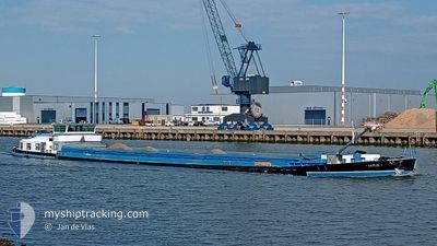
SIJTJE
Cargo
Current Trip
| Time Travelled | 18 h, 12 mins |
|---|---|
| Remaining Time | 4 h, 48 mins |
| Distance Travelled | 86.23 nm |
| Remaining Distance | 33.52 nm |
| AVG Speed | 6.7 Knots |
| MAX Speed | 8.8 Knots |
| AVG Wind | 10.6 knots |
| MAX Wind | 19.3 knots |
| MIN Temp | 3.2°C / 37.76°F |
| MAX Temp | 9.5°C / 49.1°F |
| Draught | 2.7 m |
| Position Received | Now |
Current Position
| Longitude | 5.78192° |
|---|---|
| Latitude | 53.05044° |
| Status | Under way using engine |
| Speed | 6.5 Knots |
| Course | 49.1° |
| Area | North Sea |
| Station | T-AIS |
| Position Received | Now |
Info
Information
The current position of SIJTJE is in North Sea with coordinates 53.05044° / 5.78192° as reported on 2024-04-25 03:53 by AIS to our vessel tracker app. The vessel's current speed is 6.5 Knots and is heading at the port of GRONINGEN. The estimated time of arrival as calculated by MyShipTracking vessel tracking app is 2024-04-25 08:42 LT
The vessel SIJTJE (MMSI: 244650640) is a Cargo It's sailing under the flag of [NL] Netherlands.
In this page you can find informations about the vessels current position, last detected port calls, and current voyage information. If the vessels is not in coverage by AIS you will find the latest position.
The current position of SIJTJE is detected by our AIS receivers and we are not responsible for the reliability of the data. The last position was recorded while the vessel was in Coverage by the Ais receivers of our vessel tracking app.
The current draught of SIJTJE as reported by AIS is 2.7 meters
Weather
| Temperature | 3.2°C / 37.76°F |
|---|---|
| Wind Speed | 5 knots |
| Direction | 294° WNW |
| Pressure | 1005.6 hPa |
| Humidity | 84 % |
| Cloud Coverage | 100 % |
Featured Company
Last Port Calls
| Port | Arrival | Departure | Time In Port |
|---|---|---|---|
| 2024-04-24 09:06 | 2024-04-24 09:42 | 36 m | |
| 2024-04-23 18:17 | 2024-04-24 07:49 | 13 h | |
| 2024-04-23 08:21 | 2024-04-23 11:36 | 3 h | |
| 2024-04-22 14:15 | 2024-04-22 15:52 | 1 h | |
| 2024-04-19 12:25 | 2024-04-22 07:50 | 2 d | |
| 2024-04-17 13:58 | 2024-04-18 15:25 | 1 d | |
| 2024-04-17 04:06 | 2024-04-17 06:16 | 2 h | |
| 2024-04-16 10:56 | 2024-04-16 12:46 | 1 h | |
| 2024-04-15 12:33 | 2024-04-15 13:20 | 47 m | |
| 2024-04-12 11:58 | 2024-04-15 05:12 | 2 d |
Last Trips
| Origin | Departure | Destination | Arrival | Distance | |
|---|---|---|---|---|---|
| 2024-04-24 09:49 | 2024-04-24 11:06 | 9.54 nm | |||
| 2024-04-23 13:36 | 2024-04-23 20:17 | 53.79 nm | |||
| 2024-04-22 17:52 | 2024-04-23 10:21 | 50.68 nm | |||
| 2024-04-22 09:50 | 2024-04-22 16:15 | 50.32 nm | |||
| 2024-04-18 17:25 | 2024-04-19 14:25 | 9.24 nm | |||
| 2024-04-17 08:16 | 2024-04-17 15:58 | 50.48 nm | |||
| 2024-04-16 14:46 | 2024-04-17 06:06 | 41.06 nm | |||
| 2024-04-15 15:20 | 2024-04-16 12:56 | 34.95 nm | |||
| 2024-04-15 07:12 | 2024-04-15 14:33 | 39.52 nm | |||
| 2024-04-12 13:10 | 2024-04-12 13:58 | 4.07 nm |
Events
| Time | Event | Details | Position / Dest | Info |
|---|---|---|---|---|
| 2024-04-25 02:35 | Status Changed | Under way using engine Default |
52.93349 / 5.68936
BETERE TOEKOMST
|
Speed: 6.4 kn Course: 342° |
| 2024-04-25 02:28 | Status Changed | Default Under way using engine |
52.92242 / 5.69503
BETERE TOEKOMST
|
Speed: 6 kn Course: 341.2° |
| 2024-04-25 01:49 | START Moving | 0.88 nm, West of LEMMER |
52.85415 / 5.67807
BETERE TOEKOMST
|
Speed: 4.5 kn Course: 19° |
| 2024-04-25 01:40 | STOP Moving | 0.89 nm, West of LEMMER |
52.85114 / 5.67631
BETERE TOEKOMST
|
Speed: 0.3 kn Course: 20° |
| 2024-04-24 23:10 | START Moving | 3.39 nm, West of SCHOKKERHAVEN |
52.61120 / 5.65501
BETERE TOEKOMST
|
Speed: 3.7 kn Course: 284° |
| 2024-04-24 23:07 | Status Changed | Under way using engine Moored |
52.61076 / 5.65723
BETERE TOEKOMST
|
Speed: 0.2 kn Course: 15° |
| 2024-04-24 19:02 | Status Changed | Moored Under way using engine |
52.61049 / 5.65782
BETERE TOEKOMST
|
Speed: Course: 311° |
| 2024-04-24 18:43 | STOP Moving | 3.29 nm, West of SCHOKKERHAVEN |
52.61043 / 5.65773
BETERE TOEKOMST
|
Speed: 0.2 kn Course: 320° |
| 2024-04-24 17:32 | START Moving | 1 nm, North West of ROGGEBOTSLUIS |
52.55705 / 5.84449
BETERE TOEKOMST
|
Speed: 6.3 kn Course: 317° |
| 2024-04-24 17:31 | STOP Moving | 0.88 nm, North West of ROGGEBOTSLUIS |
52.55558 / 5.84675
BETERE TOEKOMST
|
Speed: Course: 0° |