
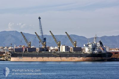
SHOU CHEN SHAN
Bulk Carrier
Current Trip
| Time Travelled | 12 days |
|---|---|
| Remaining Time | --- |
| Distance Travelled | 3460.11 nm |
| Remaining Distance | --- |
| AVG Speed | 11.1 Knots |
| MAX Speed | 13.3 Knots |
| AVG Wind | 13.5 knots |
| MAX Wind | 30.3 knots |
| MIN Temp | 14.1°C / 57.38°F |
| MAX Temp | 31.2°C / 88.16°F |
| Draught | 9.5 m |
| Position Received | 1 d ago |
Current Position
| Longitude | -24.68138° |
|---|---|
| Latitude | 38.85268° |
| Status | Under way using engine |
| Speed | 12.5 Knots |
| Course | 60.6° |
| Area | North Atlantic Ocean |
| Station | T-AIS |
| Position Received | 1 d ago |
Info
Information
The current position of SHOU CHEN SHAN is in North Atlantic Ocean with coordinates 38.85268° / -24.68138° as reported on 2024-04-23 05:59 by AIS to our vessel tracker app. The vessel's current speed is 12.5 Knots and is heading at the port of GIJON. The estimated time of arrival as calculated by MyShipTracking vessel tracking app is 2024-04-26 19:00 LT
The vessel SHOU CHEN SHAN (IMO: 9632296, MMSI: 477767300) is a Bulk Carrier that was built in 2013 ( 11 years old ). It's sailing under the flag of [HK] Hong Kong.
In this page you can find informations about the vessels current position, last detected port calls, and current voyage information. If the vessels is not in coverage by AIS you will find the latest position.
The current position of SHOU CHEN SHAN is detected by our AIS receivers and we are not responsible for the reliability of the data. The last position was recorded while the vessel was in Coverage by the Ais receivers of our vessel tracking app.
The current draught of SHOU CHEN SHAN as reported by AIS is 9.5 meters
Weather
| Temperature | 14.1°C / 57.38°F |
|---|---|
| Wind Speed | 10 knots |
| Direction | 61° ENE |
| Pressure | 1026.8 hPa |
| Humidity | 83.7 % |
| Cloud Coverage | 8 % |
Featured Company
Last Port Calls
| Port | Arrival | Departure | Time In Port |
|---|---|---|---|
| 2024-04-01 12:14 | 2024-04-11 19:30 | 10 d | |
| 2024-03-15 22:00 | 2024-03-22 04:56 | 6 d | |
| 2024-02-26 00:16 | 2024-03-02 19:19 | 5 d | |
| 2024-02-19 22:07 | 2024-02-22 17:49 | 2 d | |
| 2024-02-15 20:49 | 2024-02-17 13:44 | 1 d | |
| 2024-02-09 01:09 | 2024-02-11 03:47 | 2 d |
Most Visited Ports (Last year)
| Port | Arrivals | |
|---|---|---|
| 2 | ||
| 1 | ||
| 1 | ||
| 1 | ||
| 1 | ||
| 1 |
Last Trips
| Origin | Departure | Destination | Arrival | Distance | |
|---|---|---|---|---|---|
| 2024-03-21 23:56 | 2024-04-01 07:14 | 396.19 nm | |||
| 2024-03-02 13:19 | 2024-03-15 17:00 | 1606.93 nm | |||
| 2024-02-22 11:49 | 2024-02-25 18:16 | 990.37 nm | |||
| 2024-02-17 07:44 | 2024-02-19 16:07 | 22.01 nm | |||
| 2024-02-10 21:47 | 2024-02-15 14:49 | 1158.93 nm | |||
| 2024-01-26 15:18 | 2024-02-08 19:09 | 1443.35 nm |
Events
| Time | Event | Details | Position / Dest | Info |
|---|---|---|---|---|
| 2024-04-23 06:03 | Status Changed | Default Under way using engine |
38.86061 / -24.66584
GIJON
|
Speed: 12.5 kn Course: 60.6° |
| 2024-04-23 05:59 | OUT of Coverage |
38.85268 / -24.68138
North Atlantic Ocean
GIJON
|
Speed: 12.5 kn Course: 60.6° |
|
| 2024-04-22 22:32 | Status Changed | Under way using engine Default |
38.10720 / -26.30046
GIJON
|
Speed: 12 kn Course: 60° |
| 2024-04-22 22:32 | IN Coverage |
38.10720 / -26.30046
North Atlantic Ocean
GIJON
|
Speed: 11.7 kn Course: 59.2° |
|
| 2024-04-22 19:08 | Status Changed | Default Under way using engine |
37.86863 / -27.07529
GIJON
|
Speed: 11.7 kn Course: 72.7° |
| 2024-04-22 19:03 | OUT of Coverage |
37.86310 / -27.09594
North Atlantic Ocean
GIJON
|
Speed: 11.7 kn Course: 72.7° |
|
| 2024-04-22 07:58 | ETA Changed | 2024/04/26 19:00 2024/04/26 12:00 |
37.21333 / -29.70513
GIJON
|
Speed: 11.5 kn Course: 73° |
| 2024-04-22 07:54 | Change Sea Area | Portuguese (Azores) part of the North Atlantic Ocean Puerto Rican part of the North Atlantic Ocean |
37.21054 / -29.71613
North Atlantic Ocean
GIJON
|
Speed: 11.6 kn Course: 72.1° |
| 2024-04-22 07:54 | Status Changed | Under way using engine Default |
37.21054 / -29.71613
GIJON
|
Speed: 11.5 kn Course: 72° |
| 2024-04-22 07:45 | IN Coverage |
37.21054 / -29.71613
North Atlantic Ocean
GIJON
|
Speed: 11.6 kn Course: 72.1° |