
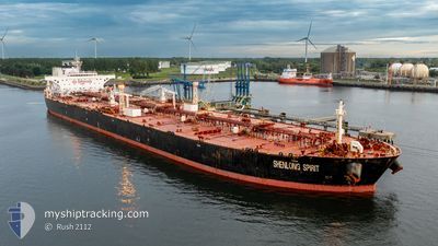
SHENLONG SPIRIT
Crude Oil Tanker
Current Trip
FOR ORDER
| Time Travelled | 31 days |
|---|---|
| Remaining Time | --- |
| Distance Travelled | 6823.68 nm |
| Remaining Distance | --- |
| AVG Speed | 10.7 Knots |
| MAX Speed | 17.4 Knots |
| AVG Wind | 13.4 knots |
| MAX Wind | 29.2 knots |
| MIN Temp | 10.3°C / 50.54°F |
| MAX Temp | 29.6°C / 85.28°F |
| Draught | 9.3 m |
| Position Received | 6 d ago |
Current Position
| Longitude | --- |
|---|---|
| Latitude | --- |
| Status | Under way using engine |
| Speed | 12.6 Knots |
| Course | 334.7° |
| Area | Caribbean Sea |
| Station | T-AIS |
| Position Received | 6 d ago |
Info
Information
The current position of SHENLONG SPIRIT is in Caribbean Sea with coordinates 9.78194° / -76.35493° as reported on 2024-12-08 11:41 by AIS to our vessel tracker app. The vessel's current speed is 12.6 Knots
The vessel SHENLONG SPIRIT (IMO: 9379210, MMSI: 309504000) is a Crude Oil Tanker that was built in 2009 ( 15 years old ). It's sailing under the flag of [BS] Bahamas.
In this page you can find informations about the vessels current position, last detected port calls, and current voyage information. If the vessels is not in coverage by AIS you will find the latest position.
The current position of SHENLONG SPIRIT is detected by our AIS receivers and we are not responsible for the reliability of the data. The last position was recorded while the vessel was in Coverage by the Ais receivers of our vessel tracking app.
The current draught of SHENLONG SPIRIT as reported by AIS is 9.3 meters
Weather
| Temperature | 23.4°C / 74.12°F |
|---|---|
| Wind Speed | 12 knots |
| Direction | 178° S |
| Pressure | 1021 hPa |
| Humidity | 81 % |
| Cloud Coverage | 7 % |
Featured Company
Last Port Calls
| Port | Arrival | Departure | Time In Port |
|---|---|---|---|
| 2024-11-11 22:53 | 2024-11-13 17:17 | 1 d | |
| 2024-11-09 03:50 | 2024-11-11 22:35 | 2 d |
Most Visited Ports (Last year)
| Port | Arrivals | |
|---|---|---|
| 1 | ||
| 1 | ||
| 1 | ||
| 1 | ||
| 1 | ||
| 1 |
Last Trips
| Origin | Departure | Destination | Arrival | Distance | |
|---|---|---|---|---|---|
| 2024-11-11 22:35 | 2024-11-11 22:53 | 1.63 nm | |||
| 2024-09-18 12:54 | 2024-11-09 03:50 | 10015.81 nm |
Events
| Time | Event | Details | Position / Dest | Info |
|---|---|---|---|---|
| 2024-12-14 17:53 | START Moving |
28.39680 / -94.50844
FOR ORDER
|
Speed: 3.1 kn Course: 174° |
|
| 2024-12-14 12:57 | STOP Moving |
28.33120 / -94.47954
FOR ORDER
|
Speed: 0.3 kn Course: 113° |
|
| 2024-12-08 11:57 | Status Changed | Default Under way using engine |
9.83421 / -76.38000
FOR ORDER
|
Speed: 12.6 kn Course: 334.7° |
| 2024-12-08 11:41 | OUT of Coverage |
9.78194 / -76.35493
Caribbean Sea
|
Speed: 12.6 kn Course: 334.7° |
|
| 2024-12-08 11:19 | Status Changed | Under way using engine Default |
9.71486 / -76.32334
FOR ORDER
|
Speed: 12.4 kn Course: 294° |
| 2024-12-08 11:00 | IN Coverage |
9.71486 / -76.32334
Caribbean Sea
|
Speed: 12.2 kn Course: 309.3° |
|
| 2024-12-08 08:39 | START Moving | 11.05 nm, North West of COVENAS |
9.53416 / -75.83102
FOR ORDER
|
Speed: 3.9 kn Course: 289° |
| 2024-12-08 03:34 | STOP Moving | 10.68 nm, North West of COVENAS |
9.53105 / -75.82555
FOR ORDER
|
Speed: 0.3 kn Course: 338° |
| 2024-12-08 03:20 | Status Changed | Default Under way sailing |
9.52379 / -75.82333
FOR ORDER
|
Speed: 4.8 kn Course: 299° |
| 2024-12-08 03:08 | OUT of Coverage |
9.51778 / -75.81233
Caribbean Sea
|
Speed: 4.8 kn Course: 313.4° |