
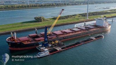
NGM GLORY
Bulk Carrier
Current Trip
SG PEBGB
| Time Travelled | 47 days |
|---|---|
| Remaining Time | --- |
| Distance Travelled | 11370.97 nm |
| Remaining Distance | --- |
| AVG Speed | 9.9 Knots |
| MAX Speed | 13.1 Knots |
| AVG Wind | 12 knots |
| MAX Wind | 39.8 knots |
| MIN Temp | 18°C / 64.4°F |
| MAX Temp | 30.5°C / 86.9°F |
| Draught | 17.6 m |
| Position Received | 6 m ago |
Current Position
| Longitude | 104.01941° |
|---|---|
| Latitude | 1.28526° |
| Status | At anchor |
| Speed | |
| Course | 74° |
| Area | Singapore Strait |
| Station | T-AIS |
| Position Received | 6 m ago |
Info
Information
The current position of NGM GLORY is in Singapore Strait with coordinates 1.28526° / 104.01941° as reported on 2024-04-16 11:12 by AIS to our vessel tracker app. The vessel's current speed is 0 Knots
The vessel NGM GLORY (IMO: 9595591, MMSI: 636019103) is a Bulk Carrier that was built in 2011 ( 13 years old ). It's sailing under the flag of [LR] Liberia.
In this page you can find informations about the vessels current position, last detected port calls, and current voyage information. If the vessels is not in coverage by AIS you will find the latest position.
The current position of NGM GLORY is detected by our AIS receivers and we are not responsible for the reliability of the data. The last position was recorded while the vessel was in Coverage by the Ais receivers of our vessel tracking app.
The current draught of NGM GLORY as reported by AIS is 17.6 meters
Weather
| Temperature | 29.6°C / 85.28°F |
|---|---|
| Wind Speed | 10 knots |
| Direction | 77° ENE |
| Pressure | 1007.8 hPa |
| Humidity | 71.6 % |
| Cloud Coverage | 34 % |
Featured Company
Last Port Calls
| Port | Arrival | Departure | Time In Port |
|---|---|---|---|
| 2024-02-26 21:53 | 2024-02-28 16:43 | 1 d |
Most Visited Ports (Last year)
| Port | Arrivals | |
|---|---|---|
| 4 | ||
| 3 | ||
| 1 | ||
| 1 | ||
| 1 | ||
| 1 |
Last Trips
| Origin | Departure | Destination | Arrival | Distance | |
|---|---|---|---|---|---|
| 2023-12-20 02:52 | 2024-02-26 16:53 | 15298.95 nm |
Events
| Time | Event | Details | Position / Dest | Info |
|---|---|---|---|---|
| 2024-04-16 11:18 | Status Changed | At anchor Default |
1.28523 / 104.01923
SG PEBGB
|
Speed: 0.1 kn Course: 77° |
| 2024-04-16 11:15 | Status Changed | Default At anchor |
1.28525 / 104.01933
SG PEBGB
|
Speed: Course: 74° |
| 2024-04-16 10:51 | Status Changed | At anchor Default |
1.28495 / 104.01943
SG PEBGB
|
Speed: Course: 67° |
| 2024-04-16 10:45 | Status Changed | Default At anchor |
1.28492 / 104.01940
SG PEBGB
|
Speed: Course: 67° |
| 2024-04-16 10:30 | Status Changed | At anchor Default |
1.28492 / 104.01941
SG PEBGB
|
Speed: Course: 67° |
| 2024-04-16 10:27 | Status Changed | Default At anchor |
1.28491 / 104.01941
SG PEBGB
|
Speed: Course: 67° |
| 2024-04-16 09:27 | Status Changed | At anchor Default |
1.28463 / 104.01993
SG PEBGB
|
Speed: Course: 64° |
| 2024-04-16 09:21 | Status Changed | Default At anchor |
1.28451 / 104.01990
SG PEBGB
|
Speed: Course: 64° |
| 2024-04-16 06:00 | Status Changed | At anchor Under way using engine |
1.28369 / 104.02556
SG PEBGB
|
Speed: 0.3 kn Course: 313° |
| 2024-04-16 05:56 | STOP Moving | 1.78 nm, South of TANAH MERAH |
1.28337 / 104.02541
SG PEBGB
|
Speed: 0.3 kn Course: 311° |