
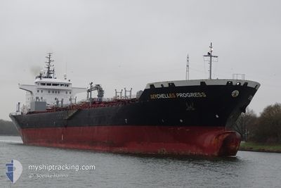
SEYCHELLES PROGRESS
Oil/Chemical Tanker
Current Trip
IT SPA
| Time Travelled | 2 days |
|---|---|
| Remaining Time | --- |
| Distance Travelled | 345.48 nm |
| Remaining Distance | --- |
| AVG Speed | 9.8 Knots |
| MAX Speed | 13.2 Knots |
| AVG Wind | 19.8 knots |
| MAX Wind | 29 knots |
| MIN Temp | 15.1°C / 59.18°F |
| MAX Temp | 18.8°C / 65.84°F |
| Draught | 7.3 m |
| Position Received | 2 d ago |
Current Position
| Longitude | 14.58612° |
|---|---|
| Latitude | 36.44185° |
| Status | Under way using engine |
| Speed | 11 Knots |
| Course | 287° |
| Area | Mediterranean Sea - Eastern Basin |
| Station | T-AIS |
| Position Received | 2 d ago |
Info
Information
The current position of SEYCHELLES PROGRESS is in Mediterranean Sea - Eastern Basin with coordinates 36.44185° / 14.58612° as reported on 2024-04-16 18:54 by AIS to our vessel tracker app. The vessel's current speed is 11 Knots
The vessel SEYCHELLES PROGRESS (IMO: 9298181, MMSI: 664296000) is a Oil/Chemical Tanker that was built in 2005 ( 19 years old ). It's sailing under the flag of [SC] Seychelles.
In this page you can find informations about the vessels current position, last detected port calls, and current voyage information. If the vessels is not in coverage by AIS you will find the latest position.
The current position of SEYCHELLES PROGRESS is detected by our AIS receivers and we are not responsible for the reliability of the data. The last position was recorded while the vessel was in Coverage by the Ais receivers of our vessel tracking app.
The current draught of SEYCHELLES PROGRESS as reported by AIS is 7.3 meters
Weather
| Temperature | 13.4°C / 56.12°F |
|---|---|
| Wind Speed | 22 knots |
| Direction | 338° NNW |
| Pressure | 1015.2 hPa |
| Humidity | 70.6 % |
| Cloud Coverage | 100 % |
Featured Company
Last Port Calls
| Port | Arrival | Departure | Time In Port |
|---|---|---|---|
| 2024-04-14 14:54 | 2024-04-16 11:55 | 1 d | |
| 2024-04-08 11:38 | 2024-04-12 18:00 | 4 d | |
| 2024-03-29 22:00 | 2024-04-04 05:18 | 5 d | |
| 2024-03-15 07:04 | 2024-03-17 14:12 | 2 d | |
| 2024-02-28 10:37 | 2024-03-02 08:16 | 2 d | |
| 2024-02-11 07:47 | 2024-02-15 19:45 | 4 d | |
| 2024-02-04 21:00 | 2024-02-06 17:40 | 1 d |
Most Visited Ports (Last year)
| Port | Arrivals | |
|---|---|---|
| 8 | ||
| 5 | ||
| 4 | ||
| 3 | ||
| 2 | ||
| 2 |
Last Trips
| Origin | Departure | Destination | Arrival | Distance | |
|---|---|---|---|---|---|
| 2024-04-12 20:00 | 2024-04-14 16:54 | 523.74 nm | |||
| 2024-04-04 08:18 | 2024-04-08 13:38 | 1078.78 nm | |||
| 2024-03-17 14:12 | 2024-03-30 00:00 | 1875.61 nm | |||
| 2024-03-02 09:16 | 2024-03-15 07:04 | 460.33 nm | |||
| 2024-02-15 20:45 | 2024-02-28 11:37 | 437.23 nm | |||
| 2024-02-06 18:40 | 2024-02-11 08:47 | 658.13 nm | |||
| 2024-01-27 20:40 | 2024-02-04 22:00 | 1007.62 nm |
Events
| Time | Event | Details | Position / Dest | Info |
|---|---|---|---|---|
| 2024-04-16 18:57 | Status Changed | Default Under way using engine |
36.44500 / 14.57667
IT SPA
|
Speed: 11 kn Course: 287° |
| 2024-04-16 18:54 | OUT of Coverage |
36.44185 / 14.58612
Mediterranean Sea - Eastern Basin
|
Speed: 11 kn Course: 287° |
|
| 2024-04-16 18:40 | Change Sea Area | Italian part of the Mediterranean Sea - Eastern Basin Italian part of the Ionian Sea |
36.43251 / 14.63678
Mediterranean Sea - Eastern Basin
|
Speed: 11.1 kn Course: 268° |
| 2024-04-16 18:40 | Status Changed | Under way using engine Default |
36.43251 / 14.63678
IT SPA
|
Speed: 11 kn Course: 268° |
| 2024-04-16 18:33 | IN Coverage |
36.43251 / 14.63678
Mediterranean Sea - Eastern Basin
|
Speed: 11.1 kn Course: 268° |
|
| 2024-04-16 11:55 | START Moving | 0.44 nm, North East of SANTA PANAGIA |
37.11716 / 15.27403
IT SPA
|
Speed: 4 kn Course: 76° |
| 2024-04-16 11:55 | PORT DEPARTURE |
|
37.11716 / 15.27403
IT SPA
|
Speed: Course: 49° |
| 2024-04-14 14:58 | STOP Moving |
37.11516 / 15.26818
[IT] SANTA PANAGIA
|
Speed: 0.2 kn Course: 48° |
|
| 2024-04-14 14:54 | PORT ARRIVAL |
|
37.11532 / 15.26883
[IT] SANTA PANAGIA
|
Speed: 2.9 kn Course: 126° |
| 2024-04-14 13:13 | OUT of Coverage |
37.36800 / 15.36531
Ionian Sea
IT SPA
|
Speed: 12.3 kn Course: 193° |