
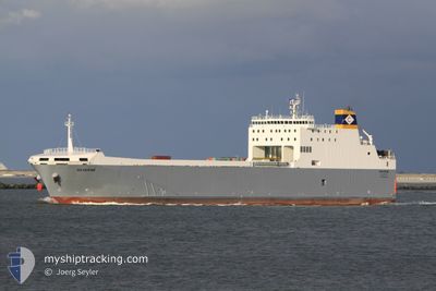
SEVERINE
Ro-Ro Cargo
Current Trip
| Time Travelled | 1 day |
|---|---|
| Remaining Time | --- |
| Distance Travelled | 325.45 nm |
| Remaining Distance | --- |
| AVG Speed | 12.1 Knots |
| MAX Speed | 16.1 Knots |
| AVG Wind | 15.6 knots |
| MAX Wind | 26.5 knots |
| MIN Temp | 14.4°C / 57.92°F |
| MAX Temp | 20°C / 68°F |
| Draught | 4.9 m |
| Position Received | 13 h, 59 m ago |
Current Position
| Longitude | 22.65405° |
|---|---|
| Latitude | 36.37534° |
| Status | Under way using engine |
| Speed | 11.7 Knots |
| Course | 256.3° |
| Area | Mediterranean Sea - Eastern Basin |
| Station | T-AIS |
| Position Received | 13 h, 59 m ago |
Info
Information
The current position of SEVERINE is in Mediterranean Sea - Eastern Basin with coordinates 36.37534° / 22.65405° as reported on 2024-04-18 14:25 by AIS to our vessel tracker app. The vessel's current speed is 11.7 Knots and is heading at the port of ANCHORAGE. The estimated time of arrival as calculated by MyShipTracking vessel tracking app is 2024-04-20 01:00 LT
The vessel SEVERINE (IMO: 9539078, MMSI: 256565000) is a Ro-Ro Cargo that was built in 2012 ( 12 years old ). It's sailing under the flag of [MT] Malta.
In this page you can find informations about the vessels current position, last detected port calls, and current voyage information. If the vessels is not in coverage by AIS you will find the latest position.
The current position of SEVERINE is detected by our AIS receivers and we are not responsible for the reliability of the data. The last position was recorded while the vessel was in Coverage by the Ais receivers of our vessel tracking app.
The current draught of SEVERINE as reported by AIS is 4.9 meters
Weather
| Temperature | 18°C / 64.4°F |
|---|---|
| Wind Speed | 20 knots |
| Direction | 259° W |
| Pressure | 1009.2 hPa |
| Humidity | 67.7 % |
| Cloud Coverage | --- |
Featured Company
Last Port Calls
| Port | Arrival | Departure | Time In Port |
|---|---|---|---|
| 2024-04-16 14:18 | 2024-04-17 12:01 | 21 h | |
| 2024-04-11 10:48 | 2024-04-11 17:12 | 6 h | |
| 2024-04-09 06:09 | 2024-04-09 09:12 | 3 h | |
| 2024-03-25 06:02 | 2024-03-25 12:39 | 6 h | |
| 2024-03-17 09:59 | 2024-03-17 15:53 | 5 h | |
| 2024-03-08 16:42 | 2024-03-08 23:27 | 6 h | |
| 2024-03-01 05:34 | 2024-03-01 20:29 | 14 h | |
| 2024-02-27 10:32 | 2024-02-27 19:36 | 9 h | |
| 2024-02-24 16:24 | 2024-02-25 18:02 | 1 d | |
| 2024-02-21 22:44 | 2024-02-22 02:13 | 3 h |
Last Trips
| Origin | Departure | Destination | Arrival | Distance | |
|---|---|---|---|---|---|
| 2024-04-11 19:12 | 2024-04-16 17:18 | 1305.13 nm | |||
| 2024-04-09 11:12 | 2024-04-11 12:48 | 133.57 nm | |||
| 2024-03-25 13:39 | 2024-04-09 08:09 | 3135.45 nm | |||
| 2024-03-17 16:53 | 2024-03-25 07:02 | 806.66 nm | |||
| 2024-03-09 00:27 | 2024-03-17 10:59 | 986.09 nm | |||
| 2024-03-01 21:29 | 2024-03-08 17:42 | 943.55 nm | |||
| 2024-02-27 20:36 | 2024-03-01 06:34 | 647.61 nm | |||
| 2024-02-25 19:02 | 2024-02-27 11:32 | 615.31 nm | |||
| 2024-02-22 03:13 | 2024-02-24 17:24 | 52.52 nm | |||
| 2024-01-16 22:02 | 2024-02-21 23:44 | 7895.62 nm |
Events
| Time | Event | Details | Position / Dest | Info |
|---|---|---|---|---|
| 2024-04-18 14:25 | OUT of Coverage |
36.37534 / 22.65405
Mediterranean Sea - Eastern Basin
MALTA ANCHORAGE
|
Speed: 11.7 kn Course: 256.3° |
|
| 2024-04-18 14:14 | Detected in Sea | Greek part of the Mediterranean Sea - Eastern Basin |
36.38369 / 22.70023
Mediterranean Sea - Eastern Basin
MALTA ANCHORAGE
|
Speed: 12.1 kn Course: 257.3° |
| 2024-04-18 14:12 | IN Coverage |
36.38369 / 22.70023
Mediterranean Sea - Eastern Basin
MALTA ANCHORAGE
|
Speed: 12.1 kn Course: 257.3° |
|
| 2024-04-18 13:09 | Status Changed | Default Under way using engine |
36.42833 / 22.96167
MALTA ANCHORAGE
|
Speed: 10.9 kn Course: 274.2° |
| 2024-04-18 12:33 | OUT of Coverage |
36.41030 / 23.09412
Aegean Sea
MALTA ANCHORAGE
|
Speed: 10.9 kn Course: 274.2° |
|
| 2024-04-18 02:37 | ETA Changed | 2024/04/20 01:00 2024/04/20 06:00 |
37.90032 / 24.51518
MALTA ANCHORAGE
|
Speed: 11.5 kn Course: 234.1° |
| 2024-04-18 02:10 | Status Changed | Under way using engine Default |
37.96746 / 24.58782
MALTA ANCHORAGE
|
Speed: 11 kn Course: 195° |
| 2024-04-18 01:54 | IN Coverage |
37.96746 / 24.58782
Aegean Sea
MALTA ANCHORAGE
|
Speed: 11.5 kn Course: 208.2° |
|
| 2024-04-17 14:05 | Status Changed | Default Under way using engine |
40.20259 / 22.91755
MALTA ANCHORAGE
|
Speed: 12.6 kn Course: 152° |
| 2024-04-17 14:05 | OUT of Coverage |
40.20515 / 22.91585
Aegean Sea
MALTA ANCHORAGE
|
Speed: 12.6 kn Course: 152° |