
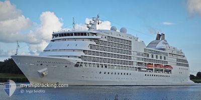
SEVEN SEAS NAVIGATOR
Passengers Ship
Current Trip
MANGALORE
| Time Travelled | 17 h, 20 mins |
|---|---|
| Remaining Time | --- |
| Distance Travelled | --- |
| Remaining Distance | --- |
| AVG Speed | --- |
| MAX Speed | --- |
| AVG Wind | --- |
| MAX Wind | --- |
| MIN Temp | --- |
| MAX Temp | --- |
| Draught | 7.5 m |
| Position Received | 1 d ago |
Current Position
| Longitude | 76.17382° |
|---|---|
| Latitude | 9.96508° |
| Status | Under way using engine |
| Speed | 14.7 Knots |
| Course | 266.1° |
| Area | Laccadive Sea |
| Station | T-AIS |
| Position Received | 1 d ago |
Info
Information
The current position of SEVEN SEAS NAVIGATOR is in Laccadive Sea with coordinates 9.96508° / 76.17382° as reported on 2024-04-17 14:27 by AIS to our vessel tracker app. The vessel's current speed is 14.7 Knots
The vessel SEVEN SEAS NAVIGATOR (IMO: 9064126, MMSI: 311050600) is a Passengers Ship that was built in 1999 ( 25 years old ). It's sailing under the flag of [BS] Bahamas.
In this page you can find informations about the vessels current position, last detected port calls, and current voyage information. If the vessels is not in coverage by AIS you will find the latest position.
The current position of SEVEN SEAS NAVIGATOR is detected by our AIS receivers and we are not responsible for the reliability of the data. The last position was recorded while the vessel was in Coverage by the Ais receivers of our vessel tracking app.
The current draught of SEVEN SEAS NAVIGATOR as reported by AIS is 7.5 meters
Weather
| Temperature | 29.2°C / 84.56°F |
|---|---|
| Wind Speed | 6 knots |
| Direction | 13° NNE |
| Pressure | 1007.8 hPa |
| Humidity | 74 % |
| Cloud Coverage | 100 % |
Featured Company
Last Port Calls
| Port | Arrival | Departure | Time In Port |
|---|---|---|---|
| 2024-04-18 02:29 | 2024-04-18 12:58 | 10 h | |
| 2024-04-17 04:04 | 2024-04-17 14:13 | 10 h | |
| 2024-04-16 00:51 | 2024-04-16 10:07 | 9 h | |
| 2024-04-10 23:01 | 2024-04-11 09:50 | 10 h | |
| 2024-04-10 00:33 | 2024-04-10 11:42 | 11 h | |
| 2024-04-08 23:15 | 2024-04-09 09:11 | 9 h | |
| 2024-04-04 03:09 | 2024-04-06 10:37 | 2 d | |
| 2024-04-03 00:32 | 2024-04-03 09:48 | 9 h | |
| 2024-03-27 02:01 | 2024-03-28 10:19 | 1 d | |
| 2024-03-25 00:15 | 2024-03-25 10:58 | 10 h |
Most Visited Ports (Last year)
| Port | Arrivals | |
|---|---|---|
| 5 | ||
| 4 | ||
| 4 | ||
| 3 | ||
| 3 | ||
| 3 |
Last Trips
| Origin | Departure | Destination | Arrival | Distance | |
|---|---|---|---|---|---|
| 2024-04-17 19:43 | 2024-04-18 07:59 | 210.28 nm | |||
| 2024-04-16 15:37 | 2024-04-17 09:34 | 328.18 nm | |||
| 2024-04-11 17:50 | 2024-04-16 06:21 | 1396.48 nm | |||
| 2024-04-10 19:42 | 2024-04-11 07:01 | 192.95 nm | |||
| 2024-04-09 17:11 | 2024-04-10 08:33 | 194.82 nm | |||
| 2024-04-06 17:37 | 2024-04-09 07:15 | 869.32 nm | |||
| 2024-04-03 16:48 | 2024-04-04 10:09 | 247.68 nm | |||
| 2024-03-28 18:19 | 2024-04-03 07:32 | 1565.31 nm | |||
| 2024-03-25 17:58 | 2024-03-27 10:01 | 685.41 nm | |||
| 2024-03-24 17:40 | 2024-03-25 07:15 | 199.12 nm |
Events
| Time | Event | Details | Position / Dest | Info |
|---|---|---|---|---|
| 2024-04-18 12:58 | PORT DEPARTURE |
|
12.92833 / 74.76709
MANGALORE
|
Speed: Course: 169° |
| 2024-04-18 02:41 | STOP Moving |
12.92791 / 74.81773
[IN] PANAMBUR
|
Speed: 0.2 kn Course: 176° |
|
| 2024-04-18 02:29 | PORT ARRIVAL |
|
12.92611 / 74.80497
[IN] PANAMBUR
|
Speed: 14.5 kn Course: 78° |
| 2024-04-17 14:32 | Status Changed | Default Under way using engine |
9.96400 / 76.15094
MANGALORE
|
Speed: 14.7 kn Course: 266.1° |
| 2024-04-17 14:27 | OUT of Coverage |
9.96508 / 76.17382
Laccadive Sea
MANGALORE
|
Speed: 14.7 kn Course: 266.1° |
|
| 2024-04-17 14:13 | PORT DEPARTURE |
|
9.96872 / 76.22684
MANGALORE
|
Speed: 13.1 kn Course: 266° |
| 2024-04-17 13:57 | Destination Changed | MANGALORE COCHIN |
9.97266 / 76.26054
[IN] KOCHI
|
Speed: 6.7 kn Course: 289° |
| 2024-04-17 13:57 | ETA Changed | 2024/04/18 02:00 2024/04/17 03:00 |
9.97266 / 76.26054
[IN] KOCHI
|
Speed: 6.7 kn Course: 289° |
| 2024-04-17 13:54 | Status Changed | Under way using engine Moored |
9.97106 / 76.26544
[IN] KOCHI
|
Speed: 5.6 kn Course: 292° |
| 2024-04-17 13:52 | START Moving |
9.97020 / 76.26764
[IN] KOCHI
|
Speed: 3.7 kn Course: 294° |