
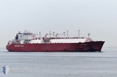
SESTAO KNUTSEN
Lng Tanker
Current Trip
FOR ORDERS
| Time Travelled | 5 days |
|---|---|
| Remaining Time | --- |
| Distance Travelled | 862.31 nm |
| Remaining Distance | --- |
| AVG Speed | 13.1 Knots |
| MAX Speed | 15.4 Knots |
| AVG Wind | 11.3 knots |
| MAX Wind | 25.6 knots |
| MIN Temp | 23.7°C / 74.66°F |
| MAX Temp | 28.6°C / 83.48°F |
| Draught | 11.5 m |
| Position Received | 4 d ago |
Current Position
| Longitude | 57.04038° |
|---|---|
| Latitude | 24.73147° |
| Status | Under way using engine |
| Speed | 13.1 Knots |
| Course | 136.7° |
| Area | Gulf of Oman |
| Station | T-AIS |
| Position Received | 4 d ago |
Info
Information
The current position of SESTAO KNUTSEN is in Gulf of Oman with coordinates 24.73147° / 57.04038° as reported on 2024-04-15 01:58 by AIS to our vessel tracker app. The vessel's current speed is 13.1 Knots
The vessel SESTAO KNUTSEN (IMO: 9338797, MMSI: 225372000) is a Lng Tanker that was built in 2007 ( 17 years old ). It's sailing under the flag of [ES] Spain.
In this page you can find informations about the vessels current position, last detected port calls, and current voyage information. If the vessels is not in coverage by AIS you will find the latest position.
The current position of SESTAO KNUTSEN is detected by our AIS receivers and we are not responsible for the reliability of the data. The last position was recorded while the vessel was in Coverage by the Ais receivers of our vessel tracking app.
The current draught of SESTAO KNUTSEN as reported by AIS is 11.5 meters
Weather
| Temperature | 27.9°C / 82.22°F |
|---|---|
| Wind Speed | 12 knots |
| Direction | 254° WSW |
| Pressure | 1012 hPa |
| Humidity | 81.2 % |
| Cloud Coverage | 5 % |
Featured Company
Last Port Calls
| Port | Arrival | Departure | Time In Port |
|---|---|---|---|
| 2024-04-12 20:47 | 2024-04-14 00:10 | 1 d | |
| 2024-03-25 04:04 | 2024-03-26 05:18 | 1 d | |
| 2024-03-06 07:07 | |||
| 2024-02-17 16:16 | 2024-02-18 20:08 | 1 d |
Most Visited Ports (Last year)
| Port | Arrivals | |
|---|---|---|
| 11 | ||
| 3 | ||
| 2 |
Last Trips
| Origin | Departure | Destination | Arrival | Distance | |
|---|---|---|---|---|---|
| 2024-03-26 13:18 | 2024-04-13 00:47 | 5939.51 nm | |||
| 2024-03-06 11:07 | 2024-03-25 12:04 | 6031.89 nm | |||
| 2024-01-04 15:51 | 2024-02-17 20:16 | 13359.78 nm |
Events
| Time | Event | Details | Position / Dest | Info |
|---|---|---|---|---|
| 2024-04-17 08:04 | START Moving | 5.46 nm, North West of MINA AL FAHL |
23.70396 / 58.44060
FOR ORDERS
|
Speed: 6.2 kn Course: 88° |
| 2024-04-16 02:55 | STOP Moving | 5.71 nm, North West of MINA AL FAHL |
23.70209 / 58.43209
FOR ORDERS
|
Speed: 0.3 kn Course: 154° |
| 2024-04-15 01:59 | Status Changed | Default Under way using engine |
24.72831 / 57.04366
FOR ORDERS
|
Speed: 13.1 kn Course: 136.7° |
| 2024-04-15 01:58 | Status Changed | Under way using engine Default |
24.73147 / 57.04038
FOR ORDERS
|
Speed: 13.1 kn Course: 138° |
| 2024-04-15 01:58 | OUT of Coverage |
24.73147 / 57.04038
Gulf of Oman
FOR ORDERS
|
Speed: 13.1 kn Course: 136.7° |
|
| 2024-04-15 01:43 | Status Changed | Default Under way using engine |
24.77311 / 56.99958
FOR ORDERS
|
Speed: 13.2 kn Course: 142.8° |
| 2024-04-15 01:31 | Detected in Sea | Omani part of the Gulf of Oman |
24.80608 / 56.97013
Gulf of Oman
FOR ORDERS
|
Speed: 13.2 kn Course: 143.1° |
| 2024-04-15 01:31 | Status Changed | Under way using engine Default |
24.80855 / 56.96810
FOR ORDERS
|
Speed: 13.1 kn Course: 143° |
| 2024-04-15 01:31 | IN Coverage |
24.80608 / 56.97013
Gulf of Oman
FOR ORDERS
|
Speed: 13.2 kn Course: 143.1° |
|
| 2024-04-15 00:11 | OUT of Coverage |
25.06505 / 56.83298
Gulf of Oman
FOR ORDERS
|
Speed: 13 kn Course: 167.6° |