
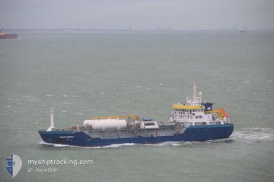
SEFARINA
Tanker
Current Trip
| Time Travelled | 8 h, 47 mins |
|---|---|
| Remaining Time | 7 h, 1 mins |
| Distance Travelled | 80.38 nm |
| Remaining Distance | 69.33 nm |
| AVG Speed | 9.4 Knots |
| MAX Speed | 11.6 Knots |
| AVG Wind | 16.8 knots |
| MAX Wind | 21 knots |
| MIN Temp | 7.1°C / 44.78°F |
| MAX Temp | 9.2°C / 48.56°F |
| Draught | 4.3 m |
| Position Received | 8 m ago |
Current Position
| Longitude | 2.51092° |
|---|---|
| Latitude | 52.56556° |
| Status | Under way using engine |
| Speed | 10.2 Knots |
| Course | 303.7° |
| Area | North Sea |
| Station | T-AIS |
| Position Received | 8 m ago |
Info
Information
The current position of SEFARINA is in North Sea with coordinates 52.56556° / 2.51092° as reported on 2024-04-25 00:01 by AIS to our vessel tracker app. The vessel's current speed is 10.2 Knots and is heading at the port of ROTTERDAM. The estimated time of arrival as calculated by MyShipTracking vessel tracking app is 2024-04-25 07:10 LT
The vessel SEFARINA (IMO: 9715701, MMSI: 244830183) is a Tanker It's sailing under the flag of [NL] Netherlands.
In this page you can find informations about the vessels current position, last detected port calls, and current voyage information. If the vessels is not in coverage by AIS you will find the latest position.
The current position of SEFARINA is detected by our AIS receivers and we are not responsible for the reliability of the data. The last position was recorded while the vessel was in Coverage by the Ais receivers of our vessel tracking app.
The current draught of SEFARINA as reported by AIS is 4.3 meters
Weather
| Temperature | 7.1°C / 44.78°F |
|---|---|
| Wind Speed | 10 knots |
| Direction | 329° NNW |
| Pressure | 1009.8 hPa |
| Humidity | 62.6 % |
| Cloud Coverage | 74 % |
Featured Company
Last Port Calls
| Port | Arrival | Departure | Time In Port |
|---|---|---|---|
| 2024-04-22 01:42 | 2024-04-24 15:22 | 2 d | |
| 2024-04-20 08:03 | 2024-04-20 23:43 | 15 h | |
| 2024-04-17 15:21 | 2024-04-18 17:48 | 1 d | |
| 2024-04-16 12:50 | 2024-04-16 12:55 | 5 m | |
| 2024-04-15 19:54 | 2024-04-16 12:40 | 16 h | |
| 2024-04-13 20:10 | 2024-04-14 23:01 | 1 d | |
| 2024-04-12 09:14 | 2024-04-13 01:21 | 16 h | |
| 2024-04-10 12:50 | 2024-04-11 11:06 | 22 h | |
| 2024-04-08 15:13 | 2024-04-09 05:44 | 14 h | |
| 2024-04-05 09:12 | 2024-04-07 12:24 | 2 d |
Last Trips
| Origin | Departure | Destination | Arrival | Distance | |
|---|---|---|---|---|---|
| 2024-04-21 00:43 | 2024-04-22 03:42 | 217.43 nm | |||
| 2024-04-18 19:48 | 2024-04-20 09:03 | 238.04 nm | |||
| 2024-04-16 13:55 | 2024-04-17 17:21 | 243.30 nm | |||
| 2024-04-16 13:40 | 2024-04-16 13:50 | 0.55 nm | |||
| 2024-04-15 01:01 | 2024-04-15 20:54 | 201.62 nm | |||
| 2024-04-13 02:21 | 2024-04-13 22:10 | 202.02 nm | |||
| 2024-04-11 13:06 | 2024-04-12 10:14 | 231.66 nm | |||
| 2024-04-09 06:44 | 2024-04-10 14:50 | 242.76 nm | |||
| 2024-04-07 14:24 | 2024-04-08 16:13 | 241.41 nm | |||
| 2024-04-03 16:14 | 2024-04-05 11:12 | 247.18 nm |
Events
| Time | Event | Details | Position / Dest | Info |
|---|---|---|---|---|
| 2024-04-25 00:01 | Status Changed | Under way using engine Default |
52.56556 / 2.51092
ROTTERDAM
|
Speed: 10.1 kn Course: 304° |
| 2024-04-25 00:00 | Status Changed | Default Under way using engine |
52.56477 / 2.51293
ROTTERDAM
|
Speed: 9.8 kn Course: 302.5° |
| 2024-04-24 23:55 | Change Sea Area | United Kingdom part of the North Sea Dutch part of the North Sea |
52.55589 / 2.53491
North Sea
|
Speed: 9.8 kn Course: 302.5° |
| 2024-04-24 23:54 | Status Changed | Under way using engine Default |
52.55565 / 2.53554
ROTTERDAM
|
Speed: 10 kn Course: 304° |
| 2024-04-24 23:52 | IN Coverage |
52.55589 / 2.53491
North Sea
|
Speed: 9.8 kn Course: 302.5° |
|
| 2024-04-24 18:54 | Status Changed | Default Under way using engine |
52.13751 / 3.54890
ROTTERDAM
|
Speed: 9.1 kn Course: 300.7° |
| 2024-04-24 18:47 | OUT of Coverage |
52.12969 / 3.57185
North Sea
|
Speed: 9.1 kn Course: 300.7° |
|
| 2024-04-24 18:39 | START Moving | 19.65 nm, North West of MAASVLAKTE - ROTTERDAM |
52.11890 / 3.60405
ROTTERDAM
|
Speed: 10 kn Course: 300.6° |
| 2024-04-24 18:39 | STOP Moving | 19.54 nm, North West of MAASVLAKTE - ROTTERDAM |
52.11803 / 3.60665
ROTTERDAM
|
Speed: Course: 0° |
| 2024-04-24 17:40 | START Moving | 10.01 nm, North West of MAASVLAKTE - ROTTERDAM |
52.06256 / 3.85412
ROTTERDAM
|
Speed: 9.9 kn Course: 288.1° |