
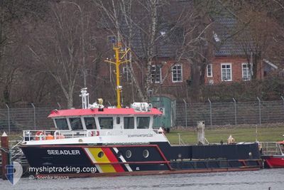
SEEADLER
Other Type
Current Trip
| Time Travelled | 2 h, 4 mins |
|---|---|
| Remaining Time | 4 h, 38 mins |
| Distance Travelled | 1.30 nm |
| Remaining Distance | 33.09 nm |
| AVG Speed | 4.2 Knots |
| MAX Speed | 6.5 Knots |
| AVG Wind | 7.4 knots |
| MAX Wind | 7.8 knots |
| MIN Temp | 4°C / 39.2°F |
| MAX Temp | 4.7°C / 40.46°F |
| Draught | 1.4 m |
| Position Received | 1 h, 32 m ago |
Current Position
| Longitude | 10.88819° |
|---|---|
| Latitude | 53.96059° |
| Status | Under way using engine |
| Speed | 6.6 Knots |
| Course | 69.1° |
| Area | Baltic Sea |
| Station | T-AIS |
| Position Received | 1 h, 32 m ago |
Info
Information
The current position of SEEADLER is in Baltic Sea with coordinates 53.96059° / 10.88819° as reported on 2024-04-23 07:57 by AIS to our vessel tracker app. The vessel's current speed is 6.6 Knots and is heading at the port of HEILIGENHAFEN. The estimated time of arrival as calculated by MyShipTracking vessel tracking app is 2024-04-23 14:07 LT
The vessel SEEADLER (MMSI: 211264670) is a Other Type It's sailing under the flag of [DE] Germany.
In this page you can find informations about the vessels current position, last detected port calls, and current voyage information. If the vessels is not in coverage by AIS you will find the latest position.
The current position of SEEADLER is detected by our AIS receivers and we are not responsible for the reliability of the data. The last position was recorded while the vessel was in Coverage by the Ais receivers of our vessel tracking app.
The current draught of SEEADLER as reported by AIS is 1.4 meters
Weather
| Temperature | 3.6°C / 38.48°F |
|---|---|
| Wind Speed | 8 knots |
| Direction | 251° WSW |
| Pressure | 1020.1 hPa |
| Humidity | 68.4 % |
| Cloud Coverage | 11 % |
Featured Company
Last Port Calls
| Port | Arrival | Departure | Time In Port |
|---|---|---|---|
| 2024-04-23 06:38 | 2024-04-23 07:25 | 47 m | |
| 2024-04-22 10:55 | 2024-04-23 03:03 | 16 h | |
| 2024-04-18 10:35 | 2024-04-22 05:46 | 3 d | |
| 2024-04-17 11:03 | 2024-04-18 06:08 | 19 h | |
| 2024-04-17 10:05 | 2024-04-17 10:07 | 1 m | |
| 2024-04-17 05:56 | |||
| 2024-04-15 12:35 | 2024-04-16 04:08 | 15 h | |
| 2024-04-15 09:41 | 2024-04-15 10:21 | 40 m | |
| 2024-04-15 08:29 | 2024-04-15 08:36 | 6 m | |
| 2024-04-11 11:31 | 2024-04-15 05:10 | 3 d |
Most Visited Ports (Last year)
| Port | Arrivals | |
|---|---|---|
| 55 | ||
| 14 | ||
| 9 | ||
| 4 | ||
| 3 | ||
| 3 |
Last Trips
| Origin | Departure | Destination | Arrival | Distance | |
|---|---|---|---|---|---|
| 2024-04-23 05:03 | 2024-04-23 08:38 | 28.55 nm | |||
| 2024-04-22 07:46 | 2024-04-22 12:55 | 14.77 nm | |||
| 2024-04-18 08:08 | 2024-04-18 12:35 | 35.85 nm | |||
| 2024-04-17 12:07 | 2024-04-17 13:03 | 8.28 nm | |||
| 2024-04-17 07:56 | 2024-04-17 12:05 | 13.45 nm | |||
| 2024-04-15 12:21 | 2024-04-15 14:35 | 11.70 nm | |||
| 2024-04-15 10:36 | 2024-04-15 11:41 | 5.82 nm | |||
| 2024-04-15 07:10 | 2024-04-15 10:29 | 26.87 nm | |||
| 2024-04-11 07:21 | 2024-04-11 13:31 | 51.52 nm | |||
| 2024-04-08 05:10 | 2024-04-08 12:55 | 53.06 nm |
Events
| Time | Event | Details | Position / Dest | Info |
|---|---|---|---|---|
| 2024-04-23 07:57 | OUT of Coverage |
53.96059 / 10.88819
Baltic Sea
HEILIGENHAFEN
|
Speed: 6.6 kn Course: 69.1° |
|
| 2024-04-23 07:25 | Destination Changed | HEILIGENHAFEN KO 6/T 63 |
53.96221 / 10.89125
HEILIGENHAFEN
|
Speed: 5.6 kn Course: 19.9° |
| 2024-04-23 07:25 | ETA Changed | 2024/04/23 14:30 2024/04/18 14:30 |
53.96221 / 10.89125
HEILIGENHAFEN
|
Speed: 5.6 kn Course: 19.9° |
| 2024-04-23 07:25 | PORT DEPARTURE |
|
53.96221 / 10.89125
KO 6/T 63
|
Speed: 6.3 kn Course: 61.5° |
| 2024-04-23 07:23 | START Moving |
53.96008 / 10.88651
[DE] TRAVEMUNDE
|
Speed: 6 kn Course: 63.6° |
|
| 2024-04-23 06:38 | STOP Moving |
53.96008 / 10.88247
[DE] TRAVEMUNDE
|
Speed: 0.3 kn Course: 511° |
|
| 2024-04-23 06:38 | PORT ARRIVAL |
|
53.96008 / 10.88247
[DE] TRAVEMUNDE
|
Speed: 3.1 kn Course: 269.4° |
| 2024-04-23 06:21 | IN Coverage |
53.98780 / 10.91070
Baltic Sea
|
Speed: 9.9 kn Course: 207.2° |
|
| 2024-04-23 03:40 | OUT of Coverage |
54.37645 / 11.16373
Baltic Sea
|
Speed: 9.8 kn Course: 200.3° |
|
| 2024-04-23 03:31 | IN Coverage |
54.39242 / 11.13692
Baltic Sea
|
Speed: 10 kn Course: 124.1° |