
SEATRIBUTE
Tanker
Current Trip
| Time Travelled | 8 days |
|---|---|
| Remaining Time | 1 day |
| Distance Travelled | 1655.87 nm |
| Remaining Distance | 239.44 nm |
| AVG Speed | 9.5 Knots |
| MAX Speed | 13.1 Knots |
| AVG Wind | 13 knots |
| MAX Wind | 31 knots |
| MIN Temp | 15.3°C / 59.54°F |
| MAX Temp | 21.4°C / 70.52°F |
| Draught | 8.3 m |
| Position Received | Now |
Current Position
| Longitude | 31.47298° |
|---|---|
| Latitude | 35.82206° |
| Status | Under way sailing |
| Speed | 7.6 Knots |
| Course | 90.1° |
| Area | Mediterranean Sea - Eastern Basin |
| Station | T-AIS |
| Position Received | Now |
Info
Information
The current position of SEATRIBUTE is in Mediterranean Sea - Eastern Basin with coordinates 35.82206° / 31.47298° as reported on 2024-04-16 09:49 by AIS to our vessel tracker app. The vessel's current speed is 7.6 Knots and is heading at the port of CEYHAN. The estimated time of arrival as calculated by MyShipTracking vessel tracking app is 2024-04-17 17:40 LT
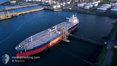
The vessel SEATRIBUTE (IMO: 9857468, MMSI: 215544000) is a Tanker It's sailing under the flag of [MT] Malta.
In this page you can find informations about the vessels current position, last detected port calls, and current voyage information. If the vessels is not in coverage by AIS you will find the latest position.
The current position of SEATRIBUTE is detected by our AIS receivers and we are not responsible for the reliability of the data. The last position was recorded while the vessel was in Coverage by the Ais receivers of our vessel tracking app.
The current draught of SEATRIBUTE as reported by AIS is 8.3 meters
Weather
| Temperature | 21°C / 69.8°F |
|---|---|
| Wind Speed | 5 knots |
| Direction | 240° WSW |
| Pressure | 1016.7 hPa |
| Humidity | 64.1 % |
| Cloud Coverage | 40 % |
Featured Company
Events
| Time | Event | Details | Position / Dest | Info |
|---|---|---|---|---|
| 2024-04-16 06:35 | Status Changed | Under way sailing Default |
35.81836 / 30.97704
TRCEY
|
Speed: 7.5 kn Course: 92° |
| 2024-04-16 06:25 | Status Changed | Default Under way sailing |
35.81876 / 30.95104
TRCEY
|
Speed: 7.5 kn Course: 91.6° |
| 2024-04-16 06:24 | Status Changed | Under way sailing Default |
35.81886 / 30.94725
TRCEY
|
Speed: 8 kn Course: 92° |
| 2024-04-16 06:15 | IN Coverage |
35.81886 / 30.94725
Mediterranean Sea - Eastern Basin
TRCEY
|
Speed: 7.5 kn Course: 91.6° |
|
| 2024-04-16 05:06 | Status Changed | Default Under way sailing |
35.81933 / 30.66299
TRCEY
|
Speed: 10.9 kn Course: 89.9° |
| 2024-04-16 05:02 | OUT of Coverage |
35.81911 / 30.64774
Mediterranean Sea - Eastern Basin
TRCEY
|
Speed: 10.9 kn Course: 89.9° |
|
| 2024-04-16 04:37 | Status Changed | Under way sailing Default |
35.81882 / 30.56073
TRCEY
|
Speed: 9.6 kn Course: 91° |
| 2024-04-16 04:10 | Status Changed | Default Under way sailing |
35.81976 / 30.47458
TRCEY
|
Speed: 9.7 kn Course: 91° |
| 2024-04-16 02:17 | Status Changed | Under way sailing Default |
35.81466 / 30.08347
TRCEY
|
Speed: 10.1 kn Course: 88° |
| 2024-04-16 01:40 | Status Changed | Default Under way sailing |
35.81330 / 29.95737
TRCEY
|
Speed: 9.7 kn Course: 88.4° |