
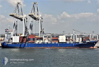
SEATRADE BLUE
Cargo
Current Trip
PFPPT
| Time Travelled | 14 days |
|---|---|
| Remaining Time | --- |
| Distance Travelled | 4874.85 nm |
| Remaining Distance | --- |
| AVG Speed | 15.9 Knots |
| MAX Speed | 20 Knots |
| AVG Wind | 12.2 knots |
| MAX Wind | 21.8 knots |
| MIN Temp | 18.7°C / 65.66°F |
| MAX Temp | 34.5°C / 94.1°F |
| Draught | 8.6 m |
| Position Received | 5 d ago |
Current Position
| Longitude | -91.44029° |
|---|---|
| Latitude | 3.54402° |
| Status | Under way using engine |
| Speed | 17.7 Knots |
| Course | 252.7° |
| Area | North Pacific Ocean |
| Station | T-AIS |
| Position Received | 5 d ago |
Info
Information
The current position of SEATRADE BLUE is in North Pacific Ocean with coordinates 3.54402° / -91.44029° as reported on 2024-04-18 18:13 by AIS to our vessel tracker app. The vessel's current speed is 17.7 Knots
The vessel SEATRADE BLUE (IMO: 9756107, MMSI: 636092713) is a Cargo It's sailing under the flag of [LR] Liberia.
In this page you can find informations about the vessels current position, last detected port calls, and current voyage information. If the vessels is not in coverage by AIS you will find the latest position.
The current position of SEATRADE BLUE is detected by our AIS receivers and we are not responsible for the reliability of the data. The last position was recorded while the vessel was in Coverage by the Ais receivers of our vessel tracking app.
The current draught of SEATRADE BLUE as reported by AIS is 8.6 meters
Weather
| Temperature | 27.1°C / 80.78°F |
|---|---|
| Wind Speed | 11 knots |
| Direction | 82° E |
| Pressure | 1010.8 hPa |
| Humidity | 74.4 % |
| Cloud Coverage | 55 % |
Featured Company
Last Port Calls
| Port | Arrival | Departure | Time In Port |
|---|---|---|---|
| 2024-04-09 16:34 | 2024-04-10 09:55 | 17 h | |
| 2024-04-06 08:21 | 2024-04-06 09:35 | 1 h | |
| 2024-03-24 19:32 | 2024-03-25 11:38 | 16 h | |
| 2024-03-23 12:25 | 2024-03-23 23:07 | 10 h | |
| 2024-03-22 19:59 | 2024-03-23 06:24 | 10 h | |
| 2024-03-21 15:27 | 2024-03-22 06:51 | 15 h | |
| 2024-03-10 18:22 | 2024-03-11 03:16 | 8 h | |
| 2024-03-07 17:49 | 2024-03-08 18:01 | 1 d | |
| 2024-03-03 06:58 | 2024-03-03 22:25 | 15 h | |
| 2024-02-11 22:06 | 2024-02-12 21:39 | 23 h |
Last Trips
| Origin | Departure | Destination | Arrival | Distance | |
|---|---|---|---|---|---|
| 2024-04-06 05:35 | 2024-04-09 12:34 | 733.80 nm | |||
| 2024-03-25 12:38 | 2024-04-06 04:21 | 3335.71 nm | |||
| 2024-03-24 00:07 | 2024-03-24 20:32 | 181.42 nm | |||
| 2024-03-23 06:24 | 2024-03-23 13:25 | 84.35 nm | |||
| 2024-03-22 07:51 | 2024-03-22 19:59 | 159.73 nm | |||
| 2024-03-10 23:16 | 2024-03-21 16:27 | 4150.44 nm | |||
| 2024-03-08 13:01 | 2024-03-10 14:22 | 692.02 nm | |||
| 2024-03-03 17:25 | 2024-03-07 12:49 | 1535.29 nm | |||
| 2024-02-13 10:39 | 2024-03-03 01:58 | 6539.55 nm | |||
| 2024-02-11 01:49 | 2024-02-12 11:06 | 155.74 nm |
Events
| Time | Event | Details | Position / Dest | Info |
|---|---|---|---|---|
| 2024-04-18 18:56 | Status Changed | Default Under way using engine |
3.48333 / -91.63834
PFPPT
|
Speed: 17.7 kn Course: 252.7° |
| 2024-04-18 18:13 | OUT of Coverage |
3.54402 / -91.44029
North Pacific Ocean
PFPPT
|
Speed: 17.7 kn Course: 252.7° |
|
| 2024-04-18 18:11 | Status Changed | Under way using engine Default |
3.54690 / -91.43088
PFPPT
|
Speed: 17.8 kn Course: 253° |
| 2024-04-18 17:55 | IN Coverage |
3.54690 / -91.43088
North Pacific Ocean
PFPPT
|
Speed: 17.7 kn Course: 253.4° |
|
| 2024-04-18 16:29 | Status Changed | Default Under way using engine |
3.69452 / -90.94849
PFPPT
|
Speed: 17.7 kn Course: 253.2° |
| 2024-04-18 16:04 | Status Changed | Under way using engine Default |
3.72982 / -90.83307
PFPPT
|
Speed: 17.7 kn Course: 253° |
| 2024-04-18 16:04 | OUT of Coverage |
3.72982 / -90.83307
North Pacific Ocean
PFPPT
|
Speed: 17.7 kn Course: 253.2° |
|
| 2024-04-18 15:46 | IN Coverage |
3.72982 / -90.83307
North Pacific Ocean
PFPPT
|
Speed: 17.7 kn Course: 253.2° |
|
| 2024-04-18 14:52 | Status Changed | Default Under way using engine |
3.83333 / -90.49500
PFPPT
|
Speed: 17.5 kn Course: 252.9° |
| 2024-04-18 14:47 | OUT of Coverage |
3.84018 / -90.47190
North Pacific Ocean
PFPPT
|
Speed: 17.5 kn Course: 252.9° |