
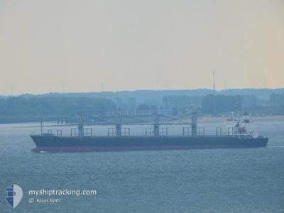
SEA MOON
Bulk Carrier
Current Trip
| Time Travelled | 6 days |
|---|---|
| Remaining Time | 11 days |
| Distance Travelled | 1960.36 nm |
| Remaining Distance | 3333.04 nm |
| AVG Speed | 11.7 Knots |
| MAX Speed | 14.5 Knots |
| AVG Wind | 12.9 knots |
| MAX Wind | 27 knots |
| MIN Temp | 15.7°C / 60.26°F |
| MAX Temp | 21.8°C / 71.24°F |
| Draught | 9.3 m |
| Position Received | 3 d ago |
Current Position
| Longitude | 18.03409° |
|---|---|
| Latitude | -34.30819° |
| Status | Under way using engine |
| Speed | 12.1 Knots |
| Course | 311.1° |
| Area | South Atlantic Ocean |
| Station | T-AIS |
| Position Received | 3 d ago |
Info
Information
The current position of SEA MOON is in South Atlantic Ocean with coordinates -34.30819° / 18.03409° as reported on 2024-04-15 08:29 by AIS to our vessel tracker app. The vessel's current speed is 12.1 Knots and is heading at the port of LAS PALMAS. The estimated time of arrival as calculated by MyShipTracking vessel tracking app is 2024-04-30 08:59 LT
The vessel SEA MOON (IMO: 9228227, MMSI: 636016427) is a Bulk Carrier that was built in 2002 ( 22 years old ). It's sailing under the flag of [LR] Liberia.
In this page you can find informations about the vessels current position, last detected port calls, and current voyage information. If the vessels is not in coverage by AIS you will find the latest position.
The current position of SEA MOON is detected by our AIS receivers and we are not responsible for the reliability of the data. The last position was recorded while the vessel was in Coverage by the Ais receivers of our vessel tracking app.
The current draught of SEA MOON as reported by AIS is 9.3 meters
Weather
| Temperature | 21.6°C / 70.88°F |
|---|---|
| Wind Speed | 14 knots |
| Direction | 140° SE |
| Pressure | 1016.2 hPa |
| Humidity | 85.8 % |
| Cloud Coverage | 40 % |
Featured Company
Last Port Calls
| Port | Arrival | Departure | Time In Port |
|---|---|---|---|
| 2024-04-06 13:52 | 2024-04-12 01:16 | 5 d |
Most Visited Ports (Last year)
| Port | Arrivals | |
|---|---|---|
| 2 | ||
| 1 | ||
| 1 | ||
| 1 | ||
| 1 | ||
| 1 |
Last Trips
| Origin | Departure | Destination | Arrival | Distance |
|---|
Events
| Time | Event | Details | Position / Dest | Info |
|---|---|---|---|---|
| 2024-04-15 08:41 | Status Changed | Default Under way using engine |
-34.28211 / 17.99907
ES LPA
|
Speed: 12.1 kn Course: 311.1° |
| 2024-04-15 08:29 | OUT of Coverage |
-34.30819 / 18.03409
South Atlantic Ocean
ES LPA
|
Speed: 12.1 kn Course: 311.1° |
|
| 2024-04-15 08:28 | Status Changed | Under way using engine Default |
-34.31196 / 18.03918
ES LPA
|
Speed: 12.2 kn Course: 313° |
| 2024-04-15 08:12 | Status Changed | Default Under way using engine |
-34.34404 / 18.09033
ES LPA
|
Speed: 12.2 kn Course: 299.6° |
| 2024-04-15 08:08 | Status Changed | Under way using engine Default |
-34.34978 / 18.10192
ES LPA
|
Speed: 12.1 kn Course: 298° |
| 2024-04-15 07:57 | Status Changed | Default Under way using engine |
-34.36987 / 18.14170
ES LPA
|
Speed: 11.9 kn Course: 300.5° |
| 2024-04-15 07:14 | Status Changed | Under way using engine Default |
-34.44315 / 18.28826
ES LPA
|
Speed: 11.5 kn Course: 300° |
| 2024-04-15 07:11 | Status Changed | Default Under way using engine |
-34.44865 / 18.29948
ES LPA
|
Speed: 11.6 kn Course: 304.2° |
| 2024-04-15 06:24 | Draught Changed | 9.3 9.8 |
-34.52730 / 18.46385
ES LPA
|
Speed: 12.2 kn Course: 302° |
| 2024-04-15 06:24 | Destination Changed | ES LPA KANDLA,INDIA |
-34.52730 / 18.46385
ES LPA
|
Speed: 12.2 kn Course: 302° |