
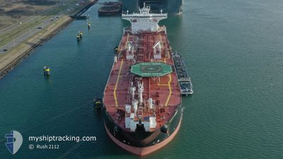
SCOTT SPIRIT
Oil Products Tanker
Current Trip
| Time Travelled | 13 days |
|---|---|
| Remaining Time | --- |
| Distance Travelled | 2781.56 nm |
| Remaining Distance | --- |
| AVG Speed | 12 Knots |
| MAX Speed | 17.6 Knots |
| AVG Wind | 11.2 knots |
| MAX Wind | 38.9 knots |
| MIN Temp | 4.3°C / 39.74°F |
| MAX Temp | 18°C / 64.4°F |
| Draught | 12.2 m |
| Position Received | 4 h, 35 m ago |
Current Position
| Longitude | -5.20521° |
|---|---|
| Latitude | 51.79085° |
| Status | Under way using engine |
| Speed | 0.2 Knots |
| Course | 5° |
| Area | Celtic Sea |
| Station | T-AIS |
| Position Received | 4 h, 35 m ago |
Info
Information
The current position of SCOTT SPIRIT is in Celtic Sea with coordinates 51.79085° / -5.20521° as reported on 2024-04-24 19:24 by AIS to our vessel tracker app. The vessel's current speed is 0.2 Knots
The vessel SCOTT SPIRIT (IMO: 9466142, MMSI: 311027400) is a Oil Products Tanker that was built in 2011 ( 13 years old ). It's sailing under the flag of [BS] Bahamas.
In this page you can find informations about the vessels current position, last detected port calls, and current voyage information. If the vessels is not in coverage by AIS you will find the latest position.
The current position of SCOTT SPIRIT is detected by our AIS receivers and we are not responsible for the reliability of the data. The last position was recorded while the vessel was in Coverage by the Ais receivers of our vessel tracking app.
The current draught of SCOTT SPIRIT as reported by AIS is 12.2 meters
Weather
| Temperature | 8.9°C / 48.02°F |
|---|---|
| Wind Speed | 4 knots |
| Direction | 323° NW |
| Pressure | 1013.2 hPa |
| Humidity | 66.8 % |
| Cloud Coverage | 24 % |
Featured Company
Most Visited Ports (Last year)
| Port | Arrivals | |
|---|---|---|
| 6 | ||
| 3 | ||
| 3 | ||
| 3 | ||
| 2 | ||
| 1 |
Last Trips
| Origin | Departure | Destination | Arrival | Distance | |
|---|---|---|---|---|---|
| 2024-03-25 00:48 | 2024-04-09 16:27 | 2398.63 nm | |||
| 2024-03-08 05:35 | 2024-03-22 01:49 | 1030.83 nm | |||
| 2024-02-25 16:11 | 2024-03-05 18:23 | 1281.99 nm | |||
| 2024-02-17 08:06 | 2024-02-24 17:47 | 1199.36 nm | |||
| 2024-01-28 13:47 | 2024-02-15 04:41 | 1354.65 nm |
Events
| Time | Event | Details | Position / Dest | Info |
|---|---|---|---|---|
| 2024-04-24 19:31 | Status Changed | Default Under way using engine |
51.79022 / -5.20503
PEMBROKE
|
Speed: 0.2 kn Course: 5° |
| 2024-04-24 19:24 | OUT of Coverage |
51.79085 / -5.20521
Celtic Sea
PEMBROKE
|
Speed: 0.2 kn Course: 191.4° |
|
| 2024-04-24 19:20 | Status Changed | Under way using engine Default |
51.79131 / -5.20525
PEMBROKE
|
Speed: 0.5 kn Course: 4° |
| 2024-04-24 19:18 | Status Changed | Default Under way using engine |
51.79152 / -5.20528
PEMBROKE
|
Speed: 0.1 kn Course: 5° |
| 2024-04-24 19:13 | STOP Moving | 10.6 nm, North West of PEMBROKE |
51.79225 / -5.20541
PEMBROKE
|
Speed: 0.1 kn Course: 5° |
| 2024-04-24 18:43 | Status Changed | Under way using engine Default |
51.78884 / -5.29347
PEMBROKE
|
Speed: 11.2 kn Course: 92° |
| 2024-04-24 18:42 | Status Changed | Default Under way using engine |
51.78885 / -5.29591
PEMBROKE
|
Speed: 10.7 kn Course: 91° |
| 2024-04-24 18:29 | Status Changed | Under way using engine Default |
51.78977 / -5.36264
PEMBROKE
|
Speed: 10.4 kn Course: 90° |
| 2024-04-24 18:26 | Status Changed | Default Under way using engine |
51.78982 / -5.37350
PEMBROKE
|
Speed: 10.6 kn Course: 91° |
| 2024-04-24 18:13 | Change Sea Area | United Kingdom part of the Celtic Sea Irish part of the Irish Sea and St. George's Channel |
51.79091 / -5.43959
Celtic Sea
PEMBROKE
|
Speed: 12.2 kn Course: 92.1° |