
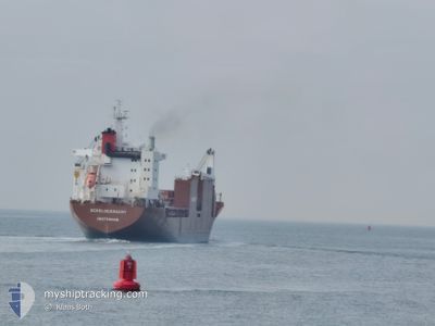
SCHELDEGRACHT
General Cargo
Current Trip
| Time Travelled | 3 days |
|---|---|
| Remaining Time | --- |
| Distance Travelled | 45.03 nm |
| Remaining Distance | --- |
| AVG Speed | 15.5 Knots |
| MAX Speed | 18.6 Knots |
| AVG Wind | 4.9 knots |
| MAX Wind | 11 knots |
| MIN Temp | 10.7°C / 51.26°F |
| MAX Temp | 15.1°C / 59.18°F |
| Draught | 7.9 m |
| Position Received | 1 m ago |
Current Position
| Longitude | --- |
|---|---|
| Latitude | --- |
| Status | At anchor |
| Speed | |
| Course | 199° |
| Area | Tyrrhenian Sea |
| Station | T-AIS |
| Position Received | 1 m ago |
Info
Information
The current position of SCHELDEGRACHT is in Tyrrhenian Sea with coordinates 43.49726° / 10.25858° as reported on 2025-12-09 15:47 by AIS to our vessel tracker app. The vessel's current speed is 0 Knots
The vessel SCHELDEGRACHT (IMO: 9202510, MMSI: 244730000) is a General Cargo that was built in 2000 ( 25 years old ). It's sailing under the flag of [NL] Netherlands.
In this page you can find informations about the vessels current position, last detected port calls, and current voyage information. If the vessels is not in coverage by AIS you will find the latest position.
The current position of SCHELDEGRACHT is detected by our AIS receivers and we are not responsible for the reliability of the data. The last position was recorded while the vessel was in Coverage by the Ais receivers of our vessel tracking app.
The current draught of SCHELDEGRACHT as reported by AIS is 7.9 meters
Weather
| Temperature | 14°C / 57.2°F |
|---|---|
| Wind Speed | 2 knots |
| Direction | 220° SW |
| Pressure | 1023.8 hPa |
| Humidity | 69.9 % |
| Cloud Coverage | 8 % |
Featured Company
Last Port Calls
| Port | Arrival | Departure | Time In Port |
|---|---|---|---|
| 2025-12-04 22:46 | 2025-12-05 18:15 | 19 h | |
| 2025-11-30 10:08 | 2025-11-30 23:49 | 13 h | |
| 2025-11-27 16:00 | 2025-11-29 06:28 | 1 d | |
| 2025-11-18 10:22 | 2025-11-18 16:20 | 5 h | |
| 2025-11-05 13:08 | 2025-11-05 21:32 | 8 h | |
| 2025-10-24 01:23 | 2025-10-25 18:26 | 1 d | |
| 2025-10-06 21:16 | 2025-10-09 11:31 | 2 d | |
| 2025-09-30 21:26 | 2025-10-04 08:17 | 3 d |
Most Visited Ports (Last year)
| Port | Arrivals | |
|---|---|---|
| 4 | ||
| 4 | ||
| 3 | ||
| 2 | ||
| 2 | ||
| 2 |
Last Trips
| Origin | Departure | Destination | Arrival | Distance | |
|---|---|---|---|---|---|
| 2025-11-30 23:49 | 2025-12-04 22:46 | 801.47 nm | |||
| 2025-11-29 06:28 | 2025-11-30 10:08 | 350.87 nm | |||
| 2025-11-18 16:20 | 2025-11-27 16:00 | 2886.23 nm | |||
| 2025-11-05 21:32 | 2025-11-18 10:22 | 3788.68 nm | |||
| 2025-10-25 18:26 | 2025-11-05 13:08 | 742.38 nm | |||
| 2025-10-09 11:31 | 2025-10-24 01:23 | 3505.01 nm | |||
| 2025-10-04 08:17 | 2025-10-06 21:16 | 935.17 nm | |||
| 2025-09-30 14:33 | 2025-09-30 21:26 | 69.59 nm |
Events
| Time | Event | Details | Position / Dest | Info |
|---|---|---|---|---|
| 2025-12-09 15:47 | Status Changed | At anchor Default |
43.49726 / 10.25858
IT MDC-IT LIV
|
Speed: Course: 201° |
| 2025-12-09 15:44 | Status Changed | Default At anchor |
43.49726 / 10.25860
IT MDC-IT LIV
|
Speed: Course: 194° |
| 2025-12-09 15:38 | Status Changed | At anchor Default |
43.49732 / 10.25850
IT MDC-IT LIV
|
Speed: Course: 190° |
| 2025-12-09 15:35 | Status Changed | Default At anchor |
43.49732 / 10.25841
IT MDC-IT LIV
|
Speed: Course: 187° |
| 2025-12-09 15:26 | Status Changed | At anchor Default |
43.49723 / 10.25826
IT MDC-IT LIV
|
Speed: Course: 189° |
| 2025-12-09 15:17 | Status Changed | Default At anchor |
43.49717 / 10.25823
IT MDC-IT LIV
|
Speed: Course: 188° |
| 2025-12-09 14:38 | Status Changed | At anchor Default |
43.49717 / 10.25781
IT MDC-IT LIV
|
Speed: Course: 175° |
| 2025-12-09 14:20 | Status Changed | Default At anchor |
43.49714 / 10.25751
IT MDC-IT LIV
|
Speed: Course: 165° |
| 2025-12-09 13:38 | Status Changed | At anchor Default |
43.49663 / 10.25641
IT MDC-IT LIV
|
Speed: Course: 125° |
| 2025-12-09 13:35 | Status Changed | Default At anchor |
43.49657 / 10.25636
IT MDC-IT LIV
|
Speed: Course: 119° |