
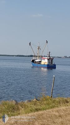
SCH10 DRIEGEBROEDERS
Fishing Vessel
Current Trip
SCHEVENINGEN
| Time Travelled | 17 days |
|---|---|
| Remaining Time | --- |
| Distance Travelled | 784.67 nm |
| Remaining Distance | --- |
| AVG Speed | 3.8 Knots |
| MAX Speed | 11.8 Knots |
| AVG Wind | 15.4 knots |
| MAX Wind | 29.5 knots |
| MIN Temp | 2.8°C / 37.04°F |
| MAX Temp | 12.5°C / 54.5°F |
| Draught | 2.4 m |
| Position Received | 1 m ago |
Current Position
| Longitude | 8.17548° |
|---|---|
| Latitude | 54.94754° |
| Status | Engaged in Fishing |
| Speed | 3.1 Knots |
| Course | 220° |
| Area | North Sea |
| Station | T-AIS |
| Position Received | 1 m ago |
Info
Information
The current position of SCH10 DRIEGEBROEDERS is in North Sea with coordinates 54.94754° / 8.17548° as reported on 2024-04-19 20:44 by AIS to our vessel tracker app. The vessel's current speed is 3.1 Knots
The vessel SCH10 DRIEGEBROEDERS (IMO: 8432625, MMSI: 244049000) is a Fishing Vessel that was built in 1968 ( 56 years old ). It's sailing under the flag of [NL] Netherlands.
In this page you can find informations about the vessels current position, last detected port calls, and current voyage information. If the vessels is not in coverage by AIS you will find the latest position.
The current position of SCH10 DRIEGEBROEDERS is detected by our AIS receivers and we are not responsible for the reliability of the data. The last position was recorded while the vessel was in Coverage by the Ais receivers of our vessel tracking app.
The current draught of SCH10 DRIEGEBROEDERS as reported by AIS is 2.4 meters
Weather
| Temperature | 6.9°C / 44.42°F |
|---|---|
| Wind Speed | 19 knots |
| Direction | 15° NNE |
| Pressure | 1009.4 hPa |
| Humidity | 58.3 % |
| Cloud Coverage | 34 % |
Featured Company
Last Port Calls
| Port | Arrival | Departure | Time In Port |
|---|---|---|---|
| 2024-03-28 02:13 | 2024-04-02 08:30 | 5 d | |
| 2024-02-29 07:44 | 2024-03-11 10:47 | 11 d | |
| 2024-02-21 10:05 | 2024-02-27 13:57 | 6 d | |
| 2024-02-16 07:05 | 2024-02-18 22:59 | 2 d | |
| 2024-02-09 05:37 | 2024-02-14 12:28 | 5 d | |
| 2024-02-07 07:03 |
Most Visited Ports (Last year)
| Port | Arrivals | |
|---|---|---|
| 59 | ||
| 7 | ||
| 2 | ||
| 1 | ||
| 1 |
Last Trips
| Origin | Departure | Destination | Arrival | Distance | |
|---|---|---|---|---|---|
| 2024-03-11 11:47 | 2024-03-28 03:13 | 999.02 nm | |||
| 2024-02-27 14:57 | 2024-02-29 08:44 | 133.73 nm | |||
| 2024-02-18 23:59 | 2024-02-21 11:05 | 191.72 nm | |||
| 2024-02-14 13:28 | 2024-02-16 08:05 | 136.94 nm | |||
| 2024-02-07 08:03 | 2024-02-09 06:37 | 154.96 nm |
Events
| Time | Event | Details | Position / Dest | Info |
|---|---|---|---|---|
| 2024-04-19 17:23 | Change Sea Area | German part of the North Sea Danish part of the North Sea |
55.05794 / 8.46974
North Sea
|
Speed: 9.1 kn Course: 277° |
| 2024-04-19 16:49 | START Moving | 6.2 nm, North East of LIST SYLT |
55.08683 / 8.57113
SCHEVENINGEN
|
Speed: 7.1 kn Course: 109.4° |
| 2024-04-19 06:03 | STOP Moving | 6.13 nm, North East of LIST SYLT |
55.08701 / 8.56784
SCHEVENINGEN
|
Speed: 0.3 kn Course: 182° |
| 2024-04-19 05:37 | Change Sea Area | Danish part of the North Sea German part of the North Sea |
55.05242 / 8.48956
North Sea
|
Speed: 9.3 kn Course: 81.5° |
| 2024-04-18 21:40 | IN Coverage |
54.89864 / 8.02845
North Sea
|
Speed: 2.8 kn Course: 101.9° |
|
| 2024-04-18 19:25 | OUT of Coverage |
54.80196 / 8.02087
North Sea
|
Speed: 2.8 kn Course: 335.6° |
|
| 2024-04-18 10:15 | IN Coverage |
54.74155 / 8.06882
North Sea
|
Speed: 1.3 kn Course: 67.7° |
|
| 2024-04-18 08:49 | OUT of Coverage |
54.68476 / 7.99744
North Sea
|
Speed: 3 kn Course: 255.7° |
|
| 2024-04-18 02:02 | IN Coverage |
54.87262 / 8.00700
North Sea
|
Speed: 3.3 kn Course: 236.7° |
|
| 2024-04-18 00:40 | OUT of Coverage |
54.80985 / 8.00066
North Sea
|
Speed: 3.9 kn Course: 273.6° |