
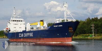
SCAN FJORD
General Cargo
Current Trip
| Time Travelled | 17 h, 31 mins |
|---|---|
| Remaining Time | 11 h, 23 mins |
| Distance Travelled | 191.28 nm |
| Remaining Distance | 111.69 nm |
| AVG Speed | 10.6 Knots |
| MAX Speed | 11.5 Knots |
| AVG Wind | 14.2 knots |
| MAX Wind | 22.2 knots |
| MIN Temp | 5.8°C / 42.44°F |
| MAX Temp | 7°C / 44.6°F |
| Draught | 5 m |
| Position Received | Now |
Current Position
| Longitude | 7.92177° |
|---|---|
| Latitude | 56.23632° |
| Status | Under way using engine |
| Speed | 10 Knots |
| Course | 8.3° |
| Area | North Sea |
| Station | T-AIS |
| Position Received | Now |
Info
Information
The current position of SCAN FJORD is in North Sea with coordinates 56.23632° / 7.92177° as reported on 2024-04-23 13:53 by AIS to our vessel tracker app. The vessel's current speed is 10 Knots and is heading at the port of MANDAL. The estimated time of arrival as calculated by MyShipTracking vessel tracking app is 2024-04-24 01:17 LT
The vessel SCAN FJORD (IMO: 8015879, MMSI: 314318000) is a General Cargo that was built in 1981 ( 43 years old ). It's sailing under the flag of [BB] Barbados.
In this page you can find informations about the vessels current position, last detected port calls, and current voyage information. If the vessels is not in coverage by AIS you will find the latest position.
The current position of SCAN FJORD is detected by our AIS receivers and we are not responsible for the reliability of the data. The last position was recorded while the vessel was in Coverage by the Ais receivers of our vessel tracking app.
The current draught of SCAN FJORD as reported by AIS is 5 meters
Weather
| Temperature | 5.9°C / 42.62°F |
|---|---|
| Wind Speed | 22 knots |
| Direction | 304° NW |
| Pressure | 1010.9 hPa |
| Humidity | 70.9 % |
| Cloud Coverage | 100 % |
Featured Company
Last Port Calls
| Port | Arrival | Departure | Time In Port |
|---|---|---|---|
| 2024-04-21 09:03 | 2024-04-22 20:23 | 1 d | |
| 2024-04-19 16:14 | 2024-04-19 21:30 | 5 h | |
| 2024-04-18 01:55 | 2024-04-18 02:21 | 25 m | |
| 2024-04-15 20:25 | 2024-04-15 22:54 | 2 h | |
| 2024-04-14 08:57 | 2024-04-14 09:16 | 18 m | |
| 2024-04-13 09:19 | 2024-04-13 16:10 | 6 h | |
| 2024-04-13 03:09 | 2024-04-13 05:34 | 2 h | |
| 2024-04-10 06:07 | 2024-04-10 09:56 | 3 h | |
| 2024-04-09 14:19 | 2024-04-09 15:49 | 1 h | |
| 2024-04-07 18:28 | 2024-04-07 20:45 | 2 h |
Last Trips
| Origin | Departure | Destination | Arrival | Distance | |
|---|---|---|---|---|---|
| 2024-04-19 23:30 | 2024-04-21 11:03 | 413.97 nm | |||
| 2024-04-18 04:21 | 2024-04-19 18:14 | 376.48 nm | |||
| 2024-04-16 00:54 | 2024-04-18 03:55 | 527.23 nm | |||
| 2024-04-14 11:16 | 2024-04-15 22:25 | 396.79 nm | |||
| 2024-04-13 18:10 | 2024-04-14 10:57 | 34.40 nm | |||
| 2024-04-13 07:34 | 2024-04-13 11:19 | 43.53 nm | |||
| 2024-04-10 11:56 | 2024-04-13 05:09 | 640.09 nm | |||
| 2024-04-09 17:49 | 2024-04-10 08:07 | 124.57 nm | |||
| 2024-04-07 22:45 | 2024-04-09 16:19 | 324.27 nm | |||
| 2024-04-07 17:14 | 2024-04-07 20:28 | 38.78 nm |
Events
| Time | Event | Details | Position / Dest | Info |
|---|---|---|---|---|
| 2024-04-23 09:08 | Detected in Sea | Danish part of the North Sea |
55.53308 / 7.14481
North Sea
MANDAL
|
Speed: 11.3 kn Course: 41.7° |
| 2024-04-23 09:05 | Status Changed | Under way using engine Default |
55.52610 / 7.13375
MANDAL
|
Speed: 11.2 kn Course: 42° |
| 2024-04-23 09:05 | IN Coverage |
55.53308 / 7.14481
North Sea
MANDAL
|
Speed: 11.3 kn Course: 41.7° |
|
| 2024-04-22 21:00 | Status Changed | Default Under way using engine |
53.53470 / 6.73656
MANDAL
|
Speed: 9.6 kn Course: 306.9° |
| 2024-04-22 20:56 | OUT of Coverage |
53.52682 / 6.75384
North Sea
MANDAL
|
Speed: 9.6 kn Course: 306.9° |
|
| 2024-04-22 20:48 | Change Sea Area | German part of the North Sea Dutch part of the North Sea |
53.51503 / 6.77922
North Sea
MANDAL
|
Speed: 9.8 kn Course: 308.2° |
| 2024-04-22 20:26 | Draught Changed | 5 3.5 |
53.46792 / 6.83781
MANDAL
|
Speed: 7.9 kn Course: 352.9° |
| 2024-04-22 20:26 | Destination Changed | MANDAL EEMSHAVEN |
53.46792 / 6.83781
MANDAL
|
Speed: 7.9 kn Course: 352.9° |
| 2024-04-22 20:26 | ETA Changed | 2024/04/24 07:00 2024/04/21 16:00 |
53.46792 / 6.83781
MANDAL
|
Speed: 7.9 kn Course: 352.9° |
| 2024-04-22 20:23 | PORT DEPARTURE |
|
53.46348 / 6.83760
EEMSHAVEN
|
Speed: 6.8 kn Course: 352° |