
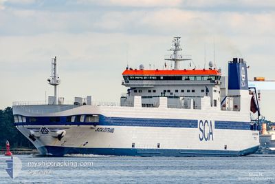
SCA OSTRAND
Ro-Ro Cargo
Current Trip
| Time Travelled | 1 day |
|---|---|
| Remaining Time | 2 days |
| Distance Travelled | 328.25 nm |
| Remaining Distance | 419.03 nm |
| AVG Speed | 9.8 Knots |
| MAX Speed | 17.4 Knots |
| AVG Wind | 9.3 knots |
| MAX Wind | 16 knots |
| MIN Temp | --- |
| MAX Temp | 8.4°C / 47.12°F |
| Draught | 6.1 m |
| Position Received | 1 m ago |
Current Position
| Longitude | 10.14061° |
|---|---|
| Latitude | 54.36616° |
| Status | Under way using engine |
| Speed | |
| Course | 104° |
| Area | North Sea |
| Station | T-AIS |
| Position Received | 1 m ago |
Info
Information
The current position of SCA OSTRAND is in North Sea with coordinates 54.36616° / 10.14061° as reported on 2024-04-23 12:56 by AIS to our vessel tracker app. The vessel's current speed is 0 Knots and is heading at the port of OXELOSUND. The estimated time of arrival as calculated by MyShipTracking vessel tracking app is 2024-04-26 05:35 LT
The vessel SCA OSTRAND (IMO: 9087362, MMSI: 265413000) is a Ro-Ro Cargo that was built in 1996 ( 28 years old ). It's sailing under the flag of [SE] Sweden.
In this page you can find informations about the vessels current position, last detected port calls, and current voyage information. If the vessels is not in coverage by AIS you will find the latest position.
The current position of SCA OSTRAND is detected by our AIS receivers and we are not responsible for the reliability of the data. The last position was recorded while the vessel was in Coverage by the Ais receivers of our vessel tracking app.
The current draught of SCA OSTRAND as reported by AIS is 6.1 meters
Weather
| Temperature | 7.3°C / 45.14°F |
|---|---|
| Wind Speed | 12 knots |
| Direction | 252° WSW |
| Pressure | 1016 hPa |
| Humidity | 69.7 % |
| Cloud Coverage | 59 % |
Featured Company
Last Port Calls
| Port | Arrival | Departure | Time In Port |
|---|---|---|---|
| 2024-04-22 02:30 | 2024-04-22 08:35 | 6 h | |
| 2024-04-20 17:51 | 2024-04-21 11:09 | 17 h | |
| 2024-04-16 04:35 | 2024-04-16 07:27 | 2 h | |
| 2024-04-15 08:30 | 2024-04-15 19:45 | 11 h | |
| 2024-04-13 05:17 | 2024-04-13 10:44 | 5 h | |
| 2024-04-12 10:32 | 2024-04-12 16:48 | 6 h | |
| 2024-04-10 10:28 | 2024-04-10 15:06 | 4 h | |
| 2024-04-10 04:37 | 2024-04-10 06:09 | 1 h | |
| 2024-04-09 14:12 | 2024-04-09 19:40 | 5 h | |
| 2024-04-07 06:03 | 2024-04-07 13:19 | 7 h |
Last Trips
| Origin | Departure | Destination | Arrival | Distance | |
|---|---|---|---|---|---|
| 2024-04-21 12:09 | 2024-04-22 04:30 | 215.67 nm | |||
| 2024-04-16 09:27 | 2024-04-20 18:51 | 1136.95 nm | |||
| 2024-04-15 21:45 | 2024-04-16 06:35 | 127.05 nm | |||
| 2024-04-13 12:44 | 2024-04-15 10:30 | 687.67 nm | |||
| 2024-04-12 18:48 | 2024-04-13 07:17 | 159.89 nm | |||
| 2024-04-10 17:06 | 2024-04-12 12:32 | 657.84 nm | |||
| 2024-04-10 08:09 | 2024-04-10 12:28 | 63.54 nm | |||
| 2024-04-09 21:40 | 2024-04-10 06:37 | 127.42 nm | |||
| 2024-04-07 15:19 | 2024-04-09 16:12 | 774.52 nm | |||
| 2024-04-05 12:04 | 2024-04-07 08:03 | 657.35 nm |
Events
| Time | Event | Details | Position / Dest | Info |
|---|---|---|---|---|
| 2024-04-23 12:41 | STOP Moving | 1.39 nm, South West of STICKENHΟRN SPORT |
54.36617 / 10.14058
OXELOSUND VIA NOK
|
Speed: 0.3 kn Course: 104° |
| 2024-04-23 04:15 | START Moving | 0.64 nm, South West of BRUNSBUETTEL |
53.89489 / 9.14800
OXELOSUND VIA NOK
|
Speed: 3.2 kn Course: 49° |
| 2024-04-23 03:24 | STOP Moving | 0.77 nm, South West of BRUNSBUETTEL |
53.89347 / 9.14538
OXELOSUND VIA NOK
|
Speed: 0.3 kn Course: 48° |
| 2024-04-23 02:59 | START Moving | 2.43 nm, South West of BRUNSBUETTEL |
53.88215 / 9.10108
OXELOSUND VIA NOK
|
Speed: 3.2 kn Course: 82° |
| 2024-04-23 02:21 | STOP Moving | 2.73 nm, South West of BRUNSBUETTEL |
53.88016 / 9.09329
OXELOSUND VIA NOK
|
Speed: 0.3 kn Course: 46° |
| 2024-04-23 01:47 | Destination Changed | OXELOSUND VIA NOK OXELSUND VIA NOK |
53.86255 / 9.04300
OXELOSUND VIA NOK
|
Speed: 6.2 kn Course: 66.4° |
| 2024-04-22 22:17 | Status Changed | Under way using engine Default |
53.92878 / 7.70402
OXELSUND VIA NOK
|
Speed: 17 kn Course: 75° |
| 2024-04-22 22:09 | Status Changed | Default Under way using engine |
53.91833 / 7.64167
OXELSUND VIA NOK
|
Speed: 17.2 kn Course: 75.2° |
| 2024-04-22 20:18 | Status Changed | Under way using engine Default |
53.80132 / 6.77714
OXELSUND VIA NOK
|
Speed: 17.1 kn Course: 77° |
| 2024-04-22 20:13 | Status Changed | Default Under way using engine |
53.79549 / 6.73290
OXELSUND VIA NOK
|
Speed: 17 kn Course: 77.9° |