
SC MONTREUX
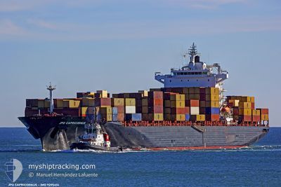
Container Ship
Current Trip
| Time Travelled | 4 days |
|---|---|
| Remaining Time | 31 mins |
| Distance Travelled | 1526.49 nm |
| Remaining Distance | 4.95 nm |
| AVG Speed | 14.2 Knots |
| MAX Speed | 20 Knots |
| AVG Wind | 11.9 knots |
| MAX Wind | 30.5 knots |
| MIN Temp | 14.6°C / 58.28°F |
| MAX Temp | 21.6°C / 70.88°F |
| Draught | 11.9 m |
| Position Received | 1 m ago |
Current Position
| Longitude | 23.61854° |
|---|---|
| Latitude | 37.87963° |
| Status | Under way using engine |
| Speed | 4.7 Knots |
| Course | 301° |
| Area | Aegean Sea |
| Station | T-AIS |
| Position Received | 1 m ago |
Info
Information
The current position of SC MONTREUX is in Aegean Sea with coordinates 37.87963° / 23.61854° as reported on 2024-04-24 15:59 by AIS to our vessel tracker app. The vessel's current speed is 4.7 Knots and is heading at the port of PIRAEUS. The estimated time of arrival as calculated by MyShipTracking vessel tracking app is 2024-04-24 16:31 LT
The vessel SC MONTREUX (IMO: 9295414, MMSI: 538008593) is a Container Ship that was built in 2005 ( 19 years old ). It's sailing under the flag of [MH] Marshall Is.
In this page you can find informations about the vessels current position, last detected port calls, and current voyage information. If the vessels is not in coverage by AIS you will find the latest position.
The current position of SC MONTREUX is detected by our AIS receivers and we are not responsible for the reliability of the data. The last position was recorded while the vessel was in Coverage by the Ais receivers of our vessel tracking app.
The current draught of SC MONTREUX as reported by AIS is 11.9 meters
Weather
| Temperature | 22°C / 71.6°F |
|---|---|
| Wind Speed | 7 knots |
| Direction | 250° WSW |
| Pressure | 1004.9 hPa |
| Humidity | 39.5 % |
| Cloud Coverage | 100 % |
Featured Company
Last Port Calls
| Port | Arrival | Departure | Time In Port |
|---|---|---|---|
| 2024-04-20 01:41 | 2024-04-20 10:07 | 8 h | |
| 2024-04-19 15:01 | 2024-04-19 22:15 | 7 h | |
| 2024-04-18 17:01 | 2024-04-19 11:43 | 18 h | |
| 2024-04-11 21:14 | 2024-04-12 18:28 | 21 h | |
| 2024-04-09 06:29 | 2024-04-11 15:43 | 2 d | |
| 2024-04-06 20:30 | 2024-04-08 05:05 | 1 d | |
| 2024-04-05 10:05 | 2024-04-06 05:25 | 19 h | |
| 2024-03-29 14:49 | 2024-03-30 03:20 | 12 h | |
| 2024-03-27 19:41 | 2024-03-28 20:29 | 1 d | |
| 2024-03-18 04:51 | 2024-03-19 02:47 | 21 h |
Last Trips
| Origin | Departure | Destination | Arrival | Distance | |
|---|---|---|---|---|---|
| 2024-04-19 23:15 | 2024-04-20 03:41 | 22.40 nm | |||
| 2024-04-19 13:43 | 2024-04-19 16:01 | 24.98 nm | |||
| 2024-04-12 21:28 | 2024-04-18 19:01 | 1955.87 nm | |||
| 2024-04-11 18:43 | 2024-04-12 00:14 | 55.51 nm | |||
| 2024-04-08 08:05 | 2024-04-09 09:29 | 323.06 nm | |||
| 2024-04-06 08:25 | 2024-04-06 23:30 | 276.70 nm | |||
| 2024-03-30 03:20 | 2024-04-05 13:05 | 1664.97 nm | |||
| 2024-03-28 21:29 | 2024-03-29 14:49 | 78.34 nm | |||
| 2024-03-19 05:47 | 2024-03-27 20:41 | 1957.69 nm | |||
| 2024-03-17 17:53 | 2024-03-18 07:51 | 59.85 nm |
Events
| Time | Event | Details | Position / Dest | Info |
|---|---|---|---|---|
| 2024-04-24 14:22 | ETA Changed | 2024/04/24 16:00 2025/01/01 16:00 |
37.73974 / 23.71655
GRPIRTM
|
Speed: 6 kn Course: 333.4° |
| 2024-04-24 14:16 | ETA Changed | 2025/01/01 16:00 2024/04/24 16:00 |
37.73075 / 23.72220
GRPIRTM
|
Speed: 6 kn Course: 332.9° |
| 2024-04-24 01:01 | Change Sea Area | Greek part of the Aegean Sea Greek part of the Mediterranean Sea - Eastern Basin |
36.05208 / 23.15083
Aegean Sea
GRPIRTM
|
Speed: 8.5 kn Course: 60.2° |
| 2024-04-24 00:01 | Status Changed | Under way using engine Default |
36.02611 / 22.97796
GRPIRTM
|
Speed: 8.7 kn Course: 94° |
| 2024-04-23 23:57 | Status Changed | Default Under way using engine |
36.02663 / 22.96745
GRPIRTM
|
Speed: 8.7 kn Course: 93.8° |
| 2024-04-23 23:42 | Status Changed | Under way using engine Default |
36.03010 / 22.92253
GRPIRTM
|
Speed: 8.8 kn Course: 96° |
| 2024-04-23 23:33 | ETA Changed | 2024/04/24 16:00 2024/04/24 02:00 |
36.03243 / 22.88975
GRPIRTM
|
Speed: 8.8 kn Course: 95.7° |
| 2024-04-23 23:33 | Status Changed | Default Under way using engine |
36.03217 / 22.89275
GRPIRTM
|
Speed: 8.8 kn Course: 95.7° |
| 2024-04-23 23:26 | Status Changed | Under way using engine Default |
36.03352 / 22.87463
GRPIRTM
|
Speed: 8.9 kn Course: 94° |
| 2024-04-23 23:16 | IN Coverage |
36.03332 / 22.87768
Mediterranean Sea - Eastern Basin
GRPIRTM
|
Speed: 8.9 kn Course: 94.4° |