
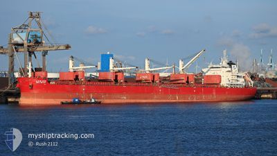
BBG NOVA
Cargo
Current Trip
| Time Travelled | 5 days |
|---|---|
| Remaining Time | 17 h, 36 mins |
| Distance Travelled | 1366.00 nm |
| Remaining Distance | 177.00 nm |
| AVG Speed | 10.1 Knots |
| MAX Speed | 12.2 Knots |
| AVG Wind | 11.5 knots |
| MAX Wind | 18.9 knots |
| MIN Temp | 24.9°C / 76.82°F |
| MAX Temp | 28.1°C / 82.58°F |
| Draught | 6.9 m |
| Position Received | 2 d ago |
Current Position
| Longitude | -84.36162° |
|---|---|
| Latitude | 20.51301° |
| Status | Under way using engine |
| Speed | 11.6 Knots |
| Course | 144° |
| Area | Caribbean Sea |
| Station | T-AIS |
| Position Received | 2 d ago |
Info
Information
The current position of BBG NOVA is in Caribbean Sea with coordinates 20.51301° / -84.36162° as reported on 2024-04-23 10:34 by AIS to our vessel tracker app. The vessel's current speed is 11.6 Knots and is heading at the port of CRISTOBAL. The estimated time of arrival as calculated by MyShipTracking vessel tracking app is 2024-04-26 10:55 LT
The vessel BBG NOVA (IMO: 9705342, MMSI: 636017382) is a Cargo It's sailing under the flag of [LR] Liberia.
In this page you can find informations about the vessels current position, last detected port calls, and current voyage information. If the vessels is not in coverage by AIS you will find the latest position.
The current position of BBG NOVA is detected by our AIS receivers and we are not responsible for the reliability of the data. The last position was recorded while the vessel was in Coverage by the Ais receivers of our vessel tracking app.
The current draught of BBG NOVA as reported by AIS is 6.9 meters
Weather
| Temperature | 28.1°C / 82.58°F |
|---|---|
| Wind Speed | 17 knots |
| Direction | 43° NE |
| Pressure | 1012.9 hPa |
| Humidity | 79.6 % |
| Cloud Coverage | 16 % |
Featured Company
Last Trips
| Origin | Departure | Destination | Arrival | Distance | |
|---|---|---|---|---|---|
| 2024-03-22 16:03 | 2024-04-15 22:30 | 6126.18 nm | |||
| 2024-03-07 16:38 | 2024-03-10 18:59 | 778.85 nm | |||
| 2024-02-28 22:54 | 2024-03-04 21:42 | 671.04 nm | |||
| 2024-02-23 16:44 | 2024-02-28 13:13 | 908.66 nm | |||
| 2024-01-06 06:26 | 2024-02-21 03:05 | 10221.37 nm |
Events
| Time | Event | Details | Position / Dest | Info |
|---|---|---|---|---|
| 2024-04-23 10:41 | Status Changed | Default Under way using engine |
20.49442 / -84.34752
PA CTB
|
Speed: 11.6 kn Course: 144° |
| 2024-04-23 10:34 | OUT of Coverage |
20.51301 / -84.36162
Caribbean Sea
PA CTB
|
Speed: 11.6 kn Course: 144° |
|
| 2024-04-23 08:34 | Detected in Sea | Cuban part of the Caribbean Sea |
20.82192 / -84.60034
Caribbean Sea
PA CTB
|
Speed: 11.6 kn Course: 141.7° |
| 2024-04-23 08:33 | Status Changed | Under way using engine Default |
20.82446 / -84.60249
PA CTB
|
Speed: 11 kn Course: 141° |
| 2024-04-23 08:30 | IN Coverage |
20.82192 / -84.60034
Caribbean Sea
PA CTB
|
Speed: 11.6 kn Course: 141.7° |
|
| 2024-04-22 05:51 | Status Changed | Default Under way using engine |
22.94833 / -88.71167
PA CTB
|
Speed: 10.5 kn Course: 85.9° |
| 2024-04-22 05:42 | Status Changed | Under way using engine Default |
22.94689 / -88.73950
PA CTB
|
Speed: 10 kn Course: 85° |
| 2024-04-22 05:42 | IN Coverage |
22.94689 / -88.73950
Gulf of Mexico
PA CTB
|
Speed: 10.5 kn Course: 85.9° |
|
| 2024-04-22 05:42 | OUT of Coverage |
22.94689 / -88.73950
Gulf of Mexico
PA CTB
|
Speed: 10.5 kn Course: 85.9° |
|
| 2024-04-20 08:53 | OUT of Coverage |
22.56100 / -97.32700
Gulf of Mexico
PA CTB
|
Speed: 10.4 kn Course: 83.9° |