
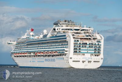
SAPPHIRE PRINCESS
Passengers Ship
Current Trip
| Time Travelled | 1 h, 46 mins |
|---|---|
| Remaining Time | --- |
| Distance Travelled | 28.91 nm |
| Remaining Distance | --- |
| AVG Speed | 18 Knots |
| MAX Speed | 20 Knots |
| AVG Wind | 13.9 knots |
| MAX Wind | 14 knots |
| MIN Temp | 28.7°C / 83.66°F |
| MAX Temp | 29°C / 84.2°F |
| Draught | 8.2 m |
| Position Received | 6 d ago |
Current Position
| Longitude | -156.62164° |
|---|---|
| Latitude | 19.22145° |
| Status | Under way using engine |
| Speed | 19.2 Knots |
| Course | 205.3° |
| Area | North Pacific Ocean |
| Station | T-AIS |
| Position Received | 6 d ago |
Info
Information
The current position of SAPPHIRE PRINCESS is in North Pacific Ocean with coordinates 19.22145° / -156.62164° as reported on 2024-04-13 12:33 by AIS to our vessel tracker app. The vessel's current speed is 19.2 Knots and is heading at the port of APIA. The estimated time of arrival as calculated by MyShipTracking vessel tracking app is 2024-04-18 17:45 LT
The vessel SAPPHIRE PRINCESS (IMO: 9228186, MMSI: 235103357) is a Passengers Ship that was built in 2004 ( 20 years old ). It's sailing under the flag of [GB] United Kingdom.
In this page you can find informations about the vessels current position, last detected port calls, and current voyage information. If the vessels is not in coverage by AIS you will find the latest position.
The current position of SAPPHIRE PRINCESS is detected by our AIS receivers and we are not responsible for the reliability of the data. The last position was recorded while the vessel was in Coverage by the Ais receivers of our vessel tracking app.
The current draught of SAPPHIRE PRINCESS as reported by AIS is 8.2 meters
Weather
| Temperature | 29°C / 84.2°F |
|---|---|
| Wind Speed | 14 knots |
| Direction | 113° ESE |
| Pressure | 1011 hPa |
| Humidity | 79.6 % |
| Cloud Coverage | 88 % |
Featured Company
Last Port Calls
| Port | Arrival | Departure | Time In Port |
|---|---|---|---|
| 2024-04-19 17:52 | 2024-04-20 04:45 | 10 h | |
| 2024-04-18 18:13 | 2024-04-19 05:25 | 11 h | |
| 2024-04-12 17:10 | 2024-04-13 04:07 | 10 h | |
| 2024-04-11 15:48 | 2024-04-12 09:01 | 17 h | |
| 2024-04-05 11:45 | 2024-04-06 03:35 | 15 h | |
| 2024-04-01 12:07 | 2024-04-01 22:23 | 10 h | |
| 2024-03-28 14:04 | 2024-03-29 01:09 | 11 h | |
| 2024-03-23 11:17 | 2024-03-24 22:29 | 1 d | |
| 2024-03-18 07:19 | 2024-03-18 22:58 | 15 h | |
| 2024-03-12 09:02 | 2024-03-12 19:08 | 10 h |
Most Visited Ports (Last year)
| Port | Arrivals | |
|---|---|---|
| 21 | ||
| 21 | ||
| 20 | ||
| 14 | ||
| 5 | ||
| 5 |
Last Trips
| Origin | Departure | Destination | Arrival | Distance | |
|---|---|---|---|---|---|
| 2024-04-19 18:25 | 2024-04-19 06:52 | 131.09 nm | |||
| 2024-04-12 18:07 | 2024-04-19 07:13 | 2319.60 nm | |||
| 2024-04-11 23:01 | 2024-04-12 07:10 | 98.72 nm | |||
| 2024-04-05 20:35 | 2024-04-11 05:48 | 2255.01 nm | |||
| 2024-04-01 16:23 | 2024-04-05 04:45 | 1137.02 nm | |||
| 2024-03-28 19:09 | 2024-04-01 06:07 | 1501.58 nm | |||
| 2024-03-24 17:29 | 2024-03-28 08:04 | 1426.11 nm | |||
| 2024-03-18 19:58 | 2024-03-23 06:17 | 1403.83 nm | |||
| 2024-03-12 16:08 | 2024-03-18 04:19 | 1751.31 nm | |||
| 2024-03-08 18:14 | 2024-03-12 06:02 | 1113.73 nm |
Events
| Time | Event | Details | Position / Dest | Info |
|---|---|---|---|---|
| 2024-04-20 04:45 | PORT DEPARTURE |
|
-14.28799 / -170.66821
APIA
|
Speed: 7.3 kn Course: 152° |
| 2024-04-20 04:36 | START Moving |
-14.27402 / -170.67831
[AS] PAGO PAGO
|
Speed: 6.7 kn Course: 107° |
|
| 2024-04-19 18:13 | STOP Moving |
-14.27476 / -170.68610
[AS] PAGO PAGO
|
Speed: 0.3 kn Course: 195° |
|
| 2024-04-19 17:52 | PORT ARRIVAL |
|
-14.27833 / -170.67166
[AS] PAGO PAGO
|
Speed: 6 kn Course: 350° |
| 2024-04-19 05:41 | START Moving | 3.33 nm, North of APIA |
-13.77256 / -171.75829
APIA
|
Speed: 12 kn Course: 2° |
| 2024-04-19 05:25 | PORT DEPARTURE |
|
-13.77256 / -171.75829
APIA
|
Speed: 0.7 kn Course: 352° |
| 2024-04-18 18:13 | STOP Moving |
-13.82545 / -171.76274
[WS] APIA
|
Speed: 0.2 kn Course: 21° |
|
| 2024-04-18 18:13 | PORT ARRIVAL |
|
-13.82545 / -171.76274
[WS] APIA
|
Speed: 2.1 kn Course: 166° |
| 2024-04-13 12:39 | Status Changed | Default Under way using engine |
19.19337 / -156.63582
APIA
|
Speed: 19.2 kn Course: 205.3° |
| 2024-04-13 12:33 | OUT of Coverage |
19.22145 / -156.62164
North Pacific Ocean
APIA
|
Speed: 19.2 kn Course: 205.3° |