
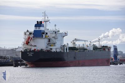
SAN FELIX
Oil/Chemical Tanker
Current Trip
| Time Travelled | 8 days |
|---|---|
| Remaining Time | --- |
| Distance Travelled | 2341.28 nm |
| Remaining Distance | --- |
| AVG Speed | 12 Knots |
| MAX Speed | 15.8 Knots |
| AVG Wind | 11.7 knots |
| MAX Wind | 23.9 knots |
| MIN Temp | -1.3°C / 29.66°F |
| MAX Temp | 14.2°C / 57.56°F |
| Draught | 10.1 m |
| Position Received | 1 d ago |
Current Position
| Longitude | -8.30981° |
|---|---|
| Latitude | 45.79520° |
| Status | Under way using engine |
| Speed | 13.1 Knots |
| Course | 206° |
| Area | North Atlantic Ocean |
| Station | T-AIS |
| Position Received | 1 d ago |
Info
Information
The current position of SAN FELIX is in North Atlantic Ocean with coordinates 45.79520° / -8.30981° as reported on 2024-04-24 18:34 by AIS to our vessel tracker app. The vessel's current speed is 13.1 Knots and is heading at the port of RIJEKA. The estimated time of arrival as calculated by MyShipTracking vessel tracking app is 2024-05-03 03:00 LT
The vessel SAN FELIX (IMO: 9314868, MMSI: 247391400) is a Oil/Chemical Tanker that was built in 2007 ( 17 years old ). It's sailing under the flag of [IT] Italy.
In this page you can find informations about the vessels current position, last detected port calls, and current voyage information. If the vessels is not in coverage by AIS you will find the latest position.
The current position of SAN FELIX is detected by our AIS receivers and we are not responsible for the reliability of the data. The last position was recorded while the vessel was in Coverage by the Ais receivers of our vessel tracking app.
The current draught of SAN FELIX as reported by AIS is 10.1 meters
Weather
| Temperature | 14.1°C / 57.38°F |
|---|---|
| Wind Speed | 17 knots |
| Direction | 307° NW |
| Pressure | 1012.9 hPa |
| Humidity | 82.2 % |
| Cloud Coverage | 6 % |
Featured Company
Last Port Calls
| Port | Arrival | Departure | Time In Port |
|---|---|---|---|
| 2024-04-16 05:03 | 2024-04-17 17:32 | 1 d | |
| 2024-04-01 08:10 | 2024-04-03 11:30 | 2 d | |
| 2024-03-29 02:04 | 2024-03-30 22:11 | 1 d | |
| 2024-03-05 18:47 | 2024-03-09 07:02 | 3 d | |
| 2024-02-15 07:48 | 2024-02-16 20:28 | 1 d | |
| 2024-02-10 22:12 | 2024-02-12 02:33 | 1 d | |
| 2024-02-07 09:06 | 2024-02-09 02:57 | 1 d | |
| 2024-02-01 21:15 | 2024-02-05 07:28 | 3 d |
Most Visited Ports (Last year)
| Port | Arrivals | |
|---|---|---|
| 4 | ||
| 3 | ||
| 2 | ||
| 2 | ||
| 2 | ||
| 2 |
Last Trips
| Origin | Departure | Destination | Arrival | Distance | |
|---|---|---|---|---|---|
| 2024-04-03 13:30 | 2024-04-16 08:03 | 1286.33 nm | |||
| 2024-03-30 23:11 | 2024-04-01 10:10 | 408.06 nm | |||
| 2024-03-09 08:02 | 2024-03-29 03:04 | 487.81 nm | |||
| 2024-02-16 21:28 | 2024-03-05 19:47 | 1176.26 nm | |||
| 2024-02-12 03:33 | 2024-02-15 08:48 | 538.27 nm | |||
| 2024-02-09 03:57 | 2024-02-10 23:12 | 519.35 nm | |||
| 2024-02-05 08:28 | 2024-02-07 10:06 | 524.44 nm | |||
| 2024-01-28 06:36 | 2024-02-01 22:15 | 581.47 nm |
Events
| Time | Event | Details | Position / Dest | Info |
|---|---|---|---|---|
| 2024-04-24 18:36 | Status Changed | Default Under way using engine |
45.78814 / -8.31488
HRRJK
|
Speed: 13.1 kn Course: 206° |
| 2024-04-24 18:34 | OUT of Coverage |
45.79520 / -8.30981
North Atlantic Ocean
HRRJK
|
Speed: 13.1 kn Course: 206° |
|
| 2024-04-24 18:27 | Status Changed | Under way using engine Default |
45.81857 / -8.29338
HRRJK
|
Speed: 12.6 kn Course: 220° |
| 2024-04-24 18:06 | Status Changed | Default Under way using engine |
45.87832 / -8.23534
HRRJK
|
Speed: 12.6 kn Course: 208.8° |
| 2024-04-24 18:02 | Detected in Sea | French part of the North Atlantic Ocean |
45.89190 / -8.22189
North Atlantic Ocean
HRRJK
|
Speed: 12.6 kn Course: 208.1° |
| 2024-04-24 18:02 | Status Changed | Under way using engine Default |
45.89190 / -8.22189
HRRJK
|
Speed: 12.6 kn Course: 208° |
| 2024-04-24 17:51 | IN Coverage |
45.89190 / -8.22189
North Atlantic Ocean
HRRJK
|
Speed: 12.6 kn Course: 208.1° |
|
| 2024-04-24 02:40 | Status Changed | Default Under way using engine |
48.72937 / -5.90167
HRRJK
|
Speed: 11.3 kn Course: 207.3° |
| 2024-04-24 02:34 | Status Changed | Under way using engine Default |
48.74624 / -5.88831
HRRJK
|
Speed: 11.4 kn Course: 208° |
| 2024-04-24 02:34 | OUT of Coverage |
48.74624 / -5.88831
Celtic Sea
HRRJK
|
Speed: 11.3 kn Course: 207.3° |