
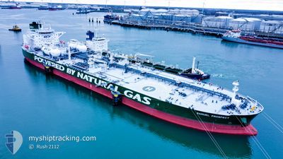
ALBERT
Tanker
Current Trip
| Time Travelled | 9 days |
|---|---|
| Remaining Time | --- |
| Distance Travelled | 728.42 nm |
| Remaining Distance | --- |
| AVG Speed | 9.8 Knots |
| MAX Speed | 13 Knots |
| AVG Wind | 9.4 knots |
| MAX Wind | 33 knots |
| MIN Temp | 12.3°C / 54.14°F |
| MAX Temp | 19.4°C / 66.92°F |
| Draught | 9.2 m |
| Position Received | 9 d ago |
Current Position
| Longitude | 128.80072° |
|---|---|
| Latitude | 34.64983° |
| Status | Under way using engine |
| Speed | 13.1 Knots |
| Course | 232.9° |
| Area | Japan Sea |
| Station | T-AIS |
| Position Received | 9 d ago |
Info
Information
The current position of ALBERT is in Japan Sea with coordinates 34.64983° / 128.80072° as reported on 2024-04-10 23:40 by AIS to our vessel tracker app. The vessel's current speed is 13.1 Knots and is heading at the port of YEOSU. The estimated time of arrival as calculated by MyShipTracking vessel tracking app is 2024-04-11 06:30 LT
The vessel ALBERT (IMO: 9843572, MMSI: 636019055) is a Tanker It's sailing under the flag of [LR] Liberia.
In this page you can find informations about the vessels current position, last detected port calls, and current voyage information. If the vessels is not in coverage by AIS you will find the latest position.
The current position of ALBERT is detected by our AIS receivers and we are not responsible for the reliability of the data. The last position was recorded while the vessel was in Coverage by the Ais receivers of our vessel tracking app.
The current draught of ALBERT as reported by AIS is 9.2 meters
Weather
| Temperature | 17.4°C / 63.32°F |
|---|---|
| Wind Speed | 21 knots |
| Direction | 221° SW |
| Pressure | 1006.3 hPa |
| Humidity | 95.4 % |
| Cloud Coverage | 100 % |
Featured Company
Last Port Calls
| Port | Arrival | Departure | Time In Port |
|---|---|---|---|
| 2024-04-10 05:41 | 2024-04-10 18:04 | 12 h | |
| 2024-04-06 03:39 | 2024-04-08 01:28 | 1 d | |
| 2024-03-26 15:24 | 2024-03-28 10:32 | 1 d | |
| 2024-03-21 14:47 | 2024-03-22 22:39 | 1 d | |
| 2024-03-17 01:18 | 2024-03-17 23:30 | 22 h | |
| 2024-02-09 07:35 | 2024-02-11 11:57 | 2 d |
Most Visited Ports (Last year)
| Port | Arrivals | |
|---|---|---|
| 3 | ||
| 2 | ||
| 2 | ||
| 2 | ||
| 2 | ||
| 1 |
Last Trips
| Origin | Departure | Destination | Arrival | Distance | |
|---|---|---|---|---|---|
| 2024-04-08 10:28 | 2024-04-10 14:41 | 174.40 nm | |||
| 2024-03-28 18:32 | 2024-04-06 12:39 | 2590.64 nm | |||
| 2024-03-23 06:39 | 2024-03-26 23:24 | 40.94 nm | |||
| 2024-03-18 07:30 | 2024-03-21 22:47 | 31.27 nm | |||
| 2024-02-11 14:57 | 2024-03-17 09:18 | 3992.70 nm | |||
| 2024-01-28 07:41 | 2024-02-09 10:35 | 2473.07 nm |
Events
| Time | Event | Details | Position / Dest | Info |
|---|---|---|---|---|
| 2024-04-19 23:42 | STOP Moving |
29.57333 / 122.92834
YEOSU
|
Speed: Course: -1° |
|
| 2024-04-15 21:13 | STOP Moving |
31.44115 / 127.15807
YEOSU
|
Speed: 0.2 kn Course: 113° |
|
| 2024-04-15 19:24 | START Moving |
31.48705 / 127.10733
YEOSU
|
Speed: 3.3 kn Course: 144° |
|
| 2024-04-15 18:22 | STOP Moving |
31.50333 / 127.10167
YEOSU
|
Speed: Course: -1° |
|
| 2024-04-15 17:45 | START Moving |
31.51382 / 127.09464
YEOSU
|
Speed: 3.2 kn Course: 144° |
|
| 2024-04-15 16:40 | STOP Moving |
31.53815 / 127.08978
YEOSU
|
Speed: 0.1 kn Course: 140° |
|
| 2024-04-14 07:54 | START Moving | 15.51 nm, South of SINSUAN-GIL |
34.65459 / 127.98272
YEOSU
|
Speed: 3.7 kn Course: 128° |
| 2024-04-14 06:02 | STOP Moving | 15.57 nm, South of SINSUAN-GIL |
34.65593 / 127.97304
YEOSU
|
Speed: 0.1 kn Course: 130° |
| 2024-04-14 03:10 | START Moving | 6.07 nm, South East of GWANGYANG |
34.83195 / 127.78657
YEOSU
|
Speed: 3.2 kn Course: 140° |
| 2024-04-11 08:13 | STOP Moving | 5.9 nm, South East of GWANGYANG |
34.83239 / 127.78196
YEOSU
|
Speed: 0.3 kn Course: 348° |