
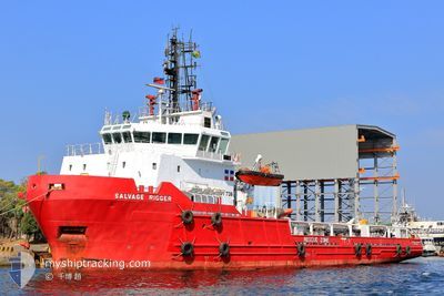
SALVAGE RIGGER
Anchor Handling Vessel
Current Trip
HIGH SEA
| Time Travelled | 7 days |
|---|---|
| Remaining Time | --- |
| Distance Travelled | 10.75 nm |
| Remaining Distance | --- |
| AVG Speed | 6.3 Knots |
| MAX Speed | 8.5 Knots |
| AVG Wind | 7.7 knots |
| MAX Wind | 11.6 knots |
| MIN Temp | 25.8°C / 78.44°F |
| MAX Temp | 29.8°C / 85.64°F |
| Draught | 4.5 m |
| Position Received | 5 m ago |
Current Position
| Longitude | 120.19277° |
|---|---|
| Latitude | 22.72836° |
| Status | At anchor |
| Speed | 0.1 Knots |
| Course | 261° |
| Area | South China Sea |
| Station | T-AIS |
| Position Received | 5 m ago |
Info
Information
The current position of SALVAGE RIGGER is in South China Sea with coordinates 22.72836° / 120.19277° as reported on 2024-04-24 07:37 by AIS to our vessel tracker app. The vessel's current speed is 0.1 Knots
The vessel SALVAGE RIGGER (IMO: 9246437, MMSI: 377275000) is a Anchor Handling Vessel that was built in 2002 ( 22 years old ). It's sailing under the flag of [VC] St Vincent Grenadines.
In this page you can find informations about the vessels current position, last detected port calls, and current voyage information. If the vessels is not in coverage by AIS you will find the latest position.
The current position of SALVAGE RIGGER is detected by our AIS receivers and we are not responsible for the reliability of the data. The last position was recorded while the vessel was in Coverage by the Ais receivers of our vessel tracking app.
The current draught of SALVAGE RIGGER as reported by AIS is 4.5 meters
Weather
| Temperature | 28.5°C / 83.3°F |
|---|---|
| Wind Speed | 9 knots |
| Direction | 270° W |
| Pressure | 1008.6 hPa |
| Humidity | 64 % |
| Cloud Coverage | 100 % |
Featured Company
Last Trips
Events
| Time | Event | Details | Position / Dest | Info |
|---|---|---|---|---|
| 2024-04-24 07:07 | Status Changed | At anchor Default |
22.72817 / 120.19271
HIGH SEA
|
Speed: 0.1 kn Course: 279° |
| 2024-04-24 06:58 | Status Changed | Default At anchor |
22.72812 / 120.19266
HIGH SEA
|
Speed: 0.1 kn Course: 292° |
| 2024-04-24 06:28 | Status Changed | At anchor Default |
22.72803 / 120.19253
HIGH SEA
|
Speed: 0.1 kn Course: 306° |
| 2024-04-24 06:28 | IN Coverage |
22.72803 / 120.19253
South China Sea
|
Speed: 0.2 kn Course: 199.5° |
|
| 2024-04-24 03:46 | Status Changed | Default At anchor |
22.72799 / 120.19258
HIGH SEA
|
Speed: 0.2 kn Course: 298° |
| 2024-04-24 03:31 | Status Changed | At anchor Default |
22.72800 / 120.19262
HIGH SEA
|
Speed: 0.1 kn Course: 298° |
| 2024-04-24 03:31 | IN Coverage |
22.72800 / 120.19262
South China Sea
|
Speed: 0.2 kn Course: 277.6° |
|
| 2024-04-24 03:31 | OUT of Coverage |
22.72800 / 120.19262
South China Sea
|
Speed: 0.2 kn Course: 277.6° |
|
| 2024-04-24 02:22 | Status Changed | Default At anchor |
22.72811 / 120.19273
HIGH SEA
|
Speed: 0.1 kn Course: 277° |
| 2024-04-24 02:19 | OUT of Coverage |
22.72811 / 120.19274
South China Sea
|
Speed: 0.1 kn Course: 238.5° |