
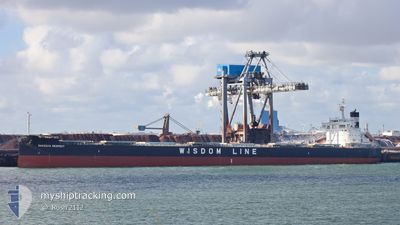
SAKIZAYA RESPECT
Cargo
Current Trip
| Time Travelled | 1 day |
|---|---|
| Remaining Time | 11 h, 3 mins |
| Distance Travelled | 465.91 nm |
| Remaining Distance | 162.17 nm |
| AVG Speed | 12.5 Knots |
| MAX Speed | 16.1 Knots |
| AVG Wind | 13.2 knots |
| MAX Wind | 24.9 knots |
| MIN Temp | 3.4°C / 38.12°F |
| MAX Temp | 9.8°C / 49.64°F |
| Draught | 7.4 m |
| Position Received | 1 m ago |
Current Position
| Longitude | 4.18415° |
|---|---|
| Latitude | 59.95525° |
| Status | Under way using engine |
| Speed | 14.4 Knots |
| Course | 359.4° |
| Area | North Sea |
| Station | T-AIS |
| Position Received | 1 m ago |
Info
Information
The current position of SAKIZAYA RESPECT is in North Sea with coordinates 59.95525° / 4.18415° as reported on 2024-04-19 03:50 by AIS to our vessel tracker app. The vessel's current speed is 14.4 Knots and is heading at the port of AAHEIM. The estimated time of arrival as calculated by MyShipTracking vessel tracking app is 2024-04-19 14:55 LT
The vessel SAKIZAYA RESPECT (IMO: 9783150, MMSI: 372798000) is a Cargo It's sailing under the flag of [PA] Panama.
In this page you can find informations about the vessels current position, last detected port calls, and current voyage information. If the vessels is not in coverage by AIS you will find the latest position.
The current position of SAKIZAYA RESPECT is detected by our AIS receivers and we are not responsible for the reliability of the data. The last position was recorded while the vessel was in Coverage by the Ais receivers of our vessel tracking app.
The current draught of SAKIZAYA RESPECT as reported by AIS is 7.4 meters
Weather
| Temperature | 3.6°C / 38.48°F |
|---|---|
| Wind Speed | 24 knots |
| Direction | 149° SSE |
| Pressure | 1003.4 hPa |
| Humidity | 96.2 % |
| Cloud Coverage | 100 % |
Featured Company
Last Port Calls
| Port | Arrival | Departure | Time In Port |
|---|---|---|---|
| 2024-04-16 07:25 | 2024-04-17 14:32 | 1 d | |
| 2024-04-02 01:16 | 2024-04-03 17:52 | 1 d | |
| 2024-02-28 04:45 | 2024-03-06 18:45 | 7 d |
Most Visited Ports (Last year)
| Port | Arrivals | |
|---|---|---|
| 4 | ||
| 3 | ||
| 1 | ||
| 1 | ||
| 1 | ||
| 1 |
Last Trips
| Origin | Departure | Destination | Arrival | Distance | |
|---|---|---|---|---|---|
| 2024-04-03 13:52 | 2024-04-16 09:25 | 3155.57 nm | |||
| 2024-03-06 19:45 | 2024-04-01 21:16 | 3877.19 nm | |||
| 2024-01-13 10:55 | 2024-02-28 05:45 | 7960.81 nm |
Events
| Time | Event | Details | Position / Dest | Info |
|---|---|---|---|---|
| 2024-04-18 13:35 | Detected in Sea | Norwegian part of the North Sea |
56.87583 / 5.54355
North Sea
NO AHM
|
Speed: 12.8 kn Course: 338.3° |
| 2024-04-18 13:35 | Status Changed | Under way using engine Default |
56.87583 / 5.54355
NO AHM
|
Speed: 12.5 kn Course: 338° |
| 2024-04-18 13:35 | IN Coverage |
56.87583 / 5.54355
North Sea
NO AHM
|
Speed: 12.8 kn Course: 338.3° |
|
| 2024-04-18 12:02 | Status Changed | Default Under way using engine |
56.56866 / 5.73435
NO AHM
|
Speed: 12.3 kn Course: 341.7° |
| 2024-04-18 11:43 | OUT of Coverage |
56.50547 / 5.76749
North Sea
NO AHM
|
Speed: 12.3 kn Course: 341.7° |
|
| 2024-04-18 11:37 | Status Changed | Under way using engine Default |
56.48830 / 5.77757
NO AHM
|
Speed: 12.2 kn Course: 342° |
| 2024-04-18 11:37 | IN Coverage |
56.48830 / 5.77757
North Sea
NO AHM
|
Speed: 12.3 kn Course: 341.9° |
|
| 2024-04-18 08:48 | OUT of Coverage |
55.95199 / 6.10653
North Sea
NO AHM
|
Speed: 12 kn Course: 342.1° |
|
| 2024-04-18 05:58 | Detected in Sea | Danish part of the North Sea |
55.40759 / 6.42859
North Sea
NO AHM
|
Speed: 12.1 kn Course: 342.3° |
| 2024-04-18 04:54 | Status Changed | Under way using engine Default |
55.20858 / 6.54437
NO AHM
|
Speed: 11.1 kn Course: 343° |