
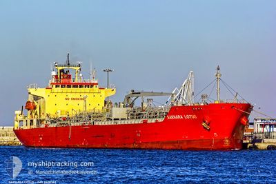
SAKHARA LOTUS
Oil/Chemical Tanker
Current Trip
| Time Travelled | 4 days |
|---|---|
| Remaining Time | 20 h, 48 mins |
| Distance Travelled | 1361.99 nm |
| Remaining Distance | 304.35 nm |
| AVG Speed | 13.3 Knots |
| MAX Speed | 14.7 Knots |
| AVG Wind | 14.8 knots |
| MAX Wind | 30.8 knots |
| MIN Temp | 13.1°C / 55.58°F |
| MAX Temp | 18.2°C / 64.76°F |
| Draught | 6.7 m |
| Position Received | 1 h, 14 m ago |
Current Position
| Longitude | 26.36913° |
|---|---|
| Latitude | 33.35715° |
| Status | Under way using engine |
| Speed | 13.6 Knots |
| Course | 105° |
| Area | Mediterranean Sea - Eastern Basin |
| Station | T-AIS |
| Position Received | 1 h, 14 m ago |
Info
Information
The current position of SAKHARA LOTUS is in Mediterranean Sea - Eastern Basin with coordinates 33.35715° / 26.36913° as reported on 2024-04-25 11:16 by AIS to our vessel tracker app. The vessel's current speed is 13.6 Knots and is heading at the port of DAMIETTA. The estimated time of arrival as calculated by MyShipTracking vessel tracking app is 2024-04-26 09:18 LT
The vessel SAKHARA LOTUS (IMO: 9400382, MMSI: 372530000) is a Oil/Chemical Tanker that was built in 2009 ( 15 years old ). It's sailing under the flag of [PA] Panama.
In this page you can find informations about the vessels current position, last detected port calls, and current voyage information. If the vessels is not in coverage by AIS you will find the latest position.
The current position of SAKHARA LOTUS is detected by our AIS receivers and we are not responsible for the reliability of the data. The last position was recorded while the vessel was in Coverage by the Ais receivers of our vessel tracking app.
The current draught of SAKHARA LOTUS as reported by AIS is 6.7 meters
Weather
| Temperature | 18.4°C / 65.12°F |
|---|---|
| Wind Speed | 13 knots |
| Direction | 299° WNW |
| Pressure | 1010.3 hPa |
| Humidity | 75.6 % |
| Cloud Coverage | 100 % |
Featured Company
Last Port Calls
| Port | Arrival | Departure | Time In Port |
|---|---|---|---|
| 2024-04-21 07:14 | |||
| 2024-04-11 11:14 | 2024-04-12 10:44 | 23 h | |
| 2024-04-04 07:58 | 2024-04-05 13:33 | 1 d | |
| 2024-03-28 06:19 | 2024-03-29 07:16 | 1 d | |
| 2024-03-22 08:58 | 2024-03-22 09:04 | 6 m | |
| 2024-03-14 14:19 | 2024-03-15 13:17 | 22 h | |
| 2024-03-13 10:08 | 2024-03-14 02:35 | 16 h | |
| 2024-02-26 07:53 | 2024-02-26 07:57 | 4 m | |
| 2024-02-24 10:34 | 2024-02-25 13:29 | 1 d | |
| 2024-02-18 07:12 | 2024-02-19 08:20 | 1 d |
Last Trips
| Origin | Departure | Destination | Arrival | Distance | |
|---|---|---|---|---|---|
| 2024-04-05 15:33 | 2024-04-11 13:14 | 1572.52 nm | |||
| 2024-03-29 10:16 | 2024-04-04 09:58 | 839.52 nm | |||
| 2024-03-22 10:04 | 2024-03-28 09:19 | 1196.90 nm | |||
| 2024-03-15 16:17 | 2024-03-22 09:58 | 1276.87 nm | |||
| 2024-03-14 05:35 | 2024-03-14 17:19 | 18.40 nm | |||
| 2024-02-26 08:57 | 2024-03-13 13:08 | 2168.48 nm | |||
| 2024-02-25 14:29 | 2024-02-26 08:53 | 116.87 nm | |||
| 2024-02-19 09:20 | 2024-02-24 11:34 | 1244.81 nm | |||
| 2024-02-16 22:27 | 2024-02-18 08:12 | 267.11 nm | |||
| 2024-02-15 05:08 | 2024-02-16 01:23 | 10.05 nm |
Events
| Time | Event | Details | Position / Dest | Info |
|---|---|---|---|---|
| 2024-04-25 11:19 | Status Changed | Default Under way using engine |
33.35415 / 26.38148
EGDAM
|
Speed: 13.6 kn Course: 105° |
| 2024-04-25 11:16 | OUT of Coverage |
33.35715 / 26.36913
Mediterranean Sea - Eastern Basin
EGDAM
|
Speed: 13.6 kn Course: 105° |
|
| 2024-04-25 04:29 | Detected in Sea | Greek part of the Mediterranean Sea - Eastern Basin |
33.81867 / 24.62455
Mediterranean Sea - Eastern Basin
EGDAM
|
Speed: 13.2 kn Course: 109° |
| 2024-04-25 04:27 | Status Changed | Under way using engine Default |
33.82092 / 24.61675
EGDAM
|
Speed: 13.2 kn Course: 108° |
| 2024-04-25 04:27 | IN Coverage |
33.81867 / 24.62455
Mediterranean Sea - Eastern Basin
EGDAM
|
Speed: 13.2 kn Course: 109° |
|
| 2024-04-24 14:49 | Status Changed | Default Under way using engine |
34.75578 / 21.01920
EGDAM
|
Speed: 13.3 kn Course: 107° |
| 2024-04-24 14:47 | OUT of Coverage |
34.75767 / 21.01193
Mediterranean Sea - Eastern Basin
EGDAM
|
Speed: 13.3 kn Course: 107° |
|
| 2024-04-24 14:35 | Status Changed | Under way using engine Default |
34.77192 / 20.95730
EGDAM
|
Speed: 13.4 kn Course: 108° |
| 2024-04-24 14:27 | Status Changed | Default Under way using engine |
34.78100 / 20.92283
EGDAM
|
Speed: 13.7 kn Course: 109° |
| 2024-04-24 14:19 | Detected in Sea | Libyan part of the Mediterranean Sea - Eastern Basin |
34.79035 / 20.88950
Mediterranean Sea - Eastern Basin
EGDAM
|
Speed: 13.7 kn Course: 109° |