
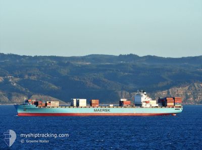
MAERSK MAKUTU
Container Ship
Current Trip
| Time Travelled | 7 days |
|---|---|
| Remaining Time | --- |
| Distance Travelled | 2472.52 nm |
| Remaining Distance | 1203.35 nm |
| AVG Speed | 14.1 Knots |
| MAX Speed | 20.3 Knots |
| AVG Wind | 17 knots |
| MAX Wind | 30.3 knots |
| MIN Temp | 5°C / 41°F |
| MAX Temp | 17.2°C / 62.96°F |
| Draught | 11.6 m |
| Position Received | 7 d ago |
Current Position
| Longitude | -73.20674° |
|---|---|
| Latitude | 40.37281° |
| Status | Under way using engine |
| Speed | 8.7 Knots |
| Course | 90.4° |
| Area | North Atlantic Ocean |
| Station | T-AIS |
| Position Received | 7 d ago |
Info
Information
The current position of MAERSK MAKUTU is in North Atlantic Ocean with coordinates 40.37281° / -73.20674° as reported on 2024-04-13 11:24 by AIS to our vessel tracker app. The vessel's current speed is 8.7 Knots and is heading at the port of BREMERHAVEN. The estimated time of arrival as calculated by MyShipTracking vessel tracking app is 2024-04-24 01:00 LT
The vessel MAERSK MAKUTU (IMO: 9318319, MMSI: 477849400) is a Container Ship that was built in 2007 ( 17 years old ). It's sailing under the flag of [HK] Hong Kong.
In this page you can find informations about the vessels current position, last detected port calls, and current voyage information. If the vessels is not in coverage by AIS you will find the latest position.
The current position of MAERSK MAKUTU is detected by our AIS receivers and we are not responsible for the reliability of the data. The last position was recorded while the vessel was in Coverage by the Ais receivers of our vessel tracking app.
The current draught of MAERSK MAKUTU as reported by AIS is 11.6 meters
Weather
| Temperature | 11.8°C / 53.24°F |
|---|---|
| Wind Speed | 18 knots |
| Direction | 148° SSE |
| Pressure | 1024.1 hPa |
| Humidity | 80 % |
| Cloud Coverage | 100 % |
Featured Company
Last Port Calls
| Port | Arrival | Departure | Time In Port |
|---|---|---|---|
| 2024-04-11 19:41 | 2024-04-13 07:19 | 1 d | |
| 2024-04-08 14:04 | 2024-04-09 11:15 | 21 h | |
| 2024-04-04 08:02 | 2024-04-05 04:22 | 20 h | |
| 2024-04-01 19:08 | 2024-04-03 01:04 | 1 d | |
| 2024-03-20 13:12 | 2024-03-21 05:14 | 16 h | |
| 2024-03-16 11:22 | 2024-03-18 02:07 | 1 d | |
| 2024-03-13 05:07 | 2024-03-14 14:15 | 1 d | |
| 2024-03-01 09:17 | 2024-03-02 08:59 | 23 h | |
| 2024-02-26 07:32 | 2024-02-27 06:19 | 22 h | |
| 2024-02-23 06:52 | 2024-02-23 22:34 | 15 h |
Last Trips
| Origin | Departure | Destination | Arrival | Distance | |
|---|---|---|---|---|---|
| 2024-04-09 07:15 | 2024-04-11 15:41 | 752.24 nm | |||
| 2024-04-05 00:22 | 2024-04-08 10:04 | 529.25 nm | |||
| 2024-04-02 21:04 | 2024-04-04 04:02 | 345.16 nm | |||
| 2024-03-21 06:14 | 2024-04-01 15:08 | 3564.96 nm | |||
| 2024-03-18 03:07 | 2024-03-20 14:12 | 282.30 nm | |||
| 2024-03-14 15:15 | 2024-03-16 12:22 | 511.92 nm | |||
| 2024-03-02 03:59 | 2024-03-13 06:07 | 3700.54 nm | |||
| 2024-02-27 01:19 | 2024-03-01 04:17 | 747.67 nm | |||
| 2024-02-23 17:34 | 2024-02-26 02:32 | 661.70 nm | |||
| 2024-02-22 00:18 | 2024-02-23 01:52 | 251.38 nm |
Events
| Time | Event | Details | Position / Dest | Info |
|---|---|---|---|---|
| 2024-04-13 11:31 | Status Changed | Default Under way using engine |
40.37320 / -73.18425
DE BRV
|
Speed: 8.7 kn Course: 90.4° |
| 2024-04-13 11:24 | OUT of Coverage |
40.37281 / -73.20674
North Atlantic Ocean
DE BRV
|
Speed: 8.7 kn Course: 90.4° |
|
| 2024-04-13 11:23 | Status Changed | Under way using engine Default |
40.37273 / -73.21053
DE BRV
|
Speed: 9.3 kn Course: 88° |
| 2024-04-13 11:16 | Status Changed | Default Under way using engine |
40.37232 / -73.23349
DE BRV
|
Speed: 9 kn Course: 100.8° |
| 2024-04-13 07:19 | PORT DEPARTURE |
|
40.57742 / -74.03540
DE BRV
|
Speed: 15.9 kn Course: 168° |
| 2024-04-13 05:35 | START Moving |
40.68268 / -74.15063
[US] NEW YORK
|
Speed: 3.1 kn Course: 316° |
|
| 2024-04-13 05:22 | Status Changed | Under way using engine Moored |
40.68574 / -74.15375
[US] NEW YORK
|
Speed: Course: 309° |
| 2024-04-13 04:06 | Draught Changed | 11.6 9.3 |
40.68569 / -74.15378
[US] NEW YORK
|
Speed: Course: 309° |
| 2024-04-13 04:06 | Destination Changed | DE BRV US NEWARK |
40.68569 / -74.15378
[US] NEW YORK
|
Speed: Course: 309° |
| 2024-04-13 04:06 | ETA Changed | 2024/04/24 01:00 2024/04/11 18:30 |
40.68569 / -74.15378
[US] NEW YORK
|
Speed: Course: 309° |