
RUYTER
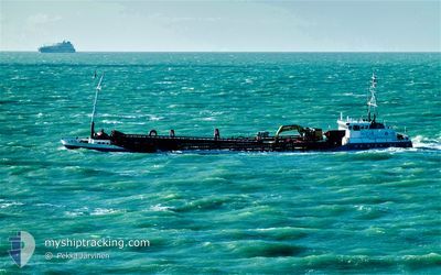
Hopper Dredger
Current Trip
| Time Travelled | 5 h, 38 mins |
|---|---|
| Remaining Time | -12 mins |
| Distance Travelled | 36.50 nm |
| Remaining Distance | 5.16 nm |
| AVG Speed | 9.9 Knots |
| MAX Speed | 11.7 Knots |
| AVG Wind | 6.7 knots |
| MAX Wind | 10 knots |
| MIN Temp | 2.7°C / 36.86°F |
| MAX Temp | 4.2°C / 39.56°F |
| Draught | 3 m |
| Position Received | 2 m ago |
Current Position
| Longitude | --- |
|---|---|
| Latitude | --- |
| Status | Moored |
| Speed | 0.1 Knots |
| Course | 122° |
| Area | North Sea |
| Station | T-AIS |
| Position Received | 2 m ago |
Info
Information
The current position of RUYTER is in North Sea with coordinates 51.39308° / 3.58992° as reported on 2024-12-13 12:51 by AIS to our vessel tracker app. The vessel's current speed is 0.1 Knots and is heading at the port of VLISSINGEN. The estimated time of arrival as calculated by MyShipTracking vessel tracking app is 2024-12-13 12:42 LT
The vessel RUYTER (IMO: 9085467, MMSI: 245231000) is a Hopper Dredger that was built in 1994 ( 30 years old ). It's sailing under the flag of [NL] Netherlands.
In this page you can find informations about the vessels current position, last detected port calls, and current voyage information. If the vessels is not in coverage by AIS you will find the latest position.
The current position of RUYTER is detected by our AIS receivers and we are not responsible for the reliability of the data. The last position was recorded while the vessel was in Coverage by the Ais receivers of our vessel tracking app.
The current draught of RUYTER as reported by AIS is 3 meters
Weather
| Temperature | 3.1°C / 37.58°F |
|---|---|
| Wind Speed | 5 knots |
| Direction | 153° SSE |
| Pressure | 1026.3 hPa |
| Humidity | 71.9 % |
| Cloud Coverage | 37 % |
Featured Company
Last Port Calls
| Port | Arrival | Departure | Time In Port |
|---|---|---|---|
| 2024-12-12 23:41 | 2024-12-13 07:16 | 7 h | |
| 2024-12-05 19:33 | 2024-12-10 05:15 | 4 d | |
| 2024-12-02 17:38 | 2024-12-03 06:56 | 13 h | |
| 2024-11-29 18:04 | 2024-12-02 05:46 | 2 d | |
| 2024-11-26 20:21 | 2024-11-27 06:46 | 10 h | |
| 2024-11-25 18:20 | 2024-11-26 05:23 | 11 h | |
| 2024-11-21 17:55 | 2024-11-25 12:35 | 3 d | |
| 2024-11-19 22:30 | 2024-11-21 06:08 | 1 d | |
| 2024-11-14 18:23 | 2024-11-18 07:27 | 3 d | |
| 2024-11-08 11:04 | 2024-11-12 08:23 | 3 d |
Most Visited Ports (Last year)
| Port | Arrivals | |
|---|---|---|
| 34 | ||
| 2 | ||
| 1 |
Last Trips
| Origin | Departure | Destination | Arrival | Distance | |
|---|---|---|---|---|---|
| 2024-12-10 06:15 | 2024-12-13 00:41 | 277.78 nm | |||
| 2024-12-03 07:56 | 2024-12-05 20:33 | 143.09 nm | |||
| 2024-12-02 06:46 | 2024-12-02 18:38 | 82.55 nm | |||
| 2024-11-27 07:46 | 2024-11-29 19:04 | 179.31 nm | |||
| 2024-11-26 06:23 | 2024-11-26 21:21 | 93.23 nm | |||
| 2024-11-25 13:35 | 2024-11-25 19:20 | 44.87 nm | |||
| 2024-11-21 07:08 | 2024-11-21 18:55 | 83.28 nm | |||
| 2024-11-18 08:27 | 2024-11-19 23:30 | 138.24 nm | |||
| 2024-11-12 09:23 | 2024-11-14 19:23 | 204.12 nm | |||
| 2024-11-04 07:32 | 2024-11-08 12:04 | 89.79 nm |
Events
| Time | Event | Details | Position / Dest | Info |
|---|---|---|---|---|
| 2024-12-13 12:51 | Status Changed | Moored Default |
51.39308 / 3.58992
NLVLI
|
Speed: 0.1 kn Course: 127° |
| 2024-12-13 12:42 | Status Changed | Default Moored |
51.39315 / 3.58998
NLVLI
|
Speed: 0.1 kn Course: 125° |
| 2024-12-13 12:27 | Status Changed | Moored Default |
51.39308 / 3.58995
NLVLI
|
Speed: 0.1 kn Course: 121° |
| 2024-12-13 12:24 | Status Changed | Default Moored |
51.39307 / 3.58997
NLVLI
|
Speed: 0.1 kn Course: 120° |
| 2024-12-13 12:11 | STOP Moving | 0.9 nm, East of BRESKENS |
51.39305 / 3.58990
NLVLI
|
Speed: 0.3 kn Course: 120° |
| 2024-12-13 10:39 | Status Changed | Moored Default |
51.57447 / 3.39977
NLVLI
|
Speed: 10.1 kn Course: 147° |
| 2024-12-13 10:35 | Status Changed | Default Moored |
51.58328 / 3.39132
NLVLI
|
Speed: 10.2 kn Course: 148° |
| 2024-12-13 09:56 | Status Changed | Moored Default |
51.64465 / 3.32878
NLVLI
|
Speed: 1 kn Course: 228° |
| 2024-12-13 09:26 | Status Changed | Default Moored |
51.64840 / 3.33817
NLVLI
|
Speed: 0.9 kn Course: 290° |
| 2024-12-13 09:23 | Status Changed | Moored Default |
51.64813 / 3.33942
NLVLI
|
Speed: 0.7 kn Course: 330° |