
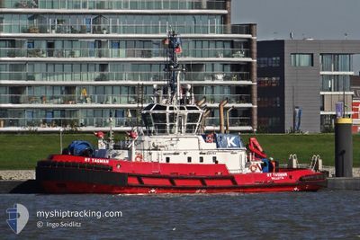
RT TASMAN
Tug
Current Trip
CG-PNR
| Time Travelled | 15 days |
|---|---|
| Remaining Time | --- |
| Distance Travelled | 98.27 nm |
| Remaining Distance | --- |
| AVG Speed | 7.1 Knots |
| MAX Speed | 9.9 Knots |
| AVG Wind | 6.2 knots |
| MAX Wind | 12 knots |
| MIN Temp | 24°C / 75.2°F |
| MAX Temp | 27.6°C / 81.68°F |
| Draught | 6.5 m |
| Position Received | 2024-07-23 13:08 |
Current Position
| Longitude | --- |
|---|---|
| Latitude | --- |
| Status | Under way using engine |
| Speed | 7.9 Knots |
| Course | 318.3° |
| Area | South Atlantic Ocean |
| Station | T-AIS |
| Position Received | 2024-07-23 13:08 |
Info
Information
The current position of RT TASMAN is in South Atlantic Ocean with coordinates -33.69922° / 18.20183° as reported on 2024-07-23 13:08 by AIS to our vessel tracker app. The vessel's current speed is 7.9 Knots
The vessel RT TASMAN (IMO: 9556909, MMSI: 311000872) is a Tug that was built in 2011 ( 13 years old ). It's sailing under the flag of [BS] Bahamas.
In this page you can find informations about the vessels current position, last detected port calls, and current voyage information. If the vessels is not in coverage by AIS you will find the latest position.
The current position of RT TASMAN is detected by our AIS receivers and we are not responsible for the reliability of the data. The last position was recorded while the vessel was in Coverage by the Ais receivers of our vessel tracking app.
The current draught of RT TASMAN as reported by AIS is 6.5 meters
Weather
| Temperature | 27.1°C / 80.78°F |
|---|---|
| Wind Speed | 8 knots |
| Direction | 227° SW |
| Pressure | 1009.7 hPa |
| Humidity | 84.9 % |
| Cloud Coverage | 72 % |
Featured Company
Last Port Calls
| Port | Arrival | Departure | Time In Port |
|---|---|---|---|
| 2024-11-29 11:07 | 2024-11-29 15:43 | 4 h | |
| 2024-11-08 09:35 | 2024-11-08 15:23 | 5 h | |
| 2024-10-19 10:20 | 2024-10-19 19:12 | 8 h | |
| 2024-10-05 09:20 | 2024-10-05 15:48 | 6 h |
Most Visited Ports (Last year)
| Port | Arrivals | |
|---|---|---|
| 8 | ||
| 7 | ||
| 1 | ||
| 1 | ||
| 1 |
Last Trips
| Origin | Departure | Destination | Arrival | Distance | |
|---|---|---|---|---|---|
| 2024-11-08 15:23 | 2024-11-29 11:07 | 81.82 nm | |||
| 2024-10-19 19:12 | 2024-11-08 09:35 | 4.97 nm | |||
| 2024-10-05 15:48 | 2024-10-19 10:20 | 78.32 nm | |||
| 2024-09-16 17:44 | 2024-10-05 09:20 | 66.12 nm |
Events
| Time | Event | Details | Position / Dest | Info |
|---|---|---|---|---|
| 2024-12-14 16:28 | START Moving | 13.6 nm, West of POINTE NOIRE |
-4.69275 / 11.62528
CG-PNR
|
Speed: 4.3 kn Course: 87° |
| 2024-12-14 16:18 | STOP Moving | 13.75 nm, West of POINTE NOIRE |
-4.69405 / 11.62193
CG-PNR
|
Speed: 0.3 kn Course: 128° |
| 2024-12-14 12:07 | START Moving | 12.93 nm, South West of POINTE NOIRE |
-4.87251 / 11.64023
CG-PNR
|
Speed: 7.2 kn Course: 353° |
| 2024-12-14 11:58 | STOP Moving | 13.06 nm, South West of POINTE NOIRE |
-4.87964 / 11.64144
CG-PNR
|
Speed: 0.2 kn Course: 7° |
| 2024-12-14 10:12 | START Moving | 1.01 nm, North of POINTE NOIRE |
-4.76265 / 11.83266
CG-PNR
|
Speed: 6.7 kn Course: 279° |
| 2024-12-13 17:51 | STOP Moving | 1.03 nm, North of POINTE NOIRE |
-4.76209 / 11.83495
CG-PNR
|
Speed: 0.1 kn Course: 352° |
| 2024-12-13 12:19 | START Moving | 8.48 nm, South of POINTE NOIRE |
-4.91974 / 11.85680
CG-PNR
|
Speed: 7.7 kn Course: 256° |
| 2024-12-13 12:16 | STOP Moving | 8.47 nm, South of POINTE NOIRE |
-4.91925 / 11.85905
CG-PNR
|
Speed: 0.2 kn Course: 262° |
| 2024-12-13 10:52 | START Moving | 0.92 nm, North of POINTE NOIRE |
-4.76427 / 11.83255
CG-PNR
|
Speed: 5.8 kn Course: 244° |
| 2024-12-10 12:46 | STOP Moving | 0.94 nm, North of POINTE NOIRE |
-4.76357 / 11.83465
CG-PNR
|
Speed: 0.3 kn Course: 230° |