
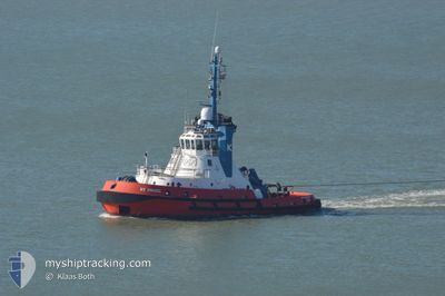
RT MAGIC
Tug
Current Trip
TAKORADI
| Time Travelled | 5 days |
|---|---|
| Remaining Time | --- |
| Distance Travelled | 26.37 nm |
| Remaining Distance | --- |
| AVG Speed | 9.9 Knots |
| MAX Speed | 10.9 Knots |
| AVG Wind | 5.5 knots |
| MAX Wind | 17.7 knots |
| MIN Temp | 27°C / 80.6°F |
| MAX Temp | 28.8°C / 83.84°F |
| Draught | 6.5 m |
| Position Received | 2021-06-23 14:18 |
Current Position
| Longitude | 14.46568° |
|---|---|
| Latitude | -22.88308° |
| Status | Default |
| Speed | 0.1 Knots |
| Course | 213° |
| Area | South Atlantic Ocean |
| Station | T-AIS |
| Position Received | 2021-06-23 14:18 |
Info
Information
The current position of RT MAGIC is in South Atlantic Ocean with coordinates -22.88308° / 14.46568° as reported on 2021-06-23 14:18 by AIS to our vessel tracker app. The vessel's current speed is 0.1 Knots
The vessel RT MAGIC (IMO: 9190066, MMSI: 311000881) is a Tug that was built in 1999 ( 25 years old ). It's sailing under the flag of [BS] Bahamas.
In this page you can find informations about the vessels current position, last detected port calls, and current voyage information. If the vessels is not in coverage by AIS you will find the latest position.
The current position of RT MAGIC is detected by our AIS receivers and we are not responsible for the reliability of the data. The last position was recorded while the vessel was in Coverage by the Ais receivers of our vessel tracking app.
The current draught of RT MAGIC as reported by AIS is 6.5 meters
Weather
| Temperature | 28.5°C / 83.3°F |
|---|---|
| Wind Speed | 9 knots |
| Direction | 170° S |
| Pressure | 1009.8 hPa |
| Humidity | 81.1 % |
| Cloud Coverage | 100 % |
Featured Company
Last Port Calls
| Port | Arrival | Departure | Time In Port |
|---|---|---|---|
| 2024-04-14 01:52 | 2024-04-14 02:40 | 47 m | |
| 2024-04-08 08:03 | 2024-04-08 20:50 | 12 h | |
| 2024-04-07 09:59 | 2024-04-07 10:18 | 19 m | |
| 2024-04-06 11:28 | 2024-04-06 12:40 | 1 h | |
| 2024-04-05 15:39 | 2024-04-05 15:55 | 16 m | |
| 2024-04-05 02:19 | 2024-04-05 03:26 | 1 h | |
| 2024-04-04 07:19 | 2024-04-04 09:24 | 2 h | |
| 2024-04-01 06:06 | 2024-04-01 07:03 | 57 m | |
| 2024-03-31 20:26 | 2024-04-01 02:58 | 6 h | |
| 2024-03-31 11:48 | 2024-03-31 12:34 | 46 m |
Last Trips
| Origin | Departure | Destination | Arrival | Distance | |
|---|---|---|---|---|---|
| 2024-04-08 21:50 | 2024-04-14 02:52 | 17.21 nm | |||
| 2024-04-07 11:18 | 2024-04-08 09:03 | 12.43 nm | |||
| 2024-04-06 13:40 | 2024-04-07 10:59 | 0.78 nm | |||
| 2024-04-05 16:55 | 2024-04-06 12:28 | 0.68 nm | |||
| 2024-04-05 04:26 | 2024-04-05 16:39 | 4.38 nm | |||
| 2024-04-04 10:24 | 2024-04-05 03:19 | 0.65 nm | |||
| 2024-04-01 08:03 | 2024-04-04 08:19 | 5.89 nm | |||
| 2024-04-01 03:58 | 2024-04-01 07:06 | 0.40 nm | |||
| 2024-03-31 13:34 | 2024-03-31 21:26 | 0.64 nm | |||
| 2024-03-31 10:41 | 2024-03-31 12:48 | 1.15 nm |
Events
| Time | Event | Details | Position / Dest | Info |
|---|---|---|---|---|
| 2024-04-18 08:00 | STOP Moving | 0.46 nm, South of CAP LOPEZ |
-.63714 / 8.71667
TAKORADI
|
Speed: 0.1 kn Course: 119° |
| 2024-04-14 14:26 | STOP Moving | 0.43 nm, South of CAP LOPEZ |
-.63653 / 8.71642
TAKORADI
|
Speed: Course: 63° |
| 2024-04-14 02:40 | PORT DEPARTURE |
|
-.63681 / 8.71495
TAKORADI
|
Speed: 1.6 kn Course: 161° |
| 2024-04-14 01:52 | PORT ARRIVAL |
|
-.63293 / 8.71689
[GA] CAP LOPEZ
|
Speed: 3.4 kn Course: 219° |
| 2024-04-13 06:44 | STOP Moving | 0.15 nm, South of CAP LOPEZ |
-.63226 / 8.71917
TAKORADI
|
Speed: 0.2 kn Course: 305° |
| 2024-04-13 05:20 | START Moving | 0.2 nm, South East of CAP LOPEZ |
-.63171 / 8.72144
TAKORADI
|
Speed: 6.8 kn Course: 50° |