
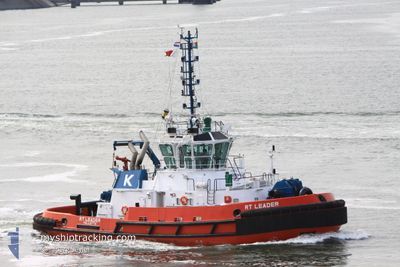
RT LEADER
Tug
Current Trip
BELL BAY
| Time Travelled | 1 day |
|---|---|
| Remaining Time | --- |
| Distance Travelled | 1.38 nm |
| Remaining Distance | --- |
| AVG Speed | 6.2 Knots |
| MAX Speed | 6.2 Knots |
| AVG Wind | 5.6 knots |
| MAX Wind | 6.3 knots |
| MIN Temp | 10.8°C / 51.44°F |
| MAX Temp | 13°C / 55.4°F |
| Draught | 6.1 m |
| Position Received | 1 m ago |
Current Position
| Longitude | 146.82490° |
|---|---|
| Latitude | -41.15160° |
| Status | Under way using engine |
| Speed | |
| Course | 343° |
| Area | Bass Strait |
| Station | T-AIS |
| Position Received | 1 m ago |
Info
Information
The current position of RT LEADER is in Bass Strait with coordinates -41.15160° / 146.82490° as reported on 2024-04-25 15:35 by AIS to our vessel tracker app. The vessel's current speed is 0 Knots
The vessel RT LEADER (IMO: 9489962, MMSI: 311000871) is a Tug that was built in 2011 ( 13 years old ). It's sailing under the flag of [BS] Bahamas.
In this page you can find informations about the vessels current position, last detected port calls, and current voyage information. If the vessels is not in coverage by AIS you will find the latest position.
The current position of RT LEADER is detected by our AIS receivers and we are not responsible for the reliability of the data. The last position was recorded while the vessel was in Coverage by the Ais receivers of our vessel tracking app.
The current draught of RT LEADER as reported by AIS is 6.1 meters
Weather
| Temperature | 5.9°C / 42.62°F |
|---|---|
| Wind Speed | 2 knots |
| Direction | 203° SSW |
| Pressure | 1022.1 hPa |
| Humidity | 87.6 % |
| Cloud Coverage | 5 % |
Featured Company
Last Port Calls
| Port | Arrival | Departure | Time In Port |
|---|---|---|---|
| 2024-04-24 01:30 | 2024-04-24 01:50 | 20 m | |
| 2024-04-23 22:58 | 2024-04-23 23:25 | 26 m | |
| 2024-04-16 18:44 | 2024-04-17 23:41 | 1 d | |
| 2024-04-16 02:28 | 2024-04-16 17:50 | 15 h | |
| 2024-04-15 04:07 | 2024-04-16 01:49 | 21 h | |
| 2024-04-14 05:25 | 2024-04-14 05:49 | 24 m | |
| 2024-04-14 01:29 | 2024-04-14 01:37 | 8 m | |
| 2024-04-14 01:13 | 2024-04-14 01:19 | 6 m | |
| 2024-04-13 23:27 | 2024-04-14 00:13 | 45 m | |
| 2024-04-13 00:49 | 2024-04-13 01:24 | 35 m |
Last Trips
| Origin | Departure | Destination | Arrival | Distance | |
|---|---|---|---|---|---|
| 2024-04-24 09:25 | 2024-04-24 11:30 | 4.89 nm | |||
| 2024-04-18 09:41 | 2024-04-24 08:58 | 52.91 nm | |||
| 2024-04-17 03:50 | 2024-04-17 04:44 | 2.89 nm | |||
| 2024-04-16 11:49 | 2024-04-16 12:28 | 2.92 nm | |||
| 2024-04-14 15:49 | 2024-04-15 14:07 | 36.72 nm | |||
| 2024-04-14 11:37 | 2024-04-14 15:25 | 9.32 nm | |||
| 2024-04-14 11:19 | 2024-04-14 11:29 | 0.49 nm | |||
| 2024-04-14 10:13 | 2024-04-14 11:13 | 6.47 nm | |||
| 2024-04-13 11:24 | 2024-04-14 09:27 | 3.98 nm | |||
| 2024-04-10 08:47 | 2024-04-13 10:49 | 19.32 nm |
Events
| Time | Event | Details | Position / Dest | Info |
|---|---|---|---|---|
| 2024-04-24 23:46 | IN Coverage |
-41.15155 / 146.82492
Bass Strait
|
Speed: Course: 209° |
|
| 2024-04-24 10:47 | Status Changed | Default Under way using engine |
-41.15154 / 146.82484
BELL BAY
|
Speed: Course: 346° |
| 2024-04-24 10:00 | OUT of Coverage |
-41.15152 / 146.82490
Bass Strait
|
Speed: Course: 328° |
|
| 2024-04-24 04:00 | Status Changed | Under way using engine Default |
-41.15155 / 146.82490
BELL BAY
|
Speed: 0.1 kn Course: 346° |
| 2024-04-24 03:59 | Status Changed | Default Under way using engine |
-41.15154 / 146.82494
BELL BAY
|
Speed: Course: 346° |
| 2024-04-24 03:17 | Status Changed | Under way using engine Default |
-41.15160 / 146.82483
BELL BAY
|
Speed: Course: 346° |
| 2024-04-24 03:00 | Status Changed | Default Under way using engine |
-41.15154 / 146.82483
BELL BAY
|
Speed: Course: 345° |
| 2024-04-24 02:09 | Status Changed | Under way using engine Default |
-41.15153 / 146.82487
BELL BAY
|
Speed: 6.2 kn Course: 188° |
| 2024-04-24 02:09 | STOP Moving | 1.82 nm, South West of BELL BAY |
-41.15153 / 146.82487
BELL BAY
|
Speed: Course: 348° |
| 2024-04-24 02:03 | Status Changed | Default Under way using engine |
-41.14987 / 146.82564
BELL BAY
|
Speed: 7.1 kn Course: 274° |