
ANTES 3
Other Type
Current Trip
PATROL
| Time Travelled | --- |
|---|---|
| Remaining Time | --- |
| Distance Travelled | 1.05 nm |
| Remaining Distance | --- |
| AVG Speed | 6.1 Knots |
| MAX Speed | 7 Knots |
| AVG Wind | 12.1 knots |
| MAX Wind | 13 knots |
| MIN Temp | 5.7°C / 42.26°F |
| MAX Temp | 9.6°C / 49.28°F |
| Draught | 1.5 m |
| Position Received | 1 d ago |
Current Position
| Longitude | 5.97127° |
|---|---|
| Latitude | 51.65501° |
| Status | Under way using engine |
| Speed | 2.1 Knots |
| Course | --- |
| Area | North Sea |
| Station | T-AIS |
| Position Received | 1 d ago |
Info
Information
The current position of ANTES 3 is in North Sea with coordinates 51.65501° / 5.97127° as reported on 2024-04-24 09:39 by AIS to our vessel tracker app. The vessel's current speed is 2.1 Knots
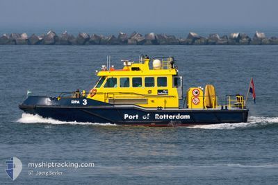
The vessel ANTES 3 (MMSI: 244070156) is a Other Type It's sailing under the flag of [NL] Netherlands.
In this page you can find informations about the vessels current position, last detected port calls, and current voyage information. If the vessels is not in coverage by AIS you will find the latest position.
The current position of ANTES 3 is detected by our AIS receivers and we are not responsible for the reliability of the data. The last position was recorded while the vessel was in Coverage by the Ais receivers of our vessel tracking app.
The current draught of ANTES 3 as reported by AIS is 1.5 meters
Weather
| Temperature | 5.6°C / 42.08°F |
|---|---|
| Wind Speed | 14 knots |
| Direction | 308° NW |
| Pressure | 1008.9 hPa |
| Humidity | 90.6 % |
| Cloud Coverage | 88 % |
Featured Company
Last Port Calls
Last Trips
| Origin | Departure | Destination | Arrival | Distance |
|---|
Events
| Time | Event | Details | Position / Dest | Info |
|---|---|---|---|---|
| 2024-04-24 09:39 | OUT of Coverage |
51.65501 / 5.97127
North Sea
|
Speed: 2.1 kn Course: 358.5° |
|
| 2024-04-24 09:27 | START Moving | 0.9 nm, South East of BOXMEER |
51.65746 / 5.97293
PATROL
|
Speed: 6.8 kn Course: 31.1° |
| 2024-04-24 06:15 | IN Coverage |
51.65496 / 5.97065
North Sea
|
Speed: Course: 181.5° |
|
| 2024-04-23 13:07 | OUT of Coverage |
51.65498 / 5.97062
North Sea
|
Speed: Course: 165.2° |
|
| 2024-04-23 12:47 | IN Coverage |
51.65495 / 5.97062
North Sea
|
Speed: Course: 163.3° |