
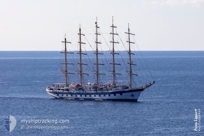
ROYAL CLIPPER
Passengers Ship
Current Trip
| Trip Time | 2 days |
|---|---|
| Trip Distance | 386.58 nm |
| AVG Speed | 6.4 Knots |
| MAX Speed | 10.4 Knots |
| Draught | 6.2 m |
| AVG Wind | 17.3 knots |
| MAX Wind | 27.3 knots |
| MIN Temp | 11.7°C / 53.06°F |
| MAX Temp | 19°C / 66.2°F |
| Position Received | 9 h, 57 m ago |
Current Position
| Longitude | 14.52495° |
|---|---|
| Latitude | 35.90163° |
| Status | Under way using engine |
| Speed | 6.6 Knots |
| Course | 250.2° |
| Area | Mediterranean Sea - Eastern Basin |
| Station | T-AIS |
| Position Received | 9 h, 57 m ago |
Info
Information
The current position of ROYAL CLIPPER is in Mediterranean Sea - Eastern Basin with coordinates 35.90163° / 14.52495° as reported on 2024-04-25 05:04 by AIS to our vessel tracker app. The vessel's current speed is 6.6 Knots and is currently inside the port of VALLETTA.
The vessel ROYAL CLIPPER (IMO: 8712178, MMSI: 215813000) is a Passengers Ship that was built in 2000 ( 24 years old ). It's sailing under the flag of [MT] Malta.
In this page you can find informations about the vessels current position, last detected port calls, and current voyage information. If the vessels is not in coverage by AIS you will find the latest position.
The current position of ROYAL CLIPPER is detected by our AIS receivers and we are not responsible for the reliability of the data. The last position was recorded while the vessel was in Coverage by the Ais receivers of our vessel tracking app.
The current draught of ROYAL CLIPPER as reported by AIS is 6.2 meters
Weather
| Temperature | 15.5°C / 59.9°F |
|---|---|
| Wind Speed | 20 knots |
| Direction | 283° WNW |
| Pressure | 1013.5 hPa |
| Humidity | 70 % |
| Cloud Coverage | 17 % |
Featured Company
Last Port Calls
| Port | Arrival | Departure | Time In Port |
|---|---|---|---|
| 2024-04-25 05:04 | |||
| 2024-04-22 04:58 | 2024-04-22 12:23 | 7 h | |
| 2024-04-20 10:32 | 2024-04-20 17:08 | 6 h | |
| 2024-04-19 16:07 | |||
| 2024-04-17 06:26 | 2024-04-17 17:12 | 10 h | |
| 2024-04-16 10:29 | 2024-04-16 17:09 | 6 h | |
| 2024-04-15 04:35 | 2024-04-15 19:06 | 14 h | |
| 2024-03-30 09:40 | 2024-03-31 02:17 | 16 h | |
| 2024-03-28 11:22 | 2024-03-28 16:11 | 4 h | |
| 2024-03-25 22:08 | 2024-03-26 03:54 | 5 h |
Most Visited Ports (Last year)
| Port | Arrivals | |
|---|---|---|
| 17 | ||
| 9 | ||
| 8 | ||
| 8 | ||
| 7 | ||
| 5 |
Last Trips
| Origin | Departure | Destination | Arrival | Distance | |
|---|---|---|---|---|---|
| 2024-04-22 14:23 | 2024-04-25 07:04 | 386.58 nm | |||
| 2024-04-20 19:08 | 2024-04-22 06:58 | 274.45 nm | |||
| 2024-04-19 18:07 | 2024-04-20 12:32 | 159.81 nm | |||
| 2024-04-16 18:09 | 2024-04-17 08:26 | 115.97 nm | |||
| 2024-04-15 20:06 | 2024-04-16 11:29 | 157.20 nm | |||
| 2024-03-30 22:17 | 2024-04-15 05:35 | 3192.89 nm | |||
| 2024-03-28 12:11 | 2024-03-30 05:40 | 153.41 nm | |||
| 2024-03-25 23:54 | 2024-03-28 07:22 | 208.30 nm | |||
| 2024-03-23 23:02 | 2024-03-25 18:08 | 208.23 nm | |||
| 2024-03-17 18:15 | 2024-03-23 05:53 | 632.95 nm |
Events
| Time | Event | Details | Position / Dest | Info |
|---|---|---|---|---|
| 2024-04-25 05:36 | STOP Moving |
35.88602 / 14.50394
[MT] VALLETTA
|
Speed: 0.2 kn Course: 36° |
|
| 2024-04-25 05:12 | Status Changed | Default Under way using engine |
35.89154 / 14.51269
[MT] VALLETTA
|
Speed: 6.6 kn Course: 250.2° |
| 2024-04-25 05:04 | OUT of Coverage |
35.90163 / 14.52495
Mediterranean Sea - Eastern Basin
[MT] VALLETTA
|
Speed: 6.6 kn Course: 250.2° |
|
| 2024-04-25 05:04 | PORT ARRIVAL |
|
35.90163 / 14.52495
[MT] VALLETTA
|
Speed: 7.4 kn Course: 219.6° |
| 2024-04-25 04:27 | Status Changed | Under way using engine Default |
35.91955 / 14.60682
MT MLA
|
Speed: 5.9 kn Course: 282° |
| 2024-04-25 04:12 | IN Coverage |
35.91955 / 14.60682
Mediterranean Sea - Eastern Basin
MT MLA
|
Speed: 5.6 kn Course: 280.1° |
|
| 2024-04-24 21:51 | Status Changed | Default Under way sailing |
35.75333 / 14.37333
MT MLA
|
Speed: 2.9 kn Course: 111° |
| 2024-04-24 21:43 | OUT of Coverage |
35.75854 / 14.36480
Mediterranean Sea - Eastern Basin
MT MLA
|
Speed: 2.9 kn Course: 120.7° |
|
| 2024-04-24 21:26 | Status Changed | Under way sailing Default |
35.76460 / 14.35308
MT MLA
|
Speed: 2 kn Course: -1° |
| 2024-04-24 21:21 | Status Changed | Default Under way sailing |
35.76500 / 14.34833
MT MLA
|
Speed: 2.4 kn Course: 113° |