
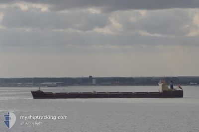
ANABELA
Bulk Carrier
Current Trip
| Time Travelled | 12 h, 55 mins |
|---|---|
| Remaining Time | 5 days |
| Distance Travelled | 143.52 nm |
| Remaining Distance | 1594.84 nm |
| AVG Speed | 10.5 Knots |
| MAX Speed | 12.6 Knots |
| AVG Wind | 7.6 knots |
| MAX Wind | 12.4 knots |
| MIN Temp | 5°C / 41°F |
| MAX Temp | 12.9°C / 55.22°F |
| Draught | 8.7 m |
| Position Received | 29 m ago |
Current Position
| Longitude | 14.26232° |
|---|---|
| Latitude | 43.87704° |
| Status | Under way using engine |
| Speed | 12.6 Knots |
| Course | 145.2° |
| Area | Adriatic Sea |
| Station | T-AIS |
| Position Received | 29 m ago |
Info
Information
The current position of ANABELA is in Adriatic Sea with coordinates 43.87704° / 14.26232° as reported on 2024-04-19 14:40 by AIS to our vessel tracker app. The vessel's current speed is 12.6 Knots and is heading at the port of GIBRALTAR. The estimated time of arrival as calculated by MyShipTracking vessel tracking app is 2024-04-25 12:34 LT
The vessel ANABELA (IMO: 9587350, MMSI: 636019937) is a Bulk Carrier that was built in 2010 ( 14 years old ). It's sailing under the flag of [LR] Liberia.
In this page you can find informations about the vessels current position, last detected port calls, and current voyage information. If the vessels is not in coverage by AIS you will find the latest position.
The current position of ANABELA is detected by our AIS receivers and we are not responsible for the reliability of the data. The last position was recorded while the vessel was in Coverage by the Ais receivers of our vessel tracking app.
The current draught of ANABELA as reported by AIS is 8.7 meters
Weather
| Temperature | 12.6°C / 54.68°F |
|---|---|
| Wind Speed | 11 knots |
| Direction | 4° N |
| Pressure | 1013.5 hPa |
| Humidity | 50.6 % |
| Cloud Coverage | 100 % |
Featured Company
Events
| Time | Event | Details | Position / Dest | Info |
|---|---|---|---|---|
| 2024-04-19 14:40 | IN Coverage |
43.87704 / 14.26232
Adriatic Sea
SIKOP > GIGIB
|
Speed: 12.6 kn Course: 145.2° |
|
| 2024-04-19 09:54 | OUT of Coverage |
44.67870 / 13.50588
Adriatic Sea
SIKOP > GIGIB
|
Speed: 11.5 kn Course: 145.9° |
|
| 2024-04-19 06:34 | Detected in Sea | Croatian part of the Adriatic Sea |
45.21797 / 13.02807
Adriatic Sea
SIKOP > GIGIB
|
Speed: 11.2 kn Course: 170.1° |
| 2024-04-19 03:01 | Change Sea Area | Italian part of the Adriatic Sea Slovenian part of the Adriatic Sea |
45.63499 / 13.58164
Adriatic Sea
SIKOP > GIGIB
|
Speed: 11.7 kn Course: 303.2° |
| 2024-04-19 02:15 | PORT DEPARTURE |
|
45.56143 / 13.71622
SIKOP > GIGIB
|
Speed: 3.6 kn Course: 269° |
| 2024-04-19 02:11 | START Moving |
45.56230 / 13.72117
[SI] KOPER
|
Speed: 3.1 kn Course: 251° |
|
| 2024-04-19 01:24 | Status Changed | Under way using engine Moored |
45.56505 / 13.74080
[SI] KOPER
|
Speed: Course: 87° |
| 2024-04-19 01:07 | Draught Changed | 8.7 9 |
45.56497 / 13.74078
[SI] KOPER
|
Speed: Course: 87° |
| 2024-04-19 00:09 | Draught Changed | 9 13 |
45.56498 / 13.74072
[SI] KOPER
|
Speed: Course: 86° |
| 2024-04-19 00:09 | ETA Changed | 2024/04/25 02:00 2024/04/25 12:00 |
45.56498 / 13.74072
[SI] KOPER
|
Speed: Course: 86° |