
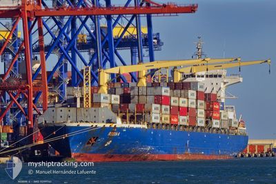
ROBIN 4
Container Ship
Current Trip
| Time Travelled | 15 h, 27 mins |
|---|---|
| Remaining Time | 4 h, 29 mins |
| Distance Travelled | 262.50 nm |
| Remaining Distance | 83.72 nm |
| AVG Speed | 16.5 Knots |
| MAX Speed | 18.3 Knots |
| AVG Wind | 13.2 knots |
| MAX Wind | 31 knots |
| MIN Temp | 12.3°C / 54.14°F |
| MAX Temp | 16.3°C / 61.34°F |
| Draught | 11.3 m |
| Position Received | Now |
Current Position
| Longitude | 7.32283° |
|---|---|
| Latitude | 43.37611° |
| Status | Under way using engine |
| Speed | 17.2 Knots |
| Course | 52.6° |
| Area | Mediterranean Sea - Western Basin |
| Station | T-AIS |
| Position Received | Now |
Info
Information
The current position of ROBIN 4 is in Mediterranean Sea - Western Basin with coordinates 43.37611° / 7.32283° as reported on 2024-04-19 22:05 by AIS to our vessel tracker app. The vessel's current speed is 17.2 Knots and is heading at the port of VADO LIGURE. The estimated time of arrival as calculated by MyShipTracking vessel tracking app is 2024-04-20 02:34 LT
The vessel ROBIN 4 (IMO: 9399741, MMSI: 636017360) is a Container Ship that was built in 2007 ( 17 years old ). It's sailing under the flag of [LR] Liberia.
In this page you can find informations about the vessels current position, last detected port calls, and current voyage information. If the vessels is not in coverage by AIS you will find the latest position.
The current position of ROBIN 4 is detected by our AIS receivers and we are not responsible for the reliability of the data. The last position was recorded while the vessel was in Coverage by the Ais receivers of our vessel tracking app.
The current draught of ROBIN 4 as reported by AIS is 11.3 meters
Weather
| Temperature | 15.6°C / 60.08°F |
|---|---|
| Wind Speed | 23 knots |
| Direction | 282° WNW |
| Pressure | 1008.3 hPa |
| Humidity | 57 % |
| Cloud Coverage | 2 % |
Featured Company
Last Port Calls
| Port | Arrival | Departure | Time In Port |
|---|---|---|---|
| 2024-04-18 18:15 | 2024-04-19 06:38 | 12 h | |
| 2024-04-14 15:14 | 2024-04-15 18:04 | 1 d | |
| 2024-04-11 13:02 | 2024-04-12 05:09 | 16 h | |
| 2024-04-07 20:19 | 2024-04-08 20:36 | 1 d | |
| 2024-04-04 23:47 | 2024-04-05 12:47 | 12 h | |
| 2024-04-02 22:17 | 2024-04-04 05:16 | 1 d | |
| 2024-03-31 14:52 | 2024-04-01 00:07 | 9 h | |
| 2024-03-26 20:22 | 2024-03-27 10:25 | 14 h | |
| 2024-03-22 17:13 | 2024-03-23 15:24 | 22 h | |
| 2024-03-21 01:04 | 2024-03-21 20:44 | 19 h |
Most Visited Ports (Last year)
| Port | Arrivals | |
|---|---|---|
| 28 | ||
| 15 | ||
| 14 | ||
| 14 | ||
| 14 | ||
| 9 |
Last Trips
| Origin | Departure | Destination | Arrival | Distance | |
|---|---|---|---|---|---|
| 2024-04-15 20:04 | 2024-04-18 20:15 | 257.70 nm | |||
| 2024-04-12 07:09 | 2024-04-14 17:14 | 459.24 nm | |||
| 2024-04-08 22:36 | 2024-04-11 15:02 | 875.28 nm | |||
| 2024-04-05 14:47 | 2024-04-07 22:19 | 357.63 nm | |||
| 2024-04-04 07:16 | 2024-04-05 01:47 | 192.87 nm | |||
| 2024-04-01 00:07 | 2024-04-03 00:17 | 426.44 nm | |||
| 2024-03-27 11:25 | 2024-03-31 14:52 | 411.51 nm | |||
| 2024-03-23 16:24 | 2024-03-26 21:22 | 951.40 nm | |||
| 2024-03-21 21:44 | 2024-03-22 18:13 | 343.58 nm | |||
| 2024-03-18 14:03 | 2024-03-21 02:04 | 226.08 nm |
Events
| Time | Event | Details | Position / Dest | Info |
|---|---|---|---|---|
| 2024-04-19 17:27 | Status Changed | Under way using engine Default |
42.64555 / 5.82064
ITVDL
|
Speed: 18.2 kn Course: 62° |
| 2024-04-19 17:07 | Status Changed | Default Under way using engine |
42.59955 / 5.69718
ITVDL
|
Speed: 18.2 kn Course: 62.7° |
| 2024-04-19 16:04 | Detected in Sea | French part of the Mediterranean Sea - Western Basin |
42.46086 / 5.32411
Mediterranean Sea - Western Basin
ITVDL
|
Speed: 17.5 kn Course: 63.3° |
| 2024-04-19 16:04 | Status Changed | Under way using engine Default |
42.45972 / 5.32106
ITVDL
|
Speed: 16.9 kn Course: 63° |
| 2024-04-19 16:04 | IN Coverage |
42.46086 / 5.32411
Mediterranean Sea - Western Basin
ITVDL
|
Speed: 17.5 kn Course: 63.3° |
|
| 2024-04-19 09:20 | OUT of Coverage |
41.58959 / 2.99499
Balearic Sea
ITVDL
|
Speed: 18 kn Course: 58.3° |
|
| 2024-04-19 06:38 | PORT DEPARTURE |
|
41.30996 / 2.17066
ITVDL
|
Speed: 9.6 kn Course: 170° |
| 2024-04-19 06:19 | START Moving |
41.30801 / 2.15120
[ES] BARCELONA
|
Speed: 3.5 kn Course: 31° |
|
| 2024-04-19 06:08 | Status Changed | Under way using engine Moored |
41.30773 / 2.14883
[ES] BARCELONA
|
Speed: 0.5 kn Course: 217° |
| 2024-04-18 23:48 | Destination Changed | ITVDL ESBCN |
41.30819 / 2.14815
[ES] BARCELONA
|
Speed: Course: 217° |