
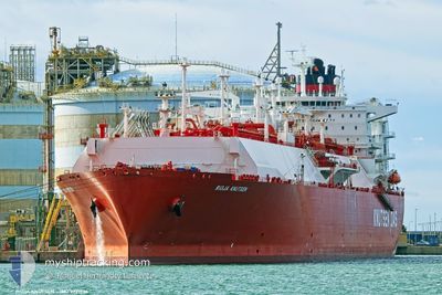
RIOJA KNUTSEN
Tanker
Current Trip
| Trip Time | 13 days |
|---|---|
| Trip Distance | 5148.76 nm |
| AVG Speed | 15.4 Knots |
| MAX Speed | 20.2 Knots |
| Draught | 9.5 m |
| AVG Wind | 17.7 knots |
| MAX Wind | 42.3 knots |
| MIN Temp | 9°C / 48.2°F |
| MAX Temp | 25.2°C / 77.36°F |
| Position Received | Now |
Current Position
| Longitude | -93.85905° |
|---|---|
| Latitude | 29.71792° |
| Status | Under way using engine |
| Speed | 7.8 Knots |
| Course | 325° |
| Area | Gulf of Mexico |
| Station | T-AIS |
| Position Received | Now |
Info
Information
The current position of RIOJA KNUTSEN is in Gulf of Mexico with coordinates 29.71792° / -93.85905° as reported on 2024-04-18 19:39 by AIS to our vessel tracker app. The vessel's current speed is 7.8 Knots and is currently inside the port of SABINE PASS.
The vessel RIOJA KNUTSEN (IMO: 9721736, MMSI: 224451000) is a Tanker It's sailing under the flag of [ES] Spain.
In this page you can find informations about the vessels current position, last detected port calls, and current voyage information. If the vessels is not in coverage by AIS you will find the latest position.
The current position of RIOJA KNUTSEN is detected by our AIS receivers and we are not responsible for the reliability of the data. The last position was recorded while the vessel was in Coverage by the Ais receivers of our vessel tracking app.
The current draught of RIOJA KNUTSEN as reported by AIS is 9.5 meters
Weather
| Temperature | 25.2°C / 77.36°F |
|---|---|
| Wind Speed | 10 knots |
| Direction | 151° SSE |
| Pressure | 1015 hPa |
| Humidity | 76.4 % |
| Cloud Coverage | 99 % |
Featured Company
Last Port Calls
| Port | Arrival | Departure | Time In Port |
|---|---|---|---|
| 2024-04-18 19:26 | |||
| 2024-04-03 20:29 | 2024-04-05 00:53 | 1 d | |
| 2024-03-19 12:33 | 2024-03-22 13:41 | 3 d | |
| 2024-03-03 19:34 | 2024-03-04 21:35 | 1 d | |
| 2024-02-13 00:49 | 2024-02-14 15:40 | 1 d |
Most Visited Ports (Last year)
| Port | Arrivals | |
|---|---|---|
| 6 | ||
| 3 | ||
| 2 | ||
| 1 | ||
| 1 | ||
| 1 |
Last Trips
| Origin | Departure | Destination | Arrival | Distance | |
|---|---|---|---|---|---|
| 2024-04-05 02:53 | 2024-04-18 14:26 | 5148.76 nm | |||
| 2024-03-22 08:41 | 2024-04-03 22:29 | 5105.67 nm | |||
| 2024-03-04 22:35 | 2024-03-19 07:33 | 5274.05 nm | |||
| 2024-02-14 09:40 | 2024-03-03 20:34 | 5328.39 nm | |||
| 2024-01-30 13:22 | 2024-02-12 18:49 | 4909.95 nm |
Events
| Time | Event | Details | Position / Dest | Info |
|---|---|---|---|---|
| 2024-04-18 19:26 | PORT ARRIVAL |
|
29.69523 / -93.84161
[US] SABINE PASS
|
Speed: 7.9 kn Course: 326.8° |
| 2024-04-18 17:09 | START Moving |
29.38276 / -93.68856
USNSS
|
Speed: 3.1 kn Course: 38° |
|
| 2024-04-18 17:02 | Status Changed | Under way using engine At anchor |
29.38199 / -93.69268
USNSS
|
Speed: 0.9 kn Course: 118° |
| 2024-04-18 13:25 | Status Changed | At anchor Default |
29.38350 / -93.69520
USNSS
|
Speed: Course: -1° |
| 2024-04-18 13:18 | Status Changed | Default At anchor |
29.38333 / -93.69500
USNSS
|
Speed: 0.1 kn Course: 125° |
| 2024-04-18 12:01 | Status Changed | At anchor Default |
29.38351 / -93.69516
USNSS
|
Speed: Course: -1° |
| 2024-04-18 11:54 | Status Changed | Default At anchor |
29.38333 / -93.69500
USNSS
|
Speed: 0.1 kn Course: 116° |
| 2024-04-18 10:37 | Status Changed | At anchor Default |
29.38364 / -93.69493
USNSS
|
Speed: Course: -1° |
| 2024-04-18 10:21 | Status Changed | Default At anchor |
29.38333 / -93.69334
USNSS
|
Speed: 0.1 kn Course: 136° |
| 2024-04-18 09:31 | Status Changed | At anchor Default |
29.38294 / -93.69545
USNSS
|
Speed: Course: 106° |