
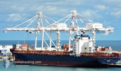
MSC BASEL V
Container Ship
Current Trip
| Time Travelled | 1 day |
|---|---|
| Remaining Time | --- |
| Distance Travelled | 125.94 nm |
| Remaining Distance | 64.05 nm |
| AVG Speed | 11.2 Knots |
| MAX Speed | 15.8 Knots |
| AVG Wind | 6.7 knots |
| MAX Wind | 10 knots |
| MIN Temp | 29.1°C / 84.38°F |
| MAX Temp | 30.3°C / 86.54°F |
| Draught | 10.1 m |
| Position Received | 1 d ago |
Current Position
| Longitude | 104.32503° |
|---|---|
| Latitude | 1.29513° |
| Status | Under way using engine |
| Speed | 14.7 Knots |
| Course | 74.6° |
| Area | Singapore Strait |
| Station | T-AIS |
| Position Received | 1 d ago |
Info
Information
The current position of MSC BASEL V is in Singapore Strait with coordinates 1.29513° / 104.32503° as reported on 2024-04-24 11:01 by AIS to our vessel tracker app. The vessel's current speed is 14.7 Knots and is heading at the port of SINGAPORE. The estimated time of arrival as calculated by MyShipTracking vessel tracking app is 2024-04-27 13:00 LT
The vessel MSC BASEL V (IMO: 9360764, MMSI: 255806448) is a Container Ship that was built in 2008 ( 16 years old ). It's sailing under the flag of [PT] Portugal.
In this page you can find informations about the vessels current position, last detected port calls, and current voyage information. If the vessels is not in coverage by AIS you will find the latest position.
The current position of MSC BASEL V is detected by our AIS receivers and we are not responsible for the reliability of the data. The last position was recorded while the vessel was in Coverage by the Ais receivers of our vessel tracking app.
The current draught of MSC BASEL V as reported by AIS is 10.1 meters
Weather
| Temperature | 29.6°C / 85.28°F |
|---|---|
| Wind Speed | 5 knots |
| Direction | 83° E |
| Pressure | 1006.5 hPa |
| Humidity | 74.4 % |
| Cloud Coverage | 100 % |
Featured Company
Last Port Calls
| Port | Arrival | Departure | Time In Port |
|---|---|---|---|
| 2024-04-23 15:00 | 2024-04-24 05:19 | 14 h | |
| 2024-04-15 01:42 | 2024-04-15 19:28 | 17 h | |
| 2024-04-10 14:05 | 2024-04-11 10:26 | 20 h | |
| 2024-04-09 22:22 | 2024-04-10 13:20 | 14 h | |
| 2024-04-07 22:26 | 2024-04-08 18:23 | 19 h | |
| 2024-04-06 22:23 | 2024-04-07 10:35 | 12 h | |
| 2024-04-03 15:47 | 2024-04-04 18:40 | 1 d | |
| 2024-04-01 08:21 | 2024-04-01 21:27 | 13 h | |
| 2024-03-26 03:35 | 2024-03-26 11:36 | 8 h | |
| 2024-03-22 03:43 | 2024-03-22 10:20 | 6 h |
Most Visited Ports (Last year)
| Port | Arrivals | |
|---|---|---|
| 10 | ||
| 9 | ||
| 5 | ||
| 5 | ||
| 3 | ||
| 3 |
Last Trips
| Origin | Departure | Destination | Arrival | Distance | |
|---|---|---|---|---|---|
| 2024-04-16 04:28 | 2024-04-23 23:00 | 2613.82 nm | |||
| 2024-04-11 19:26 | 2024-04-15 10:42 | 665.51 nm | |||
| 2024-04-10 22:20 | 2024-04-10 23:05 | 8.56 nm | |||
| 2024-04-09 03:23 | 2024-04-10 07:22 | 242.47 nm | |||
| 2024-04-07 19:35 | 2024-04-08 07:26 | 17.47 nm | |||
| 2024-04-05 03:40 | 2024-04-07 07:23 | 698.09 nm | |||
| 2024-04-02 05:27 | 2024-04-04 00:47 | 474.38 nm | |||
| 2024-03-26 19:36 | 2024-04-01 16:21 | 699.73 nm | |||
| 2024-03-22 18:20 | 2024-03-26 11:35 | 623.75 nm | |||
| 2024-03-22 10:32 | 2024-03-22 11:43 | 8.80 nm |
Events
| Time | Event | Details | Position / Dest | Info |
|---|---|---|---|---|
| 2024-04-24 15:32 | STOP Moving |
1.55167 / 104.96833
SGSIN PWBGA
|
Speed: Course: -1° |
|
| 2024-04-24 11:08 | Status Changed | Default Under way using engine |
1.30988 / 104.34877
SGSIN PWBGA
|
Speed: 14.7 kn Course: 74.6° |
| 2024-04-24 11:01 | OUT of Coverage |
1.29513 / 104.32503
Singapore Strait
SGSIN PWBGA
|
Speed: 14.7 kn Course: 74.6° |
|
| 2024-04-24 10:19 | Change Sea Area | Malaysian part of the Singapore Strait Indonesian part of the Singapore Strait |
1.25682 / 104.17308
Singapore Strait
SGSIN PWBGA
|
Speed: 10.8 kn Course: 79.9° |
| 2024-04-24 09:15 | ETA Changed | 2024/04/27 13:00 2024/04/27 02:00 |
1.22633 / 103.95877
SGSIN PWBGA
|
Speed: 10.9 kn Course: 81.9° |
| 2024-04-24 09:09 | ETA Changed | 2024/04/27 02:00 2024/04/28 02:00 |
1.21948 / 103.94073
SGSIN PWBGA
|
Speed: 11 kn Course: 63.5° |
| 2024-04-24 06:30 | Draught Changed | 10.1 10.8 |
1.11388 / 103.54187
SGSIN PWBGA
|
Speed: 10.9 kn Course: 140.8° |
| 2024-04-24 06:30 | Destination Changed | SGSIN PWBGA MYTPP |
1.11388 / 103.54187
SGSIN PWBGA
|
Speed: 10.9 kn Course: 140.8° |
| 2024-04-24 06:30 | ETA Changed | 2024/04/28 02:00 2024/04/23 14:30 |
1.11388 / 103.54187
SGSIN PWBGA
|
Speed: 10.9 kn Course: 140.8° |
| 2024-04-24 06:23 | Change Sea Area | Indonesian part of the Singapore Strait Malaysian part of the Singapore Strait |
1.13060 / 103.52920
Singapore Strait
|
Speed: 10.6 kn Course: 148.9° |