
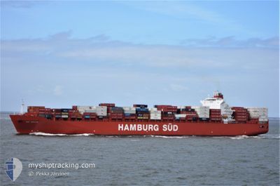
RIO BRAVO
Container Ship
Current Trip
| Time Travelled | 1 day |
|---|---|
| Remaining Time | 2 days |
| Distance Travelled | 535.14 nm |
| Remaining Distance | 820.97 nm |
| AVG Speed | 15.8 Knots |
| MAX Speed | 17.4 Knots |
| AVG Wind | 17.3 knots |
| MAX Wind | 22.3 knots |
| MIN Temp | 18°C / 64.4°F |
| MAX Temp | 23.5°C / 74.3°F |
| Draught | 10.3 m |
| Position Received | 1 d ago |
Current Position
| Longitude | 153.29244° |
|---|---|
| Latitude | -34.07364° |
| Status | Under way using engine |
| Speed | 14.5 Knots |
| Course | 89.5° |
| Area | Tasman Sea |
| Station | T-AIS |
| Position Received | 1 d ago |
Info
Information
The current position of RIO BRAVO is in Tasman Sea with coordinates -34.07364° / 153.29244° as reported on 2024-04-24 00:30 by AIS to our vessel tracker app. The vessel's current speed is 14.5 Knots and is heading at the port of TAURANGA. The estimated time of arrival as calculated by MyShipTracking vessel tracking app is 2024-04-27 05:03 LT
The vessel RIO BRAVO (IMO: 9348091, MMSI: 563050300) is a Container Ship that was built in 2009 ( 15 years old ). It's sailing under the flag of [SG] Singapore.
In this page you can find informations about the vessels current position, last detected port calls, and current voyage information. If the vessels is not in coverage by AIS you will find the latest position.
The current position of RIO BRAVO is detected by our AIS receivers and we are not responsible for the reliability of the data. The last position was recorded while the vessel was in Coverage by the Ais receivers of our vessel tracking app.
The current draught of RIO BRAVO as reported by AIS is 10.3 meters
Weather
| Temperature | 19.1°C / 66.38°F |
|---|---|
| Wind Speed | 15 knots |
| Direction | 225° SW |
| Pressure | 1011.6 hPa |
| Humidity | 64.2 % |
| Cloud Coverage | 85 % |
Featured Company
Last Port Calls
| Port | Arrival | Departure | Time In Port |
|---|---|---|---|
| 2024-04-21 16:31 | 2024-04-23 17:24 | 2 d | |
| 2024-04-08 23:23 | 2024-04-10 00:42 | 1 d | |
| 2024-04-06 22:55 | 2024-04-08 05:34 | 1 d | |
| 2024-03-18 20:37 | 2024-03-22 00:48 | 3 d | |
| 2024-03-18 08:40 | |||
| 2024-03-15 08:03 | 2024-03-16 15:08 | 1 d | |
| 2024-03-09 19:21 | 2024-03-11 13:34 | 1 d | |
| 2024-03-01 10:03 | 2024-03-03 00:20 | 1 d | |
| 2024-02-18 22:46 | 2024-02-20 06:19 | 1 d | |
| 2024-02-16 04:39 | 2024-02-17 07:57 | 1 d |
Most Visited Ports (Last year)
| Port | Arrivals | |
|---|---|---|
| 8 | ||
| 8 | ||
| 8 | ||
| 7 | ||
| 7 | ||
| 7 |
Last Trips
| Origin | Departure | Destination | Arrival | Distance | |
|---|---|---|---|---|---|
| 2024-04-10 08:42 | 2024-04-22 02:31 | 4265.45 nm | |||
| 2024-04-08 13:34 | 2024-04-09 07:23 | 47.92 nm | |||
| 2024-03-22 13:48 | 2024-04-07 06:55 | 5274.67 nm | |||
| 2024-03-18 21:40 | 2024-03-19 09:37 | 24.23 nm | |||
| 2024-03-12 02:34 | 2024-03-15 21:03 | 605.80 nm | |||
| 2024-03-03 11:20 | 2024-03-10 08:21 | 1457.88 nm | |||
| 2024-02-20 14:19 | 2024-03-01 21:03 | 4213.32 nm | |||
| 2024-02-17 15:57 | 2024-02-19 06:46 | 199.52 nm | |||
| 2024-02-01 09:17 | 2024-02-16 12:39 | 5899.18 nm |
Events
| Time | Event | Details | Position / Dest | Info |
|---|---|---|---|---|
| 2024-04-24 00:35 | Status Changed | Default Under way using engine |
-34.07362 / 153.32011
AUSYD>NZTRG
|
Speed: 14.5 kn Course: 89.5° |
| 2024-04-24 00:30 | OUT of Coverage |
-34.07364 / 153.29244
Tasman Sea
AUSYD>NZTRG
|
Speed: 14.5 kn Course: 89.5° |
|
| 2024-04-24 00:30 | Status Changed | Under way using engine Default |
-34.07364 / 153.29106
AUSYD>NZTRG
|
Speed: 14.4 kn Course: 90° |
| 2024-04-24 00:15 | IN Coverage |
-34.07364 / 153.29244
Tasman Sea
AUSYD>NZTRG
|
Speed: 14.5 kn Course: 89.5° |
|
| 2024-04-23 23:27 | Status Changed | Default Under way using engine |
-34.06805 / 152.97893
AUSYD>NZTRG
|
Speed: 14.9 kn Course: 90.6° |
| 2024-04-23 23:22 | Status Changed | Under way using engine Default |
-34.06757 / 152.95134
AUSYD>NZTRG
|
Speed: 15 kn Course: 90° |
| 2024-04-23 23:22 | OUT of Coverage |
-34.06757 / 152.95134
Tasman Sea
AUSYD>NZTRG
|
Speed: 14.9 kn Course: 90.6° |
|
| 2024-04-23 23:03 | Status Changed | Default Under way using engine |
-34.06768 / 152.85840
AUSYD>NZTRG
|
Speed: 14.9 kn Course: 89.9° |
| 2024-04-23 18:10 | ETA Changed | 2024/04/27 05:30 2024/04/27 04:45 |
-34.05225 / 151.37522
AUSYD>NZTRG
|
Speed: 15.3 kn Course: 92.5° |
| 2024-04-23 17:24 | PORT DEPARTURE |
|
-33.98428 / 151.20894
AUSYD>NZTRG
|
Speed: 7.4 kn Course: 132° |