
RIALTO
Cargo
Current Trip
| Trip Time | 5 h, 33 mins |
|---|---|
| Trip Distance | 36.49 nm |
| AVG Speed | 6.7 Knots |
| MAX Speed | 7.8 Knots |
| Draught | 2 m |
| AVG Wind | 5.3 knots |
| MAX Wind | 7 knots |
| MIN Temp | 0.5°C / 32.9°F |
| MAX Temp | 3.4°C / 38.12°F |
| Position Received | 7 m ago |
Current Position
| Longitude | --- |
|---|---|
| Latitude | --- |
| Status | Moored |
| Speed | |
| Course | --- |
| Area | North Sea |
| Station | T-AIS |
| Position Received | 7 m ago |
Info
Information
The current position of RIALTO is in North Sea with coordinates 51.80918° / 4.87633° as reported on 2024-12-13 19:01 by AIS to our vessel tracker app. The vessel's current speed is 0 Knots and is currently inside the port of WERKENDAM.
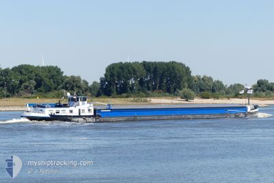
The vessel RIALTO (MMSI: 244710892) is a Cargo It's sailing under the flag of [NL] Netherlands.
In this page you can find informations about the vessels current position, last detected port calls, and current voyage information. If the vessels is not in coverage by AIS you will find the latest position.
The current position of RIALTO is detected by our AIS receivers and we are not responsible for the reliability of the data. The last position was recorded while the vessel was in Coverage by the Ais receivers of our vessel tracking app.
The current draught of RIALTO as reported by AIS is 2 meters
Weather
| Temperature | 2.1°C / 35.78°F |
|---|---|
| Wind Speed | 4 knots |
| Direction | 218° SW |
| Pressure | 1024.2 hPa |
| Humidity | 80.8 % |
| Cloud Coverage | 100 % |
Featured Company
Last Port Calls
| Port | Arrival | Departure | Time In Port |
|---|---|---|---|
| 2024-12-13 14:25 | |||
| 2024-12-12 15:49 | 2024-12-13 08:52 | 17 h | |
| 2024-12-04 14:14 | 2024-12-12 13:53 | 7 d | |
| 2024-11-19 14:27 | 2024-11-19 15:27 | 59 m | |
| 2024-11-18 19:56 | 2024-11-18 20:55 | 59 m | |
| 2024-11-16 21:33 | 2024-11-17 05:51 | 8 h | |
| 2024-11-13 22:30 | 2024-11-14 16:07 | 17 h | |
| 2024-11-12 08:01 | 2024-11-12 09:54 | 1 h | |
| 2024-11-09 19:45 | 2024-11-10 04:39 | 8 h | |
| 2024-11-08 10:39 | 2024-11-08 10:48 | 9 m |
Last Trips
| Origin | Departure | Destination | Arrival | Distance | |
|---|---|---|---|---|---|
| 2024-12-13 08:52 | 2024-12-13 14:25 | 36.49 nm | |||
| 2024-12-12 13:53 | 2024-12-12 15:49 | 8.46 nm | |||
| 2024-11-19 15:27 | 2024-12-04 14:14 | 362.15 nm | |||
| 2024-11-18 20:55 | 2024-11-19 14:27 | 43.55 nm | |||
| 2024-11-17 05:51 | 2024-11-18 19:56 | 179.76 nm | |||
| 2024-11-14 16:07 | 2024-11-16 21:33 | 129.50 nm | |||
| 2024-11-12 09:54 | 2024-11-13 22:30 | 128.36 nm | |||
| 2024-11-10 04:39 | 2024-11-12 08:01 | 148.61 nm | |||
| 2024-11-08 10:48 | 2024-11-09 19:45 | 122.43 nm | |||
| 2024-11-08 10:23 | 2024-11-08 10:39 | 0.79 nm |
Events
| Time | Event | Details | Position / Dest | Info |
|---|---|---|---|---|
| 2024-12-13 18:10 | Status Changed | Moored Default |
51.80920 / 4.87630
[NL] WERKENDAM
|
Speed: Course: -1° |
| 2024-12-13 17:38 | Status Changed | Default Moored |
51.80921 / 4.87629
[NL] WERKENDAM
|
Speed: Course: 511° |
| 2024-12-13 13:25 | STOP Moving |
51.80918 / 4.87630
[NL] WERKENDAM
|
Speed: 0.1 kn Course: 511° |
|
| 2024-12-13 13:25 | PORT ARRIVAL |
|
51.80918 / 4.87630
[NL] WERKENDAM
|
Speed: 1.6 kn Course: 511° |
| 2024-12-13 11:31 | Status Changed | Moored Default |
51.71848 / 4.64432
UELZEN
|
Speed: 7.3 kn Course: 73° |
| 2024-12-13 11:25 | Status Changed | Default Moored |
51.71425 / 4.62405
UELZEN
|
Speed: 7.3 kn Course: 71.6° |
| 2024-12-13 11:10 | Status Changed | Moored Default |
51.70464 / 4.57843
UELZEN
|
Speed: 7.4 kn Course: 71° |
| 2024-12-13 10:57 | Status Changed | Default Moored |
51.69584 / 4.53734
UELZEN
|
Speed: 7.3 kn Course: 83.8° |
| 2024-12-13 10:50 | Status Changed | Moored Default |
51.69387 / 4.51472
UELZEN
|
Speed: 7.4 kn Course: 82° |
| 2024-12-13 10:33 | Status Changed | Default Moored |
51.69680 / 4.45926
UELZEN
|
Speed: 7.6 kn Course: 99.8° |