
RESOURCE
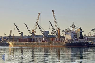
General Cargo
Current Trip
| Time Travelled | 9 days |
|---|---|
| Remaining Time | --- |
| Distance Travelled | 1492.07 nm |
| Remaining Distance | --- |
| AVG Speed | 10.4 Knots |
| MAX Speed | 10.4 Knots |
| AVG Wind | 8.8 knots |
| MAX Wind | 30.9 knots |
| MIN Temp | 10.5°C / 50.9°F |
| MAX Temp | 20.8°C / 69.44°F |
| Draught | 10.2 m |
| Position Received | 2 d ago |
Current Position
| Longitude | 13.93210° |
|---|---|
| Latitude | 36.29621° |
| Status | Under way using engine |
| Speed | 10.6 Knots |
| Course | 295° |
| Area | Mediterranean Sea - Eastern Basin |
| Station | T-AIS |
| Position Received | 2 d ago |
Info
Information
The current position of RESOURCE is in Mediterranean Sea - Eastern Basin with coordinates 36.29621° / 13.93210° as reported on 2024-04-15 20:40 by AIS to our vessel tracker app. The vessel's current speed is 10.6 Knots and is heading at the port of FOYNES. The estimated time of arrival as calculated by MyShipTracking vessel tracking app is 2024-04-24 11:00 LT
The vessel RESOURCE (IMO: 9487031, MMSI: 636021067) is a General Cargo that was built in 2010 ( 14 years old ). It's sailing under the flag of [LR] Liberia.
In this page you can find informations about the vessels current position, last detected port calls, and current voyage information. If the vessels is not in coverage by AIS you will find the latest position.
The current position of RESOURCE is detected by our AIS receivers and we are not responsible for the reliability of the data. The last position was recorded while the vessel was in Coverage by the Ais receivers of our vessel tracking app.
The current draught of RESOURCE as reported by AIS is 10.2 meters
Weather
| Temperature | 15.9°C / 60.62°F |
|---|---|
| Wind Speed | 16 knots |
| Direction | 88° E |
| Pressure | 1014.2 hPa |
| Humidity | 73.4 % |
| Cloud Coverage | 12 % |
Featured Company
Last Port Calls
| Port | Arrival | Departure | Time In Port |
|---|---|---|---|
| 2024-04-02 03:21 | 2024-04-09 03:09 | 6 d | |
| 2024-03-17 05:13 | 2024-03-23 03:35 | 5 d | |
| 2024-03-13 22:52 | 2024-03-15 22:57 | 2 d | |
| 2024-02-07 09:06 | 2024-02-10 21:46 | 3 d | |
| 2024-02-07 05:15 | |||
| 2024-02-05 02:47 | |||
| 2024-02-05 02:47 | |||
| 2024-02-02 08:51 |
Most Visited Ports (Last year)
| Port | Arrivals | |
|---|---|---|
| 3 | ||
| 3 | ||
| 2 | ||
| 2 | ||
| 2 | ||
| 1 |
Last Trips
| Origin | Departure | Destination | Arrival | Distance | |
|---|---|---|---|---|---|
| 2024-03-23 04:35 | 2024-04-02 06:21 | 1832.93 nm | |||
| 2024-03-15 23:57 | 2024-03-17 06:13 | 152.08 nm | |||
| 2024-02-10 18:46 | 2024-03-13 23:52 | 6021.26 nm | |||
| 2024-02-07 02:15 | 2024-02-07 06:06 | 24.16 nm | |||
| 2024-02-04 23:47 | 2024-02-04 23:47 | --- | |||
| 2024-01-27 17:29 | 2024-02-02 05:51 | 1107.56 nm |
Events
| Time | Event | Details | Position / Dest | Info |
|---|---|---|---|---|
| 2024-04-15 20:53 | Status Changed | Default Under way using engine |
36.31408 / 13.88896
IE FOV
|
Speed: 10.6 kn Course: 295° |
| 2024-04-15 20:40 | OUT of Coverage |
36.29621 / 13.93210
Mediterranean Sea - Eastern Basin
IE FOV
|
Speed: 10.6 kn Course: 295° |
|
| 2024-04-15 20:26 | Status Changed | Under way using engine Default |
36.27708 / 13.97824
IE FOV
|
Speed: 10.8 kn Course: 296° |
| 2024-04-15 19:51 | Status Changed | Default Under way using engine |
36.22731 / 14.09114
IE FOV
|
Speed: 11.4 kn Course: 297.5° |
| 2024-04-15 16:30 | Draught Changed | 10.2 10 |
35.88738 / 14.73985
IE FOV
|
Speed: 9.6 kn Course: 302.1° |
| 2024-04-15 16:30 | Destination Changed | IE FOV MALTA |
35.88738 / 14.73985
IE FOV
|
Speed: 9.6 kn Course: 302.1° |
| 2024-04-15 16:30 | ETA Changed | 2024/04/24 11:00 2024/04/15 10:00 |
35.88738 / 14.73985
IE FOV
|
Speed: 9.6 kn Course: 302.1° |
| 2024-04-15 16:18 | START Moving | 10.87 nm, East of MARSAXLOKK |
35.87594 / 14.76026
MALTA
|
Speed: 3.2 kn Course: 317° |
| 2024-04-15 16:17 | Status Changed | Under way using engine Default |
35.87510 / 14.76037
MALTA
|
Speed: 0.6 kn Course: 109° |
| 2024-04-15 16:11 | IN Coverage |
35.87594 / 14.76026
Mediterranean Sea - Eastern Basin
|
Speed: 3.2 kn Course: 349.9° |