
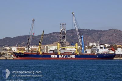
REK ROYAL
Bulk Carrier
Current Trip
| Time Travelled | 10 days |
|---|---|
| Remaining Time | --- |
| Distance Travelled | 1353.69 nm |
| Remaining Distance | --- |
| AVG Speed | 9.2 Knots |
| MAX Speed | 9.2 Knots |
| AVG Wind | 5.3 knots |
| MAX Wind | 22 knots |
| MIN Temp | 12.1°C / 53.78°F |
| MAX Temp | 20.9°C / 69.62°F |
| Draught | 5 m |
| Position Received | 1 d ago |
Current Position
| Longitude | 29.29839° |
|---|---|
| Latitude | 41.37079° |
| Status | Under way using engine |
| Speed | 11.1 Knots |
| Course | 41° |
| Area | Black Sea |
| Station | T-AIS |
| Position Received | 1 d ago |
Info
Information
The current position of REK ROYAL is in Black Sea with coordinates 41.37079° / 29.29839° as reported on 2024-04-17 22:29 by AIS to our vessel tracker app. The vessel's current speed is 11.1 Knots
The vessel REK ROYAL (IMO: 9229867, MMSI: 353539000) is a Bulk Carrier that was built in 2002 ( 22 years old ). It's sailing under the flag of [PA] Panama.
In this page you can find informations about the vessels current position, last detected port calls, and current voyage information. If the vessels is not in coverage by AIS you will find the latest position.
The current position of REK ROYAL is detected by our AIS receivers and we are not responsible for the reliability of the data. The last position was recorded while the vessel was in Coverage by the Ais receivers of our vessel tracking app.
The current draught of REK ROYAL as reported by AIS is 5 meters
Weather
| Temperature | 15°C / 59°F |
|---|---|
| Wind Speed | 5 knots |
| Direction | 269° W |
| Pressure | 998.8 hPa |
| Humidity | 81.3 % |
| Cloud Coverage | 77 % |
Featured Company
Last Port Calls
| Port | Arrival | Departure | Time In Port |
|---|---|---|---|
| 2024-04-02 12:33 | 2024-04-09 17:47 | 7 d | |
| 2024-03-27 06:00 | 2024-03-29 23:17 | 2 d | |
| 2024-03-18 13:53 | 2024-03-20 21:18 | 2 d | |
| 2024-02-20 13:07 | 2024-02-24 20:43 | 4 d | |
| 2024-02-06 17:12 | 2024-02-15 09:06 | 8 d | |
| 2024-02-02 16:11 |
Most Visited Ports (Last year)
| Port | Arrivals | |
|---|---|---|
| 5 | ||
| 3 | ||
| 2 | ||
| 2 | ||
| 2 | ||
| 1 |
Last Trips
| Origin | Departure | Destination | Arrival | Distance | |
|---|---|---|---|---|---|
| 2024-03-30 00:17 | 2024-04-02 14:33 | 119.32 nm | |||
| 2024-03-20 22:18 | 2024-03-27 07:00 | 1445.60 nm | |||
| 2024-02-24 21:43 | 2024-03-18 14:53 | 1812.17 nm | |||
| 2024-02-15 10:06 | 2024-02-20 14:07 | 1122.87 nm | |||
| 2024-02-02 17:11 | 2024-02-06 18:12 | 1097.59 nm |
Events
| Time | Event | Details | Position / Dest | Info |
|---|---|---|---|---|
| 2024-04-18 03:10 | STOP Moving |
41.82285 / 29.76370
RUNVS
|
Speed: 0.2 kn Course: 90° |
|
| 2024-04-17 22:31 | Status Changed | Default Under way using engine |
41.37468 / 29.30300
RUNVS
|
Speed: 11.1 kn Course: 41° |
| 2024-04-17 22:29 | OUT of Coverage |
41.37079 / 29.29839
Black Sea
|
Speed: 11.1 kn Course: 41° |
|
| 2024-04-17 21:32 | Change Sea Area | Turkish part of the Black Sea Turkish part of the Sea of Marmara |
41.23068 / 29.14332
Black Sea
|
Speed: 11.8 kn Course: 38° |
| 2024-04-17 19:35 | Status Changed | Under way using engine Not under command |
40.97330 / 28.99243
RUNVS
|
Speed: 8.5 kn Course: 12° |
| 2024-04-17 17:13 | START Moving | 13.58 nm, South of YESILKOY |
40.73028 / 28.79400
RUNVS
|
Speed: 3.6 kn Course: 14° |
| 2024-04-17 11:34 | STOP Moving | 11.48 nm, South of YESILKOY |
40.76609 / 28.78762
RUNVS
|
Speed: 0.3 kn Course: 302° |
| 2024-04-17 10:30 | START Moving | 15.37 nm, South of YESILKOY |
40.70868 / 28.91708
RUNVS
|
Speed: 3.4 kn Course: 298° |
| 2024-04-17 06:57 | STOP Moving | 14.63 nm, South of YESILKOY |
40.71810 / 28.89987
RUNVS
|
Speed: 0.3 kn Course: 271° |
| 2024-04-17 05:09 | START Moving | 5.13 nm, South West of TUZLA |
40.77654 / 29.18157
RUNVS
|
Speed: 3.4 kn Course: 272° |