
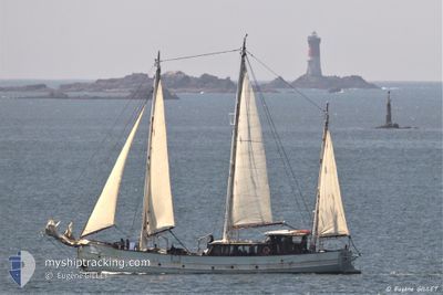
RARA AVIS
Not available
Current Trip
| Time Travelled | --- |
|---|---|
| Remaining Time | --- |
| Distance Travelled | 451.27 nm |
| Remaining Distance | --- |
| AVG Speed | 7.5 Knots |
| MAX Speed | 8.9 Knots |
| AVG Wind | 9.2 knots |
| MAX Wind | 15.9 knots |
| MIN Temp | 22.6°C / 72.68°F |
| MAX Temp | 28.2°C / 82.76°F |
| Draught | 2.4 m |
| Position Received | 1 d ago |
Current Position
| Longitude | -61.80083° |
|---|---|
| Latitude | 16.30762° |
| Status | Under way using engine |
| Speed | 0.3 Knots |
| Course | --- |
| Area | Caribbean Sea |
| Station | T-AIS |
| Position Received | 1 d ago |
Info
Information
The current position of RARA AVIS is in Caribbean Sea with coordinates 16.30762° / -61.80083° as reported on 2024-04-24 10:50 by AIS to our vessel tracker app. The vessel's current speed is 0.3 Knots
The vessel RARA AVIS (MMSI: 227536950) is a Not available It's sailing under the flag of [FR] France.
In this page you can find informations about the vessels current position, last detected port calls, and current voyage information. If the vessels is not in coverage by AIS you will find the latest position.
The current position of RARA AVIS is detected by our AIS receivers and we are not responsible for the reliability of the data. The last position was recorded while the vessel was in Coverage by the Ais receivers of our vessel tracking app.
The current draught of RARA AVIS as reported by AIS is 2.4 meters
Weather
| Temperature | 23.2°C / 73.76°F |
|---|---|
| Wind Speed | 6 knots |
| Direction | 118° ESE |
| Pressure | 1015.4 hPa |
| Humidity | 83.6 % |
| Cloud Coverage | 9 % |
Featured Company
Events
| Time | Event | Details | Position / Dest | Info |
|---|---|---|---|---|
| 2024-04-24 10:50 | OUT of Coverage |
16.30762 / -61.80083
Caribbean Sea
|
Speed: 0.3 kn Course: 39.5° |
|
| 2024-04-24 10:43 | Destination Changed | DESHAIES ROSEAU DOMINIQUE |
16.30765 / -61.80088
DESHAIES
|
Speed: 0.3 kn Course: 511° |
| 2024-04-24 10:43 | ETA Changed | 2024/04/19 09:00 2024/04/10 08:00 |
16.30765 / -61.80088
DESHAIES
|
Speed: 0.3 kn Course: 511° |
| 2024-04-24 10:41 | IN Coverage |
16.30765 / -61.80089
Caribbean Sea
|
Speed: 0.2 kn Course: 300° |
|
| 2024-04-17 10:57 | OUT of Coverage |
15.85547 / -61.61128
Caribbean Sea
|
Speed: 4.4 kn Course: 188.7° |
|
| 2024-04-17 10:49 | START Moving | 1.27 nm, West of TERRE DE HAUT |
15.86556 / -61.60753
ROSEAU DOMINIQUE
|
Speed: 3.9 kn Course: 200.6° |
| 2024-04-17 10:11 | IN Coverage |
15.86343 / -61.60220
Caribbean Sea
|
Speed: 0.1 kn Course: 324.7° |
|
| 2024-04-16 16:01 | OUT of Coverage |
15.87173 / -61.61609
Caribbean Sea
|
Speed: 4.6 kn Course: 132.9° |
|
| 2024-04-16 14:48 | IN Coverage |
15.91856 / -61.70699
Caribbean Sea
|
Speed: 5.6 kn Course: 132.6° |