
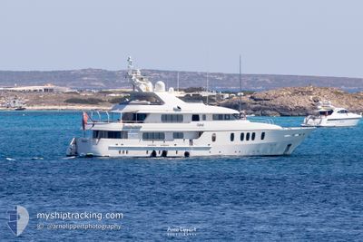
RAHAL
Yacht
Current Trip
| Trip Time | 10 h, 41 mins |
|---|---|
| Trip Distance | 1.48 nm |
| AVG Speed | 6.7 Knots |
| MAX Speed | 8.3 Knots |
| Draught | 3.2 m |
| AVG Wind | 3.4 knots |
| MAX Wind | 6.9 knots |
| MIN Temp | 8.8°C / 47.84°F |
| MAX Temp | 10.3°C / 50.54°F |
| Position Received | 1 m ago |
Current Position
| Longitude | 6.94697° |
|---|---|
| Latitude | 43.52410° |
| Status | Moored |
| Speed | 0.3 Knots |
| Course | 308° |
| Area | Mediterranean Sea - Western Basin |
| Station | T-AIS |
| Position Received | 1 m ago |
Info
Information
The current position of RAHAL is in Mediterranean Sea - Western Basin with coordinates 43.52410° / 6.94697° as reported on 2024-04-25 07:58 by AIS to our vessel tracker app. The vessel's current speed is 0.3 Knots and is currently inside the port of LA NAPOULE.
The vessel RAHAL (IMO: 1007639, MMSI: 319882000) is a Yacht that was built in 2003 ( 21 years old ). It's sailing under the flag of [KY] Cayman Is.
In this page you can find informations about the vessels current position, last detected port calls, and current voyage information. If the vessels is not in coverage by AIS you will find the latest position.
The current position of RAHAL is detected by our AIS receivers and we are not responsible for the reliability of the data. The last position was recorded while the vessel was in Coverage by the Ais receivers of our vessel tracking app.
The current draught of RAHAL as reported by AIS is 3.2 meters
Weather
| Temperature | 12°C / 53.6°F |
|---|---|
| Wind Speed | 3 knots |
| Direction | 310° NW |
| Pressure | 1006.9 hPa |
| Humidity | 54.5 % |
| Cloud Coverage | 11 % |
Featured Company
Last Port Calls
| Port | Arrival | Departure | Time In Port |
|---|---|---|---|
| 2024-04-24 06:27 | |||
| 2024-04-23 19:06 | 2024-04-23 19:46 | 40 m | |
| 2024-03-19 09:22 | 2024-04-15 07:03 | 26 d | |
| 2024-03-18 12:31 | 2024-03-19 08:27 | 19 h | |
| 2024-03-18 08:41 |
Most Visited Ports (Last year)
| Port | Arrivals | |
|---|---|---|
| 6 | ||
| 2 | ||
| 2 | ||
| 1 |
Last Trips
| Origin | Departure | Destination | Arrival | Distance | |
|---|---|---|---|---|---|
| 2024-04-23 21:46 | 2024-04-24 08:27 | 1.48 nm | |||
| 2024-04-15 09:03 | 2024-04-23 21:06 | 163.55 nm | |||
| 2024-03-19 09:27 | 2024-03-19 10:22 | 1.65 nm | |||
| 2024-03-18 09:41 | 2024-03-18 13:31 | 27.37 nm |
Events
| Time | Event | Details | Position / Dest | Info |
|---|---|---|---|---|
| 2024-04-24 06:40 | Status Changed | Moored At anchor |
43.52412 / 6.94702
[FR] LA NAPOULE
|
Speed: 0.4 kn Course: 305° |
| 2024-04-24 06:32 | STOP Moving |
43.52437 / 6.94672
[FR] LA NAPOULE
|
Speed: 0.3 kn Course: 356° |
|
| 2024-04-24 06:27 | PORT ARRIVAL |
|
43.51835 / 6.94418
[FR] LA NAPOULE
|
Speed: 8.3 kn Course: 358.6° |
| 2024-04-24 06:25 | START Moving | 0.79 nm, South of LA NAPOULE |
43.51452 / 6.94400
LA NAPOLE
|
Speed: 8.2 kn Course: 9.6° |
| 2024-04-24 00:07 | Status Changed | At anchor Under way using engine |
43.51185 / 6.94313
LA NAPOLE
|
Speed: 0.1 kn Course: 172° |
| 2024-04-23 19:56 | STOP Moving | 0.95 nm, South of LA NAPOULE |
43.51212 / 6.94268
LA NAPOLE
|
Speed: 0.2 kn Course: 168° |
| 2024-04-23 19:46 | PORT DEPARTURE |
|
43.51763 / 6.94605
LA NAPOLE
|
Speed: 7.8 kn Course: 187° |
| 2024-04-23 19:46 | START Moving |
43.51843 / 6.94623
[FR] LA NAPOULE
|
Speed: 7.8 kn Course: 187° |
|
| 2024-04-23 19:06 | STOP Moving |
43.52048 / 6.94577
[FR] LA NAPOULE
|
Speed: 0.2 kn Course: 299° |
|
| 2024-04-23 19:06 | PORT ARRIVAL |
|
43.52048 / 6.94577
[FR] LA NAPOULE
|
Speed: 3.7 kn Course: 308° |