
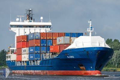
NJORD
Container Ship
Current Trip
| Time Travelled | 2 days |
|---|---|
| Remaining Time | 1 day |
| Distance Travelled | 928.63 nm |
| Remaining Distance | 662.62 nm |
| AVG Speed | 14.6 Knots |
| MAX Speed | 16.6 Knots |
| AVG Wind | 11.7 knots |
| MAX Wind | 38.1 knots |
| MIN Temp | 10°C / 50°F |
| MAX Temp | 20.3°C / 68.54°F |
| Draught | 6.7 m |
| Position Received | 3 h, 59 m ago |
Current Position
| Longitude | 14.13399° |
|---|---|
| Latitude | 36.78973° |
| Status | Under way using engine |
| Speed | 14.5 Knots |
| Course | 284.9° |
| Area | Mediterranean Sea - Eastern Basin |
| Station | T-AIS |
| Position Received | 3 h, 59 m ago |
Info
Information
The current position of NJORD is in Mediterranean Sea - Eastern Basin with coordinates 36.78973° / 14.13399° as reported on 2024-04-24 02:35 by AIS to our vessel tracker app. The vessel's current speed is 14.5 Knots and is heading at the port of VALENCIA. The estimated time of arrival as calculated by MyShipTracking vessel tracking app is 2024-04-26 04:51 LT
The vessel NJORD (IMO: 9349227, MMSI: 245872000) is a Container Ship that was built in 2007 ( 17 years old ). It's sailing under the flag of [NL] Netherlands.
In this page you can find informations about the vessels current position, last detected port calls, and current voyage information. If the vessels is not in coverage by AIS you will find the latest position.
The current position of NJORD is detected by our AIS receivers and we are not responsible for the reliability of the data. The last position was recorded while the vessel was in Coverage by the Ais receivers of our vessel tracking app.
The current draught of NJORD as reported by AIS is 6.7 meters
Weather
| Temperature | 12.6°C / 54.68°F |
|---|---|
| Wind Speed | 5 knots |
| Direction | 302° WNW |
| Pressure | 1012.7 hPa |
| Humidity | 79.4 % |
| Cloud Coverage | 91 % |
Featured Company
Last Port Calls
| Port | Arrival | Departure | Time In Port |
|---|---|---|---|
| 2024-04-21 08:21 | 2024-04-21 14:48 | 6 h | |
| 2024-04-19 15:36 | 2024-04-21 04:36 | 1 d | |
| 2024-04-14 23:47 | 2024-04-15 13:49 | 14 h | |
| 2024-04-13 15:53 | 2024-04-14 05:31 | 13 h | |
| 2024-04-12 05:43 | 2024-04-12 14:39 | 8 h | |
| 2024-04-06 15:55 | 2024-04-07 11:09 | 19 h | |
| 2024-04-05 08:48 | 2024-04-06 12:23 | 1 d | |
| 2024-04-03 17:22 | 2024-04-04 13:50 | 20 h | |
| 2024-03-29 20:55 | 2024-03-30 10:20 | 13 h | |
| 2024-03-28 01:01 | 2024-03-29 07:16 | 1 d |
Most Visited Ports (Last year)
| Port | Arrivals | |
|---|---|---|
| 24 | ||
| 16 | ||
| 15 | ||
| 15 | ||
| 13 | ||
| 11 |
Last Trips
| Origin | Departure | Destination | Arrival | Distance | |
|---|---|---|---|---|---|
| 2024-04-21 07:36 | 2024-04-21 11:21 | 48.76 nm | |||
| 2024-04-15 15:49 | 2024-04-19 18:36 | 1459.93 nm | |||
| 2024-04-14 07:31 | 2024-04-15 01:47 | 163.20 nm | |||
| 2024-04-12 16:39 | 2024-04-13 17:53 | 21.98 nm | |||
| 2024-04-07 14:09 | 2024-04-12 07:43 | 1540.11 nm | |||
| 2024-04-06 15:23 | 2024-04-06 18:55 | 46.68 nm | |||
| 2024-04-04 16:50 | 2024-04-05 11:48 | 49.95 nm | |||
| 2024-03-30 11:20 | 2024-04-03 20:22 | 1463.37 nm | |||
| 2024-03-29 08:16 | 2024-03-29 21:55 | 163.81 nm | |||
| 2024-03-27 23:27 | 2024-03-28 02:01 | 18.66 nm |
Events
| Time | Event | Details | Position / Dest | Info |
|---|---|---|---|---|
| 2024-04-24 02:40 | Status Changed | Default Under way using engine |
36.79500 / 14.10667
ESVLC
|
Speed: 14.5 kn Course: 284.9° |
| 2024-04-24 02:35 | OUT of Coverage |
36.78973 / 14.13399
Mediterranean Sea - Eastern Basin
ESVLC
|
Speed: 14.5 kn Course: 284.9° |
|
| 2024-04-24 02:00 | ETA Changed | 2024/04/26 06:00 2024/04/26 01:30 |
36.74827 / 14.29941
ESVLC
|
Speed: 14.1 kn Course: 289.5° |
| 2024-04-23 23:47 | Status Changed | Under way using engine Default |
36.60564 / 14.92479
ESVLC
|
Speed: 14.2 kn Course: 286° |
| 2024-04-23 23:47 | IN Coverage |
36.60564 / 14.92479
Mediterranean Sea - Eastern Basin
ESVLC
|
Speed: 14.1 kn Course: 285.5° |
|
| 2024-04-23 22:43 | Status Changed | Default Under way using engine |
36.56225 / 15.23075
ESVLC
|
Speed: 14.1 kn Course: 275.6° |
| 2024-04-23 22:42 | OUT of Coverage |
36.56198 / 15.23466
Mediterranean Sea - Eastern Basin
ESVLC
|
Speed: 14.1 kn Course: 275.6° |
|
| 2024-04-23 22:37 | Change Sea Area | Italian part of the Mediterranean Sea - Eastern Basin Greek part of the Mediterranean Sea - Eastern Basin |
36.56023 / 15.25888
Mediterranean Sea - Eastern Basin
ESVLC
|
Speed: 14.1 kn Course: 275.2° |
| 2024-04-23 22:35 | Status Changed | Under way using engine Default |
36.55977 / 15.26563
ESVLC
|
Speed: 14 kn Course: 271° |
| 2024-04-23 22:23 | IN Coverage |
36.56023 / 15.25888
Mediterranean Sea - Eastern Basin
ESVLC
|
Speed: 14.1 kn Course: 275.2° |