
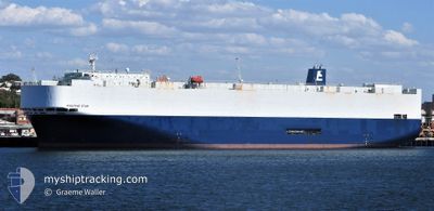
POSITIVE STAR
Vehicles Carrier
Current Trip
| Time Travelled | 16 days |
|---|---|
| Remaining Time | --- |
| Distance Travelled | 6330.73 nm |
| Remaining Distance | 74.71 nm |
| AVG Speed | 17.2 Knots |
| MAX Speed | 19.4 Knots |
| AVG Wind | 8.9 knots |
| MAX Wind | 26 knots |
| MIN Temp | 15.4°C / 59.72°F |
| MAX Temp | 30.1°C / 86.18°F |
| Draught | 7.5 m |
| Position Received | 3 d ago |
Current Position
| Longitude | 120.88102° |
|---|---|
| Latitude | 21.64290° |
| Status | Under way using engine |
| Speed | 17.8 Knots |
| Course | 41° |
| Area | South China Sea |
| Station | T-AIS |
| Position Received | 3 d ago |
Info
Information
The current position of POSITIVE STAR is in South China Sea with coordinates 21.64290° / 120.88102° as reported on 2024-04-21 10:36 by AIS to our vessel tracker app. The vessel's current speed is 17.8 Knots and is heading at the port of KANDA. The estimated time of arrival as calculated by MyShipTracking vessel tracking app is 2024-04-24 21:30 LT
The vessel POSITIVE STAR (IMO: 9304502, MMSI: 355615000) is a Vehicles Carrier that was built in 2004 ( 20 years old ). It's sailing under the flag of [PA] Panama.
In this page you can find informations about the vessels current position, last detected port calls, and current voyage information. If the vessels is not in coverage by AIS you will find the latest position.
The current position of POSITIVE STAR is detected by our AIS receivers and we are not responsible for the reliability of the data. The last position was recorded while the vessel was in Coverage by the Ais receivers of our vessel tracking app.
The current draught of POSITIVE STAR as reported by AIS is 7.5 meters
Weather
| Temperature | 15.4°C / 59.72°F |
|---|---|
| Wind Speed | 17 knots |
| Direction | 332° NNW |
| Pressure | 1010 hPa |
| Humidity | 79.8 % |
| Cloud Coverage | 38 % |
Featured Company
Last Port Calls
| Port | Arrival | Departure | Time In Port |
|---|---|---|---|
| 2024-04-07 02:55 | 2024-04-08 14:36 | 1 d | |
| 2024-03-27 18:39 | 2024-03-30 05:05 | 2 d | |
| 2024-03-11 13:44 | 2024-03-12 15:53 | 1 d | |
| 2024-03-07 21:58 | 2024-03-08 11:21 | 13 h | |
| 2024-03-05 22:12 | 2024-03-06 08:09 | 9 h | |
| 2024-02-26 17:30 | 2024-02-27 02:58 | 9 h | |
| 2024-02-17 20:30 | 2024-02-21 17:05 | 3 d |
Last Trips
| Origin | Departure | Destination | Arrival | Distance | |
|---|---|---|---|---|---|
| 2024-03-30 09:05 | 2024-04-07 05:55 | 318.21 nm | |||
| 2024-03-12 23:53 | 2024-03-27 22:39 | 6112.70 nm | |||
| 2024-03-08 20:21 | 2024-03-11 21:44 | 975.40 nm | |||
| 2024-03-06 17:09 | 2024-03-08 06:58 | 322.87 nm | |||
| 2024-02-27 12:28 | 2024-03-06 07:12 | 3120.02 nm | |||
| 2024-02-22 01:05 | 2024-02-27 03:00 | 2084.75 nm | |||
| 2024-01-29 16:16 | 2024-02-18 04:30 | 4950.26 nm |
Events
| Time | Event | Details | Position / Dest | Info |
|---|---|---|---|---|
| 2024-04-24 03:39 | START Moving |
32.05335 / 131.88013
SA DMN>JP KND
|
Speed: 5.2 kn Course: 48° |
|
| 2024-04-23 12:53 | STOP Moving |
32.00542 / 132.12399
SA DMN>JP KND
|
Speed: 0.3 kn Course: 2° |
|
| 2024-04-21 10:41 | Status Changed | Default Under way using engine |
21.66043 / 120.89802
SA DMN>JP KND
|
Speed: 17.8 kn Course: 41° |
| 2024-04-21 10:36 | Status Changed | Under way using engine Default |
21.64290 / 120.88102
SA DMN>JP KND
|
Speed: 17.8 kn Course: 42° |
| 2024-04-21 10:36 | OUT of Coverage |
21.64290 / 120.88102
South China Sea
SA DMN>JP KND
|
Speed: 17.8 kn Course: 41° |
|
| 2024-04-21 10:20 | IN Coverage |
21.64290 / 120.88102
South China Sea
SA DMN>JP KND
|
Speed: 17.8 kn Course: 41° |
|
| 2024-04-21 05:04 | Status Changed | Default Under way using engine |
20.45995 / 119.86632
SA DMN>JP KND
|
Speed: 16.3 kn Course: 44° |
| 2024-04-21 04:57 | OUT of Coverage |
20.43727 / 119.84203
South China Sea
SA DMN>JP KND
|
Speed: 16.3 kn Course: 44° |
|
| 2024-04-21 04:56 | Change Sea Area | Taiwanese part of the South China Sea Malaysian part of the Singapore Strait |
20.43228 / 119.83673
South China Sea
SA DMN>JP KND
|
Speed: 16.4 kn Course: 45° |
| 2024-04-21 04:56 | IN Coverage |
20.43228 / 119.83673
South China Sea
SA DMN>JP KND
|
Speed: 16.4 kn Course: 45° |