
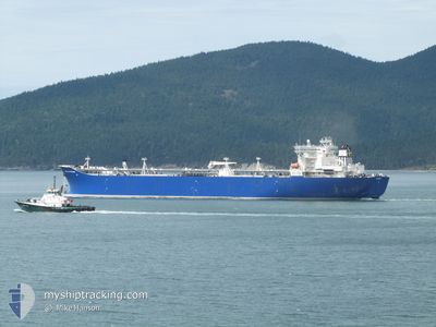
POLAR ENTERPRISE
Crude Oil Tanker
Current Trip
| Time Travelled | 2 days |
|---|---|
| Remaining Time | 1 day |
| Distance Travelled | 554.96 nm |
| Remaining Distance | 730.05 nm |
| AVG Speed | 15 Knots |
| MAX Speed | 20.7 Knots |
| AVG Wind | 5.6 knots |
| MAX Wind | 14.9 knots |
| MIN Temp | 6°C / 42.8°F |
| MAX Temp | 11.9°C / 53.42°F |
| Draught | 10.4 m |
| Position Received | 21 h, 26 m ago |
Current Position
| Longitude | -127.39948° |
|---|---|
| Latitude | 48.84212° |
| Status | Under way using engine |
| Speed | 15.5 Knots |
| Course | 302.2° |
| Area | North Pacific Ocean |
| Station | T-AIS |
| Position Received | 21 h, 26 m ago |
Info
Information
The current position of POLAR ENTERPRISE is in North Pacific Ocean with coordinates 48.84212° / -127.39948° as reported on 2024-04-24 02:40 by AIS to our vessel tracker app. The vessel's current speed is 15.5 Knots and is heading at the port of VALDEZ. The estimated time of arrival as calculated by MyShipTracking vessel tracking app is 2024-04-26 21:00 LT
The vessel POLAR ENTERPRISE (IMO: 9250660, MMSI: 367067110) is a Crude Oil Tanker that was built in 2006 ( 18 years old ). It's sailing under the flag of [US] USA.
In this page you can find informations about the vessels current position, last detected port calls, and current voyage information. If the vessels is not in coverage by AIS you will find the latest position.
The current position of POLAR ENTERPRISE is detected by our AIS receivers and we are not responsible for the reliability of the data. The last position was recorded while the vessel was in Coverage by the Ais receivers of our vessel tracking app.
The current draught of POLAR ENTERPRISE as reported by AIS is 10.4 meters
Weather
| Temperature | 7.9°C / 46.22°F |
|---|---|
| Wind Speed | 10 knots |
| Direction | 99° E |
| Pressure | 1012.2 hPa |
| Humidity | 69.1 % |
| Cloud Coverage | 99 % |
Featured Company
Last Port Calls
| Port | Arrival | Departure | Time In Port |
|---|---|---|---|
| 2024-04-21 11:59 | 2024-04-22 15:34 | 1 d | |
| 2024-04-16 13:51 | 2024-04-17 06:54 | 17 h | |
| 2024-04-06 02:17 | 2024-04-09 15:00 | 3 d | |
| 2024-03-25 18:14 | 2024-03-26 14:06 | 19 h | |
| 2024-03-19 03:46 | 2024-03-20 15:50 | 1 d | |
| 2024-03-15 09:17 | 2024-03-15 13:10 | 3 h | |
| 2024-03-14 22:26 | 2024-03-15 02:14 | 3 h | |
| 2024-03-14 13:17 | 2024-03-14 14:17 | 1 h | |
| 2024-03-14 00:44 | 2024-03-14 01:29 | 44 m | |
| 2024-03-13 22:29 | 2024-03-13 23:32 | 1 h |
Most Visited Ports (Last year)
| Port | Arrivals | |
|---|---|---|
| 27 | ||
| 24 | ||
| 8 | ||
| 8 | ||
| 4 | ||
| 3 |
Last Trips
| Origin | Departure | Destination | Arrival | Distance | |
|---|---|---|---|---|---|
| 2024-04-16 22:54 | 2024-04-21 04:59 | 1277.39 nm | |||
| 2024-04-09 08:00 | 2024-04-16 05:51 | 2123.05 nm | |||
| 2024-03-26 06:06 | 2024-04-05 19:17 | 2125.18 nm | |||
| 2024-03-20 08:50 | 2024-03-25 10:14 | 1784.20 nm | |||
| 2024-03-15 06:10 | 2024-03-18 20:46 | 1046.09 nm | |||
| 2024-03-14 19:14 | 2024-03-15 02:17 | 0.49 nm | |||
| 2024-03-14 07:17 | 2024-03-14 15:26 | 0.28 nm | |||
| 2024-03-13 18:29 | 2024-03-14 06:17 | 1.00 nm | |||
| 2024-03-13 16:32 | 2024-03-13 17:44 | 0.16 nm | |||
| 2024-03-13 10:23 | 2024-03-13 15:29 | 1.73 nm |
Events
| Time | Event | Details | Position / Dest | Info |
|---|---|---|---|---|
| 2024-04-24 02:46 | Status Changed | Default Under way using engine |
48.85333 / -127.42834
US CLM -> US VDZ
|
Speed: 15.5 kn Course: 302.2° |
| 2024-04-24 02:40 | Status Changed | Under way using engine Default |
48.84212 / -127.39948
US CLM -> US VDZ
|
Speed: 15 kn Course: 301° |
| 2024-04-24 02:40 | OUT of Coverage |
48.84212 / -127.39948
North Pacific Ocean
US CLM -> US VDZ
|
Speed: 15.5 kn Course: 302.2° |
|
| 2024-04-24 02:37 | Status Changed | Default Under way using engine |
48.83333 / -127.37833
US CLM -> US VDZ
|
Speed: 15.5 kn Course: 301.9° |
| 2024-04-24 02:22 | Status Changed | Under way using engine Default |
48.79978 / -127.29700
US CLM -> US VDZ
|
Speed: 15.6 kn Course: 302° |
| 2024-04-24 02:17 | Status Changed | Default Under way using engine |
48.78980 / -127.27327
US CLM -> US VDZ
|
Speed: 15.7 kn Course: 302.9° |
| 2024-04-24 00:44 | Status Changed | Under way using engine Default |
48.57900 / -126.76452
US CLM -> US VDZ
|
Speed: 16.2 kn Course: 303° |
| 2024-04-24 00:41 | Status Changed | Default Under way using engine |
48.57163 / -126.74789
US CLM -> US VDZ
|
Speed: 16.1 kn Course: 301.9° |
| 2024-04-23 20:37 | Change Sea Area | Canadian part of the North Pacific Ocean Canadian part of the The Coastal Waters of Southeast Alaska and British Columbia |
48.51002 / -125.16217
North Pacific Ocean
US CLM -> US VDZ
|
Speed: 15.5 kn Course: 270° |
| 2024-04-23 20:37 | Status Changed | Under way using engine Default |
48.51002 / -125.16217
US CLM -> US VDZ
|
Speed: 15.4 kn Course: 270° |