
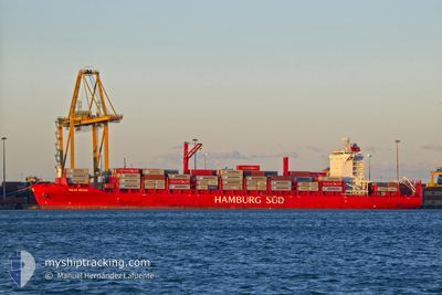
POLAR BRASIL
Cargo D
Current Trip
| Time Travelled | 1 day |
|---|---|
| Remaining Time | 6 h, 56 mins |
| Distance Travelled | 460.57 nm |
| Remaining Distance | 83.51 nm |
| AVG Speed | 11.8 Knots |
| MAX Speed | 17.3 Knots |
| AVG Wind | 10.1 knots |
| MAX Wind | 20.4 knots |
| MIN Temp | 5.5°C / 41.9°F |
| MAX Temp | 20.6°C / 69.08°F |
| Draught | 9.6 m |
| Position Received | 20 m ago |
Current Position
| Longitude | -77.19267° |
|---|---|
| Latitude | 33.62987° |
| Status | Under way using engine |
| Speed | 9.8 Knots |
| Course | 229.7° |
| Area | North Atlantic Ocean |
| Station | T-AIS |
| Position Received | 20 m ago |
Info
Information
The current position of POLAR BRASIL is in North Atlantic Ocean with coordinates 33.62987° / -77.19267° as reported on 2024-04-24 23:27 by AIS to our vessel tracker app. The vessel's current speed is 9.8 Knots and is heading at the port of WILMINGTON. The estimated time of arrival as calculated by MyShipTracking vessel tracking app is 2024-04-25 06:43 LT
The vessel POLAR BRASIL (IMO: 9797216, MMSI: 248556000) is a Cargo D It's sailing under the flag of [MT] Malta.
In this page you can find informations about the vessels current position, last detected port calls, and current voyage information. If the vessels is not in coverage by AIS you will find the latest position.
The current position of POLAR BRASIL is detected by our AIS receivers and we are not responsible for the reliability of the data. The last position was recorded while the vessel was in Coverage by the Ais receivers of our vessel tracking app.
The current draught of POLAR BRASIL as reported by AIS is 9.6 meters
Weather
| Temperature | 20.3°C / 68.54°F |
|---|---|
| Wind Speed | 17 knots |
| Direction | 224° SW |
| Pressure | 1018.3 hPa |
| Humidity | 65.4 % |
| Cloud Coverage | 1 % |
Featured Company
Last Port Calls
| Port | Arrival | Departure | Time In Port |
|---|---|---|---|
| 2024-04-22 12:27 | 2024-04-23 07:33 | 19 h | |
| 2024-04-15 12:15 | 2024-04-16 12:24 | 1 d | |
| 2024-04-12 17:18 | 2024-04-14 17:43 | 2 d | |
| 2024-04-11 17:35 | 2024-04-12 07:09 | 13 h | |
| 2024-04-05 14:58 | 2024-04-06 12:34 | 21 h | |
| 2024-04-04 09:23 | 2024-04-04 18:12 | 8 h | |
| 2024-04-01 12:47 | 2024-04-02 06:33 | 17 h | |
| 2024-03-25 02:33 | 2024-03-26 01:43 | 23 h | |
| 2024-03-22 12:50 | 2024-03-24 10:07 | 1 d | |
| 2024-03-21 12:20 | 2024-03-21 21:25 | 9 h |
Most Visited Ports (Last year)
| Port | Arrivals | |
|---|---|---|
| 17 | ||
| 16 | ||
| 15 | ||
| 15 | ||
| 15 | ||
| 14 |
Last Trips
| Origin | Departure | Destination | Arrival | Distance | |
|---|---|---|---|---|---|
| 2024-04-16 07:24 | 2024-04-22 08:27 | 2229.98 nm | |||
| 2024-04-14 12:43 | 2024-04-15 07:15 | 250.43 nm | |||
| 2024-04-12 02:09 | 2024-04-12 12:18 | 177.10 nm | |||
| 2024-04-06 08:34 | 2024-04-11 12:35 | 1503.56 nm | |||
| 2024-04-04 14:12 | 2024-04-05 10:58 | 235.46 nm | |||
| 2024-04-02 02:33 | 2024-04-04 05:23 | 554.96 nm | |||
| 2024-03-25 20:43 | 2024-04-01 08:47 | 2238.95 nm | |||
| 2024-03-24 05:07 | 2024-03-24 21:33 | 245.01 nm | |||
| 2024-03-21 16:25 | 2024-03-22 07:50 | 179.65 nm | |||
| 2024-03-16 05:41 | 2024-03-21 07:20 | 1448.83 nm |
Events
| Time | Event | Details | Position / Dest | Info |
|---|---|---|---|---|
| 2024-04-24 23:34 | Status Changed | Default Under way using engine |
33.61668 / -77.21133
WILMINGTON
|
Speed: 9.8 kn Course: 229.7° |
| 2024-04-24 23:16 | Status Changed | Under way using engine Default |
33.64917 / -77.16522
WILMINGTON
|
Speed: 9.7 kn Course: 232° |
| 2024-04-24 23:14 | Status Changed | Default Under way using engine |
33.65255 / -77.16016
WILMINGTON
|
Speed: 9.7 kn Course: 231.3° |
| 2024-04-24 23:07 | Status Changed | Under way using engine Default |
33.66364 / -77.14321
WILMINGTON
|
Speed: 9.7 kn Course: 232° |
| 2024-04-24 23:06 | Status Changed | Default Under way using engine |
33.66500 / -77.14111
WILMINGTON
|
Speed: 9.7 kn Course: 235° |
| 2024-04-24 22:49 | Status Changed | Under way using engine Default |
33.69275 / -77.09664
WILMINGTON
|
Speed: 9.7 kn Course: 232° |
| 2024-04-24 22:46 | Status Changed | Default Under way using engine |
33.69730 / -77.08920
WILMINGTON
|
Speed: 9.9 kn Course: 233.3° |
| 2024-04-24 19:56 | Status Changed | Under way using engine Default |
34.02366 / -76.57394
WILMINGTON
|
Speed: 12 kn Course: 231° |
| 2024-04-24 19:50 | IN Coverage |
34.02366 / -76.57394
North Atlantic Ocean
WILMINGTON
|
Speed: 11.5 kn Course: 231.5° |
|
| 2024-04-23 19:20 | OUT of Coverage |
38.06355 / -74.56308
North Atlantic Ocean
WILMINGTON
|
Speed: 11.5 kn Course: 185.1° |