
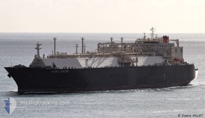
POINT FORTIN
Lng Tanker
Current Trip
FOR ORDERS
| Time Travelled | --- |
|---|---|
| Remaining Time | --- |
| Distance Travelled | 18995.04 nm |
| Remaining Distance | --- |
| AVG Speed | 16.4 Knots |
| MAX Speed | 19.6 Knots |
| AVG Wind | 13 knots |
| MAX Wind | 28 knots |
| MIN Temp | 9.1°C / 48.38°F |
| MAX Temp | 30.3°C / 86.54°F |
| Draught | 11.6 m |
| Position Received | 1 d ago |
Current Position
| Longitude | 118.02773° |
|---|---|
| Latitude | 38.76395° |
| Status | Under way using engine |
| Speed | 9.5 Knots |
| Course | 269.8° |
| Area | Yellow Sea |
| Station | T-AIS |
| Position Received | 1 d ago |
Info
Information
The current position of POINT FORTIN is in Yellow Sea with coordinates 38.76395° / 118.02773° as reported on 2024-04-21 23:56 by AIS to our vessel tracker app. The vessel's current speed is 9.5 Knots
The vessel POINT FORTIN (IMO: 9375721, MMSI: 370833000) is a Lng Tanker that was built in 2010 ( 14 years old ). It's sailing under the flag of [PA] Panama.
In this page you can find informations about the vessels current position, last detected port calls, and current voyage information. If the vessels is not in coverage by AIS you will find the latest position.
The current position of POINT FORTIN is detected by our AIS receivers and we are not responsible for the reliability of the data. The last position was recorded while the vessel was in Coverage by the Ais receivers of our vessel tracking app.
The current draught of POINT FORTIN as reported by AIS is 11.6 meters
Weather
| Temperature | 10.5°C / 50.9°F |
|---|---|
| Wind Speed | 11 knots |
| Direction | 330° NNW |
| Pressure | 1008.6 hPa |
| Humidity | 82.9 % |
| Cloud Coverage | 98 % |
Featured Company
Most Visited Ports (Last year)
| Port | Arrivals | |
|---|---|---|
| 2 | ||
| 1 | ||
| 1 | ||
| 1 | ||
| 1 | ||
| 1 |
Last Trips
| Origin | Departure | Destination | Arrival | Distance | |
|---|---|---|---|---|---|
| 2024-01-25 09:13 | 2024-02-19 09:28 | 6640.94 nm |
Events
| Time | Event | Details | Position / Dest | Info |
|---|---|---|---|---|
| 2024-04-23 09:47 | STOP Moving | 20.65 nm, South West of CAOFEIDIAN |
38.79895 / 118.23671
FOR ORDERS
|
Speed: 0.2 kn Course: 298° |
| 2024-04-23 06:52 | START Moving | 13.06 nm, South of TIANJIN |
38.76541 / 117.72294
FOR ORDERS
|
Speed: 6.9 kn Course: 71° |
| 2024-04-22 02:27 | STOP Moving | 13.61 nm, South of TIANJIN |
38.75654 / 117.71841
FOR ORDERS
|
Speed: 0.3 kn Course: 33° |
| 2024-04-22 00:04 | Status Changed | Default Under way using engine |
38.76426 / 118.00324
FOR ORDERS
|
Speed: 9.5 kn Course: 269.8° |
| 2024-04-21 23:56 | OUT of Coverage |
38.76395 / 118.02773
Yellow Sea
FOR ORDERS
|
Speed: 9.5 kn Course: 269.8° |
|
| 2024-04-21 23:50 | Status Changed | Under way using engine Default |
38.76388 / 118.04837
FOR ORDERS
|
Speed: 9.8 kn Course: 270° |
| 2024-04-21 23:32 | Status Changed | Default Under way using engine |
38.76390 / 118.11051
FOR ORDERS
|
Speed: 9.2 kn Course: 263.2° |
| 2024-04-21 23:16 | Change Sea Area | Chinese part of the Yellow Sea Philippines part of the South China Sea |
38.76929 / 118.15542
Yellow Sea
FOR ORDERS
|
Speed: 5.7 kn Course: 254.2° |
| 2024-04-21 23:14 | Status Changed | Under way using engine Default |
38.77032 / 118.15935
FOR ORDERS
|
Speed: 5.1 kn Course: 250° |
| 2024-04-21 23:08 | IN Coverage |
38.76929 / 118.15542
Yellow Sea
FOR ORDERS
|
Speed: 5.7 kn Course: 254.2° |