
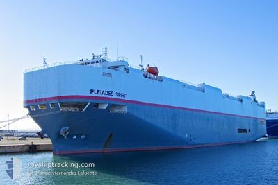
PLEIADES SPIRIT
Vehicles Carrier
Current Trip
| Time Travelled | 1 day |
|---|---|
| Remaining Time | --- |
| Distance Travelled | 168.99 nm |
| Remaining Distance | 865.01 nm |
| AVG Speed | 14.3 Knots |
| MAX Speed | 18.7 Knots |
| AVG Wind | 5.7 knots |
| MAX Wind | 9 knots |
| MIN Temp | 26.1°C / 78.98°F |
| MAX Temp | 29.5°C / 85.1°F |
| Draught | 8.4 m |
| Position Received | 6 d ago |
Current Position
| Longitude | -79.45013° |
|---|---|
| Latitude | 8.45039° |
| Status | Under way sailing |
| Speed | 18.8 Knots |
| Course | 178.2° |
| Area | North Pacific Ocean |
| Station | T-AIS |
| Position Received | 6 d ago |
Info
Information
The current position of PLEIADES SPIRIT is in North Pacific Ocean with coordinates 8.45039° / -79.45013° as reported on 2024-04-16 15:40 by AIS to our vessel tracker app. The vessel's current speed is 18.8 Knots and is heading at the port of BALBOA. The estimated time of arrival as calculated by MyShipTracking vessel tracking app is 2024-04-14 20:15 LT
The vessel PLEIADES SPIRIT (IMO: 9409326, MMSI: 370852000) is a Vehicles Carrier that was built in 2008 ( 16 years old ). It's sailing under the flag of [PA] Panama.
In this page you can find informations about the vessels current position, last detected port calls, and current voyage information. If the vessels is not in coverage by AIS you will find the latest position.
The current position of PLEIADES SPIRIT is detected by our AIS receivers and we are not responsible for the reliability of the data. The last position was recorded while the vessel was in Coverage by the Ais receivers of our vessel tracking app.
The current draught of PLEIADES SPIRIT as reported by AIS is 8.4 meters
Weather
| Temperature | 28.9°C / 84.02°F |
|---|---|
| Wind Speed | 2 knots |
| Direction | 138° SE |
| Pressure | 1011.4 hPa |
| Humidity | 72.8 % |
| Cloud Coverage | 1 % |
Featured Company
Last Port Calls
| Port | Arrival | Departure | Time In Port |
|---|---|---|---|
| 2024-04-22 03:44 | 2024-04-22 06:13 | 2 h | |
| 2024-04-20 20:25 | 2024-04-21 01:49 | 5 h | |
| 2024-04-15 03:59 | 2024-04-16 04:01 | 1 d | |
| 2024-04-13 03:38 | 2024-04-13 08:02 | 4 h | |
| 2024-04-10 07:22 | 2024-04-11 05:06 | 21 h | |
| 2024-04-05 23:22 | 2024-04-06 08:57 | 9 h | |
| 2024-03-25 12:09 | 2024-03-27 08:45 | 1 d | |
| 2024-03-21 13:12 | 2024-03-22 13:52 | 1 d | |
| 2024-03-07 23:33 | 2024-03-08 23:01 | 23 h | |
| 2024-03-01 19:34 | 2024-03-02 19:57 | 1 d |
Last Trips
| Origin | Departure | Destination | Arrival | Distance | |
|---|---|---|---|---|---|
| 2024-04-20 19:49 | 2024-04-21 21:44 | 90.11 nm | |||
| 2024-04-15 23:01 | 2024-04-20 14:25 | 740.01 nm | |||
| 2024-04-13 03:02 | 2024-04-14 22:59 | 604.00 nm | |||
| 2024-04-11 00:06 | 2024-04-12 22:38 | 790.28 nm | |||
| 2024-04-06 05:57 | 2024-04-10 02:22 | 1365.04 nm | |||
| 2024-03-27 05:45 | 2024-04-05 20:22 | 3155.59 nm | |||
| 2024-03-22 10:52 | 2024-03-25 09:09 | 1056.33 nm | |||
| 2024-03-09 00:01 | 2024-03-21 10:12 | 5508.25 nm | |||
| 2024-03-02 20:57 | 2024-03-08 00:33 | 1906.32 nm | |||
| 2024-02-24 06:54 | 2024-03-01 20:34 | 2095.29 nm |
Events
| Time | Event | Details | Position / Dest | Info |
|---|---|---|---|---|
| 2024-04-22 18:46 | STOP Moving | 4.66 nm, West of ACAJUTLA |
13.55129 / -89.91316
PA BLB
|
Speed: 0.1 kn Course: 260° |
| 2024-04-22 06:16 | START Moving | 0.69 nm, South of SAN LORENZO |
13.39167 / -87.42500
PA BLB
|
Speed: 4 kn Course: -1° |
| 2024-04-22 06:13 | PORT DEPARTURE |
|
13.39500 / -87.42500
PA BLB
|
Speed: 1.4 kn Course: 197° |
| 2024-04-22 03:44 | PORT ARRIVAL |
|
13.39962 / -87.42420
[HN] SAN LORENZO
|
Speed: Course: -1° |
| 2024-04-21 20:13 | STOP Moving | 0.32 nm, South East of SAN LORENZO |
13.39833 / -87.42167
PA BLB
|
Speed: Course: -1° |
| 2024-04-21 18:13 | START Moving | 8 nm, South East of COYOLITO |
13.18500 / -87.57500
PA BLB
|
Speed: 8 kn Course: 343° |
| 2024-04-21 06:43 | STOP Moving | 8.54 nm, South East of AMAPALA |
13.17666 / -87.57166
PA BLB
|
Speed: Course: -1° |
| 2024-04-21 01:49 | START Moving | 0.55 nm, South of CORINTO |
12.47500 / -87.16833
PA BLB
|
Speed: 4 kn Course: -1° |
| 2024-04-21 01:49 | PORT DEPARTURE |
|
12.47500 / -87.16833
PA BLB
|
Speed: 2.3 kn Course: 195° |
| 2024-04-20 20:25 | PORT ARRIVAL |
|
12.48167 / -87.16666
[NI] CORINTO
|
Speed: Course: -1° |