
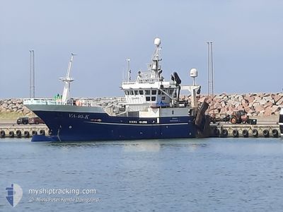
PIRAJA
Fishing
Current Trip
CH 16
| Time Travelled | 2 days |
|---|---|
| Remaining Time | --- |
| Distance Travelled | 154.67 nm |
| Remaining Distance | --- |
| AVG Speed | 7.5 Knots |
| MAX Speed | 9.2 Knots |
| AVG Wind | 18.6 knots |
| MAX Wind | 28.6 knots |
| MIN Temp | 3.1°C / 37.58°F |
| MAX Temp | 9.2°C / 48.56°F |
| Draught | 4 m |
| Position Received | 1 m ago |
Current Position
| Longitude | 3.37581° |
|---|---|
| Latitude | 59.63627° |
| Status | Engaged in Fishing |
| Speed | 1.5 Knots |
| Course | 78° |
| Area | North Sea |
| Station | T-AIS |
| Position Received | 1 m ago |
Info
Information
The current position of PIRAJA is in North Sea with coordinates 59.63627° / 3.37581° as reported on 2024-04-19 01:12 by AIS to our vessel tracker app. The vessel's current speed is 1.5 Knots
The vessel PIRAJA (IMO: 8849244, MMSI: 257654500) is a Fishing It's sailing under the flag of [NO] Norway.
In this page you can find informations about the vessels current position, last detected port calls, and current voyage information. If the vessels is not in coverage by AIS you will find the latest position.
The current position of PIRAJA is detected by our AIS receivers and we are not responsible for the reliability of the data. The last position was recorded while the vessel was in Coverage by the Ais receivers of our vessel tracking app.
The current draught of PIRAJA as reported by AIS is 4 meters
Weather
| Temperature | 4.8°C / 40.64°F |
|---|---|
| Wind Speed | 26 knots |
| Direction | 148° SSE |
| Pressure | 1002.3 hPa |
| Humidity | 96.6 % |
| Cloud Coverage | 100 % |
Featured Company
Last Port Calls
| Port | Arrival | Departure | Time In Port |
|---|---|---|---|
| 2024-04-16 21:19 | 2024-04-16 23:55 | 2 h | |
| 2024-04-16 13:04 | 2024-04-16 13:22 | 18 m | |
| 2024-04-09 16:35 | 2024-04-09 22:15 | 5 h | |
| 2024-04-07 12:57 | 2024-04-07 16:00 | 3 h | |
| 2024-04-02 08:59 | 2024-04-02 09:53 | 53 m | |
| 2024-03-25 14:48 | 2024-03-25 15:44 | 56 m | |
| 2024-03-16 17:02 | 2024-03-16 21:00 | 3 h | |
| 2024-03-13 09:18 | 2024-03-14 08:13 | 22 h | |
| 2024-02-28 04:04 | 2024-02-28 05:20 | 1 h | |
| 2024-02-25 11:07 | 2024-02-25 12:07 | 1 h |
Last Trips
| Origin | Departure | Destination | Arrival | Distance | |
|---|---|---|---|---|---|
| 2024-04-16 15:22 | 2024-04-16 23:19 | 69.94 nm | |||
| 2024-04-10 00:15 | 2024-04-16 15:04 | 449.02 nm | |||
| 2024-04-07 18:00 | 2024-04-09 18:35 | 190.86 nm | |||
| 2024-04-02 11:53 | 2024-04-07 14:57 | 499.25 nm | |||
| 2024-03-25 16:44 | 2024-04-02 10:59 | 723.08 nm | |||
| 2024-03-16 22:00 | 2024-03-25 15:48 | 699.56 nm | |||
| 2024-03-14 09:13 | 2024-03-16 18:02 | 325.37 nm | |||
| 2024-02-28 06:20 | 2024-03-13 10:18 | 551.95 nm | |||
| 2024-02-25 13:07 | 2024-02-28 05:04 | 176.48 nm | |||
| 2024-02-21 09:35 | 2024-02-25 12:07 | 698.56 nm |
Events
| Time | Event | Details | Position / Dest | Info |
|---|---|---|---|---|
| 2024-04-18 20:00 | STOP Moving |
59.57198 / 3.42930
CH 16
|
Speed: 0.3 kn Course: 211° |
|
| 2024-04-18 12:53 | START Moving |
59.87329 / 3.29489
CH 16
|
Speed: 4.9 kn Course: 188° |
|
| 2024-04-18 11:52 | STOP Moving |
59.86529 / 3.28850
CH 16
|
Speed: 0.3 kn Course: 5° |
|
| 2024-04-17 14:43 | START Moving | 0.6 nm, South West of EGERSUND |
58.44186 / 5.98792
CH 16
|
Speed: 5.4 kn Course: 182.3° |
| 2024-04-17 13:36 | STOP Moving | 0.45 nm, South of EGERSUND |
58.44419 / 5.99012
CH 16
|
Speed: 0.1 kn Course: 5° |
| 2024-04-17 13:30 | START Moving | 0.44 nm, South West of EGERSUND |
58.44663 / 5.98452
CH 16
|
Speed: 4.9 kn Course: 146° |
| 2024-04-17 12:29 | STOP Moving | 0.44 nm, West of EGERSUND |
58.44984 / 5.98160
CH 16
|
Speed: 0.1 kn Course: 175° |
| 2024-04-17 12:19 | START Moving | 0.73 nm, South West of EGERSUND |
58.44036 / 5.98463
CH 16
|
Speed: 5.9 kn Course: 51.8° |
| 2024-04-17 00:01 | STOP Moving | 0.95 nm, South West of EGERSUND |
58.43769 / 5.97949
CH 16
|
Speed: 0.1 kn Course: 325° |
| 2024-04-16 23:55 | PORT DEPARTURE |
|
58.44137 / 5.98691
CH 16
|
Speed: 6.3 kn Course: 183° |